North Pownal in Bennington County, Vermont — The American Northeast (New England)
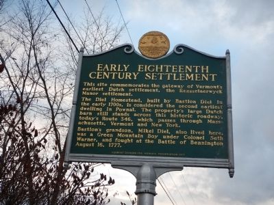
Early Eighteenth Century Settlement
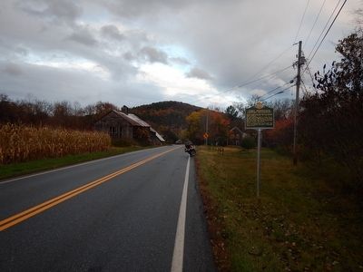
This site commemorates the gateway of Vermontís earliest Dutch settlement, the Rensselaerwyck Manor settlement. The Diel Homestead, built by Bastion Diel in the early 1700s, is considered the second earliest dwelling in Pownal. The propertyís large Dutch barn still stands across this historic roadway, todayís Route 346, which passes through Massachusetts, Vermont and New York. Bastionís grandson, Mikel Diel, also lived here, was a Green Mountain Boy under Colonel Seth Warner, and fought at the Battle of Bennington August 16, 1777.
Erected 2011 by Vermont Division for Historic Preservation.
Topics. This historical marker is listed in these topic lists: Settlements & Settlers • War, US Revolutionary. A significant historical year for this entry is 1777.
Location. Marker has been reported missing. It was located near 42° 48.407′ N, 73° 16.472′ W. Marker was in Pownal, Vermont, in Bennington County. It was in North Pownal. Marker was on Vermont Route 346, 0.1 miles west of Indian Massacre Road, on the right when traveling east. Touch for map. Marker was in this post office area: Pownal VT 05261, United States of America. Touch for directions.
Other nearby markers. At least 8 other markers are within 5 miles of this location, measured as the crow flies. Pownal (approx. 0.4 miles away); Brimmer Farm (approx. 2.3 miles away in New York); Vermont U.S. 7 follows historic route (approx. 2.7 miles away); Reynolds Farm (approx. 4.1 miles away in New York); Hoosick WW I & II Memorial (approx. 4.7 miles away in New York); Chester A. Arthur (approx. 4.7 miles away in New York); Early Tavern (approx. 4.7 miles away in New York); Dimick Tavern (approx. 5 miles away). Touch for a list and map of all markers in Pownal.
Credits. This page was last revised on February 16, 2023. It was originally submitted on October 24, 2014, by Kevin Craft of Bedford, Quebec. This page has been viewed 949 times since then and 21 times this year. Last updated on October 8, 2020, by Brian Bushner of Hoosick Falls, New York. Photos: 1, 2. submitted on October 24, 2014, by Kevin Craft of Bedford, Quebec. • Bill Pfingsten was the editor who published this page.

