Santa Rita in Grant County, New Mexico — The American Mountains (Southwest)
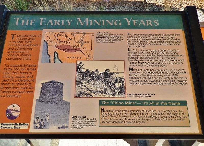
The Early Mining Years
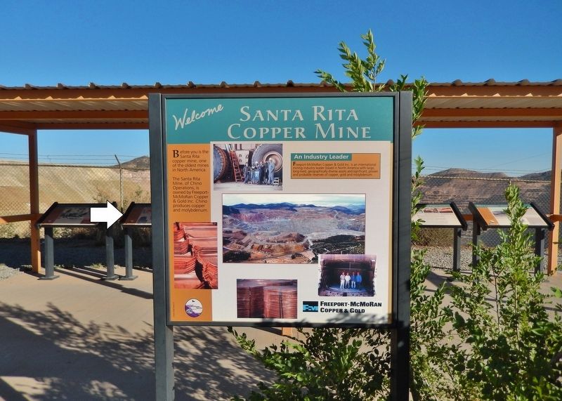
Santa Rita Copper Mine
Fur trappers Sylvester Pattie and son James tried their hand at mining copper and used the underground mines to store furs. At one time, even Kit Carson worked here as a teamster.
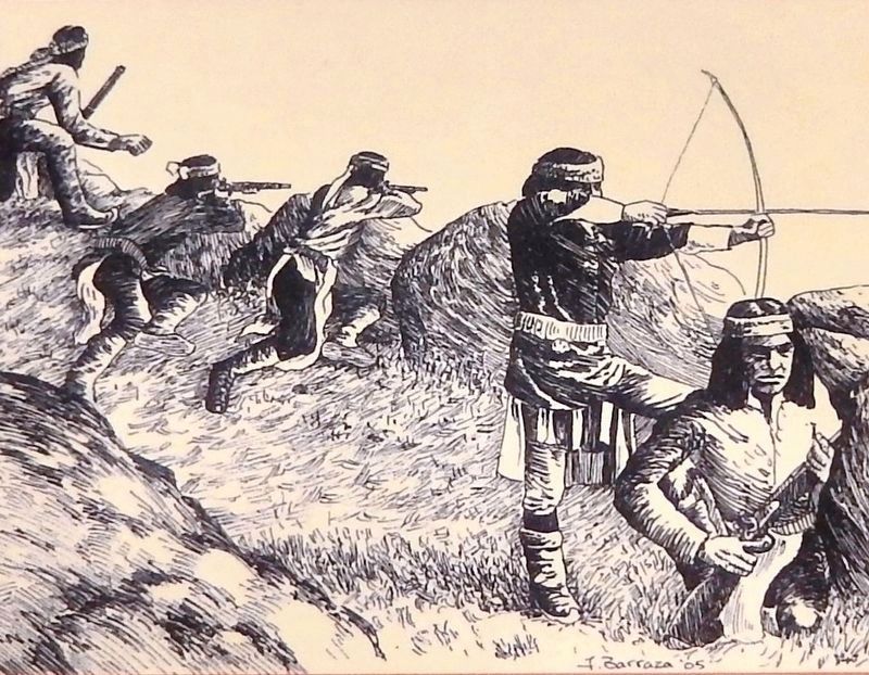
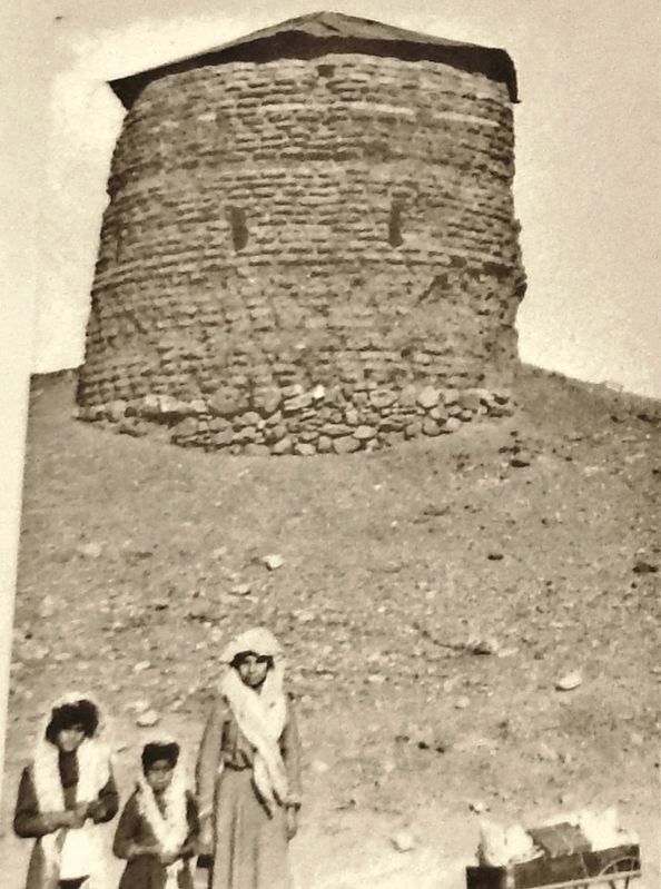
The Apache Indians regarded this country as their domain and many of the mines and nearby communities were occasionally abandoned due to raiding Apaches. The Spaniards built the Santa Rita fort using thick adobe bricks to protect miners from these raids.
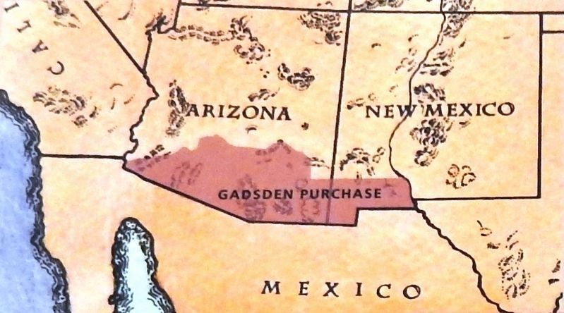
In 1821, the territory passed from Spanish to Mexican ownership, and in 1853 the region became part of the United States with the Gadsden Purchase. This change in the international boundary allowed for a southern intercontinental railroad route and included some of the richest mineral land in the United States.
Mining at Santa Rita continued under a variety of owners, but stopped during the Civil War. With the end of the Apache wars, about 1886, conditions improved and the safety of the miners was guaranteed. It was many more years, however, before copper was profitably mined in this region.
The "Chino Mine" — It's All in the Name
Named after the small community of Santa Rita, once located here, the Santa Rita Mine is often referred to as the "Chino Mine." The origin of the name "Chino," however, is not clear. It is believed that the name Chino was derived from a slang Mexican word for quartz. Today, Chino is owned by Freeport-McMoRan Copper & Gold Inc.
Erected by Freeport-McMoRan Copper & Gold.
Topics. This historical marker is listed in these topic lists: Forts and Castles • Industry & Commerce • Native Americans • Railroads & Streetcars. A significant historical year for this entry is 1821.
Location. 32° 48.408′ N, 108° 4.393′ W. Marker is in Santa Rita, New Mexico, in Grant County. Marker is on Scenic State Road 152, 1.1 miles east of State Highway 356, on the right when traveling east. Marker is located at an interpretive exhibit overlooking the open pit mine site to the south. Touch for map. Marker is in this post office area: Hanover NM 88041, United States of America. Touch for directions.
Other nearby markers. At least 8 other markers are within 3 miles of this marker, measured as the crow flies. The Discovery (here, next to this marker); Open Pit Mining (here, next to this marker); The Companies & People (here, next to this marker); Santa Rita Copper Mine (here, next to this marker); Modern Mining & Processing (here, next to this marker); Reclaiming the Land (here, next to this marker); Kneeling Nun
(approx. 2.8 miles away); Ladies Auxiliary of Local 890 (approx. 2.8 miles away). Touch for a list and map of all markers in Santa Rita.
Related markers. Click here for a list of markers that are related to this marker. Santa Rita Copper Mine
Also see . . .
1. You’ve Never Seen Anything Like The Santa Rita Mine. You’ll find the mine referred to as the Santa Rita Mine, the Santa Rita del Cobre Mine, and also the Chino Mine. (Submitted on October 15, 2020, by Cosmos Mariner of Cape Canaveral, Florida.)
2. Gadsden Purchase (Wikipedia). The purchase included lands south of the Gila River and west of the Rio Grande where the U.S. wanted to build a transcontinental railroad along a deep southern route, which the Southern Pacific Railroad later completed in 1881–1883. (Submitted on October 15, 2020, by Cosmos Mariner of Cape Canaveral, Florida.)
Credits. This page was last revised on October 16, 2020. It was originally submitted on October 14, 2020, by Cosmos Mariner of Cape Canaveral, Florida. This page has been viewed 267 times since then and 26 times this year. Photos: 1. submitted on October 14, 2020, by Cosmos Mariner of Cape Canaveral, Florida. 2, 3, 4, 5. submitted on October 15, 2020, by Cosmos Mariner of Cape Canaveral, Florida.
