Stringtown Road
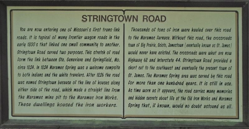
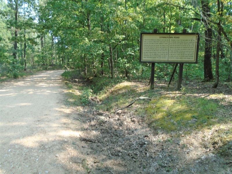
You are now entering one of Missouri's first trans-link roads. It is typical of many frontier wagon roads in the early 1800's that linked one small community to another. Stringtown Road served two purposes. This stretch of road form[ed] the link between Ste. Genevieve and Springfield, Mo. circa 1824. In 1824 Maramec Spring was a welcome campsite to both indians and the white travelers. After 1826 the road was named Stringtown because of the line of houses along either side of the road, which made a straight line from the Maramec mine pit to the Maramec Iron Works. These dwellings housed the iron workers.
Thousands of tons of iron [ore] were hauled over this road to the Maramec furnace. Without this road, the crossroads town of Big Prairie, Scioto, [and] Jamestown (eventually known as St. James) would never have existed. The crossroads were what are now Highway 68 and Interstate 44. Stringtown Road provided a short cut to the southwest and eventually [to] the present town of St. James. The Maramec Spring area was served by this road for more than one hunbdred [sic] years. It is still in use. As time worn as it appears, the road carries many memories and hidden secrets about life at the Old Iron Works and Maramec Spring that, if known, would no doubt astound us all.
Erected by
Topics. This historical marker is listed in these topic lists: Industry & Commerce • Roads & Vehicles • Settlements & Settlers. A significant historical year for this entry is 1824.
Location. 37° 57.446′ N, 91° 32.667′ W. Marker is near St. James, Missouri, in Phelps County. Marker is along the Historic Drive in Maramec Spring Park, off Missouri Highway 8. Touch for map. Marker is at or near this postal address: 21880 Maramec Spring Drive, Saint James MO 65559, United States of America. Touch for directions.
Other nearby markers. At least 8 other markers are within walking distance of this marker. Stuttering Tom Lenox (within shouting distance of this marker); George Evans (about 600 feet away, measured in a direct line); Westlake "Dog Trot" Cabin (approx. 0.2 miles away); Hyer Hewed Log Cabin (approx. ¼ mile away); Maramec Community Cemetery (approx. ¼ mile away); Maramec Iron Works (approx. half a mile away); Furnace Shelter (approx. 0.6 miles away); Two-Wheeled Charcoal Barrow (approx. 0.6 miles away). Touch for a list and map of all markers in St. James.
Also see . . .
1. Maramec Iron Works National Register District Nomination Form. (Submitted on October 15, 2020, by William Fischer, Jr. of Scranton, Pennsylvania.)
2. Maramec Iron Works (Ludwig, 1977). (Submitted on October 15, 2020, by William Fischer, Jr. of Scranton, Pennsylvania.)
3. Maramec Spring Park History. (Submitted on October 15, 2020, by William Fischer, Jr. of Scranton, Pennsylvania.)
Credits. This page was last revised on October 15, 2020. It was originally submitted on October 15, 2020, by William Fischer, Jr. of Scranton, Pennsylvania. This page has been viewed 363 times since then and 78 times this year. Photos: 1, 2, 3. submitted on October 15, 2020, by William Fischer, Jr. of Scranton, Pennsylvania. 4. submitted on October 13, 2020, by William Fischer, Jr. of Scranton, Pennsylvania.


