Walthourville in Liberty County, Georgia — The American South (South Atlantic)
Walthourville Baptist Church
Photographed by David Seibert, January 20, 2009
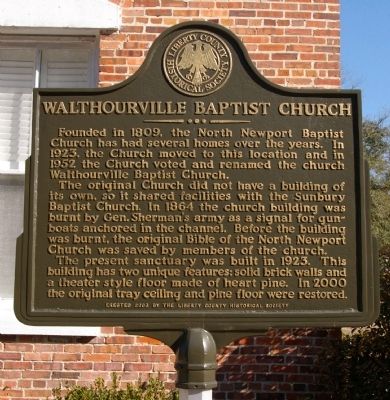
1. Walthourville Baptist Church Marker
The original church did not have a building of its own, so it shared facilities with the Sunbury Baptist Church. In 1864 the church building was burnt by Gen. Sherman’s army as a signal for gunboats anchored in the channel. Before the building was burnt, the original Bible of the North Newport Church was saved by members of the church.
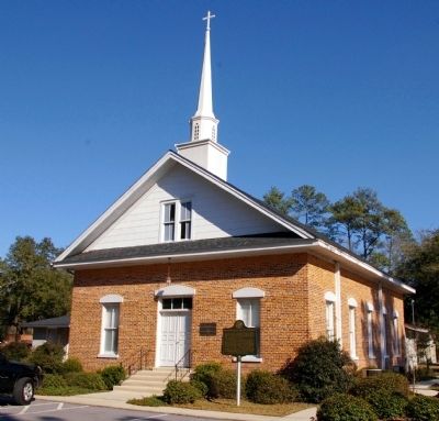
The present sanctuary was built in 1923. This building has two unique features: solid brick walls and a theater style floor made of heart pine. In 2000 the original tray ceiling and pine floor were restored.
Erected 2003 by Liberty County Historical Society.
Topics. This historical marker is listed in these topic lists: Religion & Religious Structures • War, US Civil. A significant historical year for this entry is 1809.
Location. 31° 46.061′ N, 81° 38.072′ W. Marker is in Walthourville, Georgia, in Liberty County. It is on Vandiver Road 0.1 miles south of Talmadge Road (Georgia
this page online

Regionally, this marker is on the Coastal Plain and on the Georgia Coast and the Golden Isles. It is also in the American South, specifically in the Deep South, and on the Eastern Seaboard. Globally, it is in the North Atlantic Region, North America, the Western Hemisphere, the Western World, and the Anglosphere. Historically, it finds itself in what was once New Spain, the territory of the Mississippian Culture, one of the original Thirteen Colonies, one of the Confederate States of America, and the Antebellum South.
Other nearby markers. At least 8 other markers are within 6 miles of this marker, measured as the crow flies: City of Walthourville History (approx. 0.2 miles away); Walthourville Presbyterian Church (approx. 1.7 miles away); Pleasant Grove African Methodist Episcopal (AME) Church and Camp Meeting (approx. 2½ miles away); Skirmish at Hinesville (approx. 5.6 miles away); Old Liberty County Jail (approx. 5.8 miles
Photographed by David Seibert, January 20, 2009
2. Walthourville Baptist Church and Marker
Credits. This page was last revised on January 31, 2020. It was originally submitted on February 2, 2009, by David Seibert of Sandy Springs, Georgia. This page has been viewed 1,430 times since then and 36 times this year. Photos: 1, 2. submitted on February 2, 2009, by David Seibert of Sandy Springs, Georgia. • Craig Swain was the editor who published this page.
