Dayville in Grant County, Oregon — The American West (Northwest)
James Cant Ranch Historic District
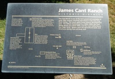
Structures presented clockwise, from the top left, around the "YOU ARE HERE" center.
Christina's Cabin Located across the river, this one-room cabin was constructed in 1932. It was built for James Cant's daughter, Christina, for homesteading purposes.
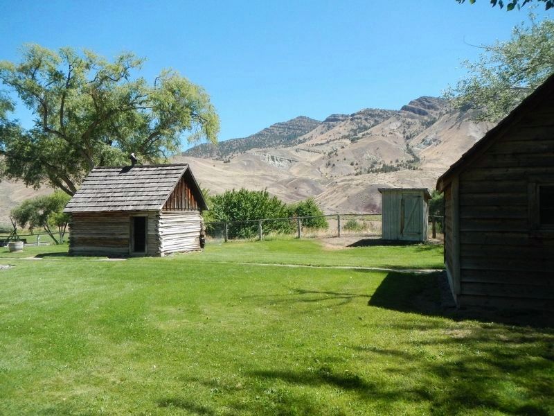
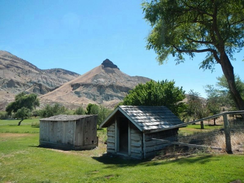
Watchman's Hut Lambing usually occurred in late March of April. Ewes that were ready to give birth were enclosed in a corral east of the barn. The sheep were tended around the clock by a watchman, the hut being used for cooking and shelter during the cold spring nights. It was common for 30 or 40 lambs to be born at night or in the early morning hours, many needing assistance.
Log Cabin Constructed by Floyd Officer around 1900, this one-room structure with dirt basement served primarily as a storage area.
Bunkhouse Built during the 1930's, this one-room structure housed hired hands who worked the ranch.
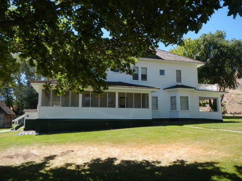
Main House Constructed for James and Elizabeth Cant between 1917 and 1918, this two and one-half story house has central always and twelve rooms. The open attic served as a schoolroom at times, and also as a dance area for socials. This house replaced the original Floyd Officer house built closer to the spring.
Blacksmith Shop This workshop was built in the 1950's to replace an older blacksmith ship near the barn. Here work centered on machinery and equipment repairs.
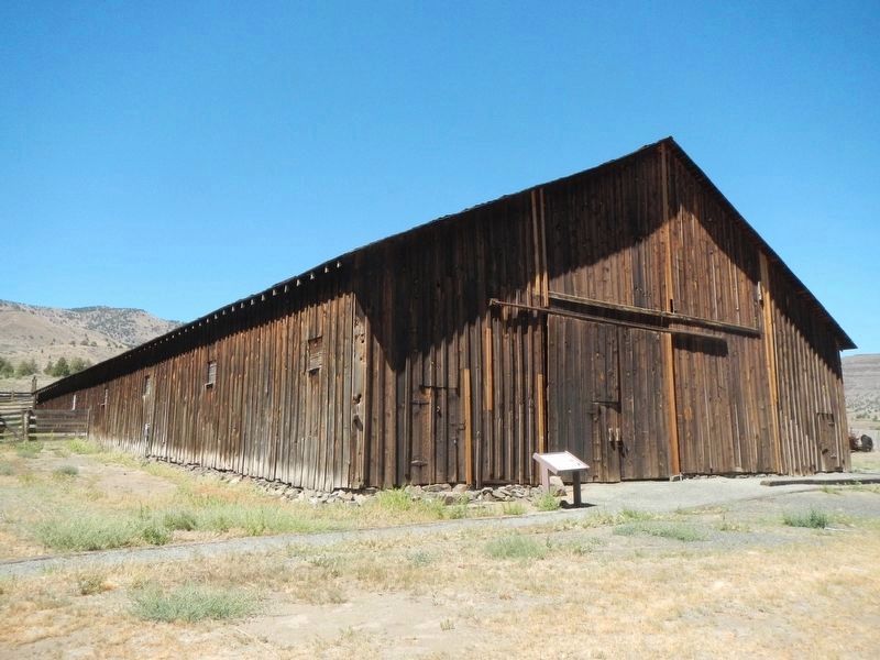
Barn Built around 1920, this 66-by-120-foot structure contained sheep pens, horse and mule stalls, a backroom, milking stations, grain storage, and a loft. The sheep pens, called "Sheep Alley," were located along the entire north wall.
Shearing Pens This open-walled, wood-frame structure has ten shearing pens. Sheep shearing began in May or June. The shearing equipment was first powered by one-cylinder engine, and one person could shear from 60 to 120 sheep in a day.
Erected by National Park Service.
Topics. This historical marker is listed in these topic lists: Agriculture • Settlements & Settlers.
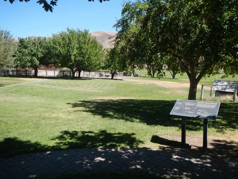
Location. 44° 33.319′ N, 119° 38.675′ W. Marker is in Dayville, Oregon, in Grant County. Marker can be reached from State Highway 19 near U.S. 26, on the right when traveling north. The marker is located on the Cant Ranch property. Touch for map. Marker is at or near this postal address: 32651 Oregon Highway 19, Dayville OR 97825, United States of America. Touch for directions.
Other nearby markers. At least 8 other markers are within walking distance of this marker. Welcome to the John Day River (here, next to this marker); a different marker also named James Cant Ranch Historic District (within shouting distance of this marker); On the Road of History (within shouting distance of this marker); Haystacker (within shouting distance of this marker); Lifeblood of a Ranch (about 300 feet away, measured in a direct line); Shearing the Sheep (about 300 feet away); Wool Bag Stand (about 300 feet away); An Oregon Fossil Rush (approx. 0.2 miles away). Touch for a list and map of all markers in Dayville.
Also see . . . James Cant Ranch Historic District -- Wikipedia. The ranch was originally homesteaded by Floyd Officer in 1890. Officer sold the property to James Cant in 1910. Cant increased the size of the property and built a modern ranch complex on the west bank of the river. The National Park Service bought the ranch from the Cant family in 1975, and incorporated the property into the John Day Fossil Beds National Monument. (Submitted on October 16, 2020, by Barry Swackhamer of Brentwood, California.)
Credits. This page was last revised on January 25, 2021. It was originally submitted on October 16, 2020, by Barry Swackhamer of Brentwood, California. This page has been viewed 146 times since then and 14 times this year. Photos: 1, 2, 3, 4, 5, 6. submitted on October 16, 2020, by Barry Swackhamer of Brentwood, California.
