Timberville in Rockingham County, Virginia — The American South (Mid-Atlantic)
Minnich's Store
Photographed by Devry Becker Jones (CC0), October 17, 2020
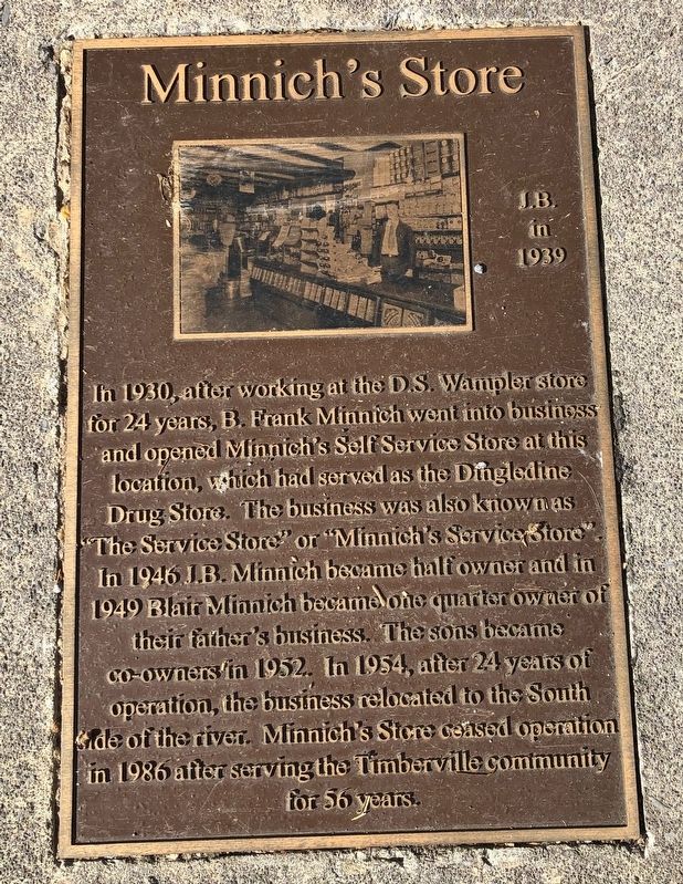
1. Minnich's Store Marker
Inscription.
Minnich's Store. . In 1930, after working at the D.W. Wampler store for 24 years, B. Frank Minnich went into business and opened Minnich's Self Service Store at this location, which had served as the Dingledine Drug Store. The business was also known as "The Service Store" or "Minnich's Service Store". In 1946 J.B. Minnich became half owner and in 1949 Blair Minich became one quarter owner of their father's business. The sons became co-owners in 1952. In 1954, after 24 years of operation, the business relocated to the South side of the river. Minnich's Store ceased operation in 1986 after serving the Timberville community for 56 years.
In 1930, after working at the D.W. Wampler store for 24 years, B. Frank Minnich went into business and opened Minnich's Self Service Store at this location, which had served as the Dingledine Drug Store. The business was also known as "The Service Store" or "Minnich's Service Store". In 1946 J.B. Minnich became half owner and in 1949 Blair Minich became one quarter owner of their father's business. The sons became co-owners in 1952. In 1954, after 24 years of operation, the business relocated to the South side of the river. Minnich's Store ceased operation in 1986 after serving the Timberville community for 56 years.
Topics. This historical marker is listed in this topic list: Industry & Commerce. A significant historical year for this entry is 1930.
Location. 38° 38.424′ N, 78° 46.43′ W. Marker is in Timberville, Virginia, in Rockingham County. It is on North Main Street (Virginia Route 42) north of Rockingham Street, on the left when traveling north. Touch for map. Marker is at or near this postal address: 200 N Main St, Timberville VA 22853, United States of America. Touch for directions.
Regionally, this marker is in
Click or scan to see this page online
Virginia’s Shenandoah Valley. It is also in the American South and specifically in the Upper South. Globally, it is in North America, the Western Hemisphere, the Western World, and the Anglosphere. Historically, it finds itself in what was once the territory of the Mississippian Culture, one of the original Thirteen Colonies, one of the Confederate States of America, and the Antebellum South.
Photographed by Devry Becker Jones (CC0), October 17, 2020
2. Minnich's Store Marker
Photographed by Devry Becker Jones (CC0), October 17, 2020
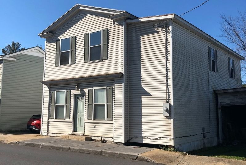
3. Minnich's Store building
Credits. This page was last revised on October 18, 2020. It was originally submitted on October 18, 2020, by Devry Becker Jones of Washington, District of Columbia. This page has been viewed 296 times since then and 22 times this year. Photos:1, 2, 3. submitted on October 18, 2020, by Devry Becker Jones of Washington, District of Columbia.