Pembroke in Bryan County, Georgia — The American South (South Atlantic)
Old City Jail
Photographed by Mike Stroud, 2009
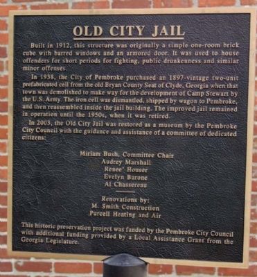
1. Old City Jail Marker
In 1928, the City of Pembroke purchased an 1897-vintage two-unit prefabrication cell from the old Bryan County Seat of Clyde, Georgia when that town was demolished to make way for the development of Camp Stewart by the U.S. Army. The iron cell was dismantled, shipped by wagon to Pembroke, and then reassembled inside the jail building. The improved jail remained in operation until the 1950s, when it was retired.
In 2003, the Old City Jail was restored as a museum by the Pembroke City Council with the guidance and assistance of a committee of dedicated citizens:
Mariam Bush, Committe Chair
Audrey Marshall • Renee' Houser • Evelyn Barone • Al Chassereau
Renovation by: M. Smith Construction • Purcell Heating and Air
This historic preservation project was funded by the Pembroke City Council with additional funding provided by a Local Assistance Grant from the Georgia
this page online
Erected 2003 by Pembroke City Council.
Topics. This historical marker is listed in this topic list: Law Enforcement. A significant historical year for this entry is 1912.
Location. 32° 8.056′ N, 81° 37.302′ W. Marker is in Pembroke, Georgia, in Bryan County. It is at the intersection of W. Gibson St. and S. College St., on the right when traveling east on W. Gibson St.. Touch for map. Marker is in this post office area: Pembroke GA 31321, United States of America. Touch for directions.

Regionally, this marker is on Georgia’s Coastal Plain, on the Georgia Coast and the Golden Isles, and in Greater Savannah. It is also in the American South, specifically in the Deep South, and on the Eastern Seaboard. Globally, it is in the North Atlantic Region, North America, the Western Hemisphere, the Western World, and the Anglosphere. Historically, it finds itself in what was once New Spain, the territory of the Mississippian Culture, one of the original Thirteen Colonies, one of the Confederate States of America, and the Antebellum South.
Other nearby markers. At least 8 other markers are within 13 miles
Photographed by Mike Stroud, February 1, 2009
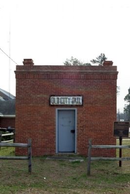
2. Old City Jail Marker
Photographed by Mike Stroud, February 1, 2009
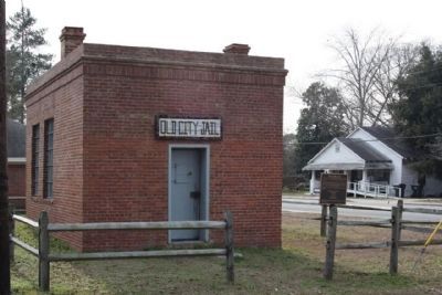
3. Old City Jail Marker, S. College St. at right
Photographed by Mike Stroud, February 1, 2009
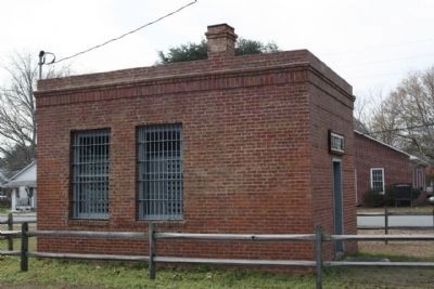
4. Old City Jail, iron cell visible through window
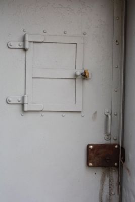
Photographed by Mike Stroud, 2009
5. Old City Jail armored door, as mentioned
Credits. This page was last revised on January 3, 2020. It was originally submitted on February 3, 2009, by Mike Stroud of Bluffton, South Carolina. This page has been viewed 1,871 times since then and 56 times this year. Photos: 1, 2, 3, 4, 5. submitted on February 3, 2009, by Mike Stroud of Bluffton, South Carolina. • Kevin W. was the editor who published this page.
