
Near Hartselle in Morgan County, Alabama — The American South (East South Central)
Crabb-Stewart-Key-Dotson Home
Morgan County
Photographed by Mark Hilton, October 18, 2020
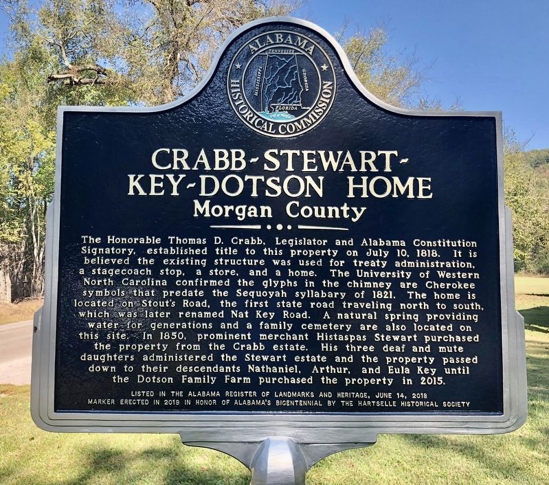
1. Crabb-Stewart-Key-Dotson Home Marker
The Honorable Thomas D. Crabb, Legislator and Alabama Constitution Signatory, established title to this property on July 10, 1818. It is believed the existing structure was used for treaty administration, a stagecoach stop, a store, and a home. The University of Western North Carolina confirmed the glyphs in the chimney are Cherokee symbols that predate the Sequoyah syllabary of 1821. The home is located on Stout's Road, the first state road traveling north to south, which was later renamed Nat Key Road. A natural spring providing water for generations and a family cemetery are also located on this site. In 1850, prominent merchant Histaspas Stewart purchased the property from the Crabb estate. His three deaf and mute daughters administered the Stewart estate and the property passed down to their descendants Nathaniel, Arthur, and Eula Key until the Dotson Family Farm purchased the property in 2015.
Listed in the Alabama Register of Landmarks and Heritage, June 14, 2018
Marker erected in 2019 in honor Of Alabama's Bicentennial by the Hartselle Historical Society
Erected 2019 by the Hartselle Historical
this page online
Topics. This historical marker is listed in this topic list: Notable Buildings. A significant historical date for this entry is June 14, 2018.
Location. 34° 23.318′ N, 86° 50.82′ W. Marker is near Hartselle, Alabama, in Morgan County. It is on Nat Key Road 0.6 miles south of Gibson Road, on the left when traveling south. Touch for map. Marker is at or near this postal address: 1004 Nat Key Rd, Hartselle AL 35640, United States of America. Touch for directions.

Regionally, this marker is in North Alabama. It is also in the American South, specifically in the Deep South, in Appalachia, and specifically in Southern Appalachia. Globally, it is in North America, a Gulf of Mexico state, the Western Hemisphere, the Western World, and the Anglosphere. Historically, it finds itself in what was once the original Cherokee Nation, the territory of the Mississippian Culture, one of the Confederate States of America, and the Antebellum South.
Other nearby markers. At least 8 other markers are within 8 miles of this marker, measured as the crow flies: Original Falkville Town Hall Building / Falkville Water Tower (approx. 3.7 miles away);

Photographed by Mark Hilton, October 18, 2020
2. The Crabb-Stewart-Key-Dotson Home and marker.
Also see . . . Historic marker unveiled at 200-year-old Hartselle home. WAFF 48 website entry (Submitted on August 5, 2024, by Larry Gertner of New York, New York.)
Credits. This page was last revised on August 5, 2024. It was originally submitted on October 18, 2020, by Mark Hilton of Montgomery, Alabama. This page has been viewed 2,172 times since then and 175 times this year. Photos: 1, 2. submitted on October 18, 2020, by Mark Hilton of Montgomery, Alabama.
