Springerville in Apache County, Arizona — The American Mountains (Southwest)
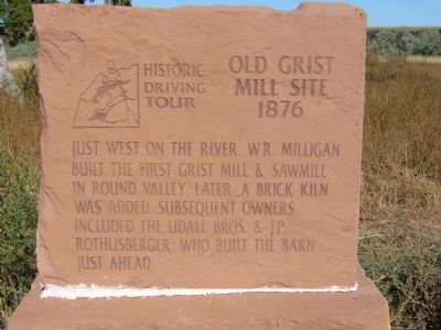
Old Grist Mill Site
1876
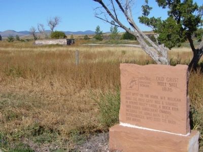
Just west on the river, W.R Milligan built the first grist mill & sawmill in Round Valley, later a brick kiln was added. Subsequent owners included the Udall Bros. & J.P. Rothlisberger who built the barn just ahead.
Erected 2002 by Round Valley Positive Action Tourism Committee and Springerville-Eagar Chamber of Commerce. (Marker Number 5.)
Topics and series. This historical marker is listed in these topic lists: Agriculture • Industry & Commerce. In addition, it is included in the Arizona, Pistols, Plows and Petticoats Historic Driving Tour series list.
Location. 34° 6.945′ N, 109° 18.379′ W. Marker is in Springerville, Arizona, in Apache County. Marker is on South River Road, 0.3 miles south of West 4th Avenue, on the right when traveling west. Keep right on South River Road to marker. There are two streets here both named River Road. Touch for map. Marker is in this post office area: Springerville AZ 85938, United States of America. Touch for directions.
Other nearby markers. At least 8 other markers are within 2 miles of this marker, measured as the crow flies. Snyder-Cavanaugh Shoot Out (approx. half a mile away); Harry Colter Home (approx. 0.8 miles away); William LeSueur Home (approx. 0.9 miles away); Joseph Udall Barn (approx. 0.9 miles away); Brawley Boarding House (approx. one mile away); Eagar Elementary School (approx. one mile away); Oscar Jepson Home (approx. 1.1 miles away); Colter Ranch (approx. 1.2 miles away).
More about this marker. This is Marker Site #5 on the Pistols, Plows and Petticoats Historic Driving Tour.
Regarding Old Grist Mill Site. William R. Milligan was the first farmer and water user on record on the Little Colorado. He established a small fort here in 1871. The houses were adobe with flat, leaky roofs. He constructed the unlined Milligan Ditch with headgates on the river one half mile east of which later became the Colter Ranch. After one year he had over 1,000 acres cultivated. Near here he began construction of a small grist mill or burr mill and sawmill. Power for them was furnished by an overshot wheel erected at the point where his irrigation ditch emptied back into the river. It is known that Milligan farmed until 1883. From then his activities are unclear.
Around 1888, David K. Udall wrote of applying sheep to the purchase of the Milligan farm from Henry Huning of Show Low. David and his younger brother enlarged the ditches and improved efficiency. The brothers ran the farm until 1898 when Joseph left for a two year Mormon mission and David moved back to St. Johns.
The next year the farm was sold to J.P. Rothlisberger, John LeSueur and other partners. Later J.P. bought out the partners and continued to run the grist mill and sawmill for several years.
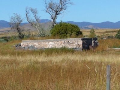
All that remains are parts of the foundation and some ditches. The old mill pond is still here in the midst of the golf course. Only a broken malpais (basalt) grinding stone, a few old brick boards, and an old ledger book J.P. had at the sawmill survive today.
Source: Pistols, Plows and Petticoats Historic Driving Tour Brochure.
Additional commentary.
1. I Am a Descendant of J.P. Rothsilberger
I am James Peter Rothlibergers Great Granddaughter. Thank you so much for your work in this history of the area my ancestor settled. If I can help in any way please contact me. Charla
— Submitted December 4, 2010, by Charla LeAnn Neff Seger of Ulysses, Kansas.
Credits. This page was last revised on October 23, 2020. It was originally submitted on October 5, 2010, by Bill Kirchner of Tucson, Arizona. This page has been viewed 1,985 times since then and 61 times this year. Last updated on October 23, 2020, by Bill Boushelle of Tucson, Arizona. Photos: 1, 2, 3. submitted on October 5, 2010, by Bill Kirchner of Tucson, Arizona. • J. Makali Bruton was the editor who published this page.


