
Near Middletown in Frederick County, Virginia — The American South (Mid-Atlantic)
Plantation Office & Store
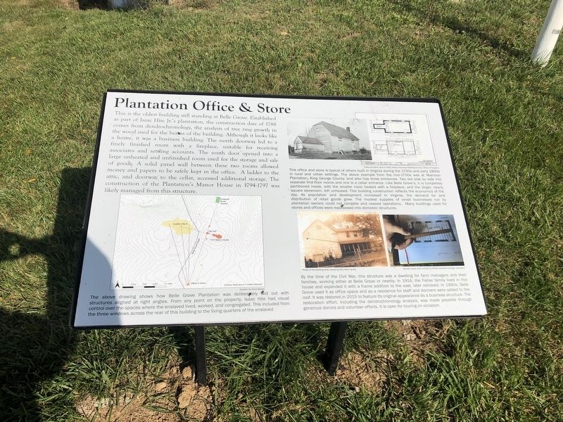
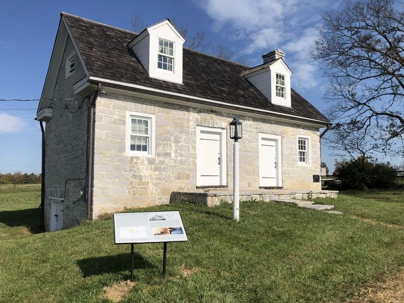
This is the oldest building still standing at Belle Grove. Established as part of Isaac Hite Jr.'s plantation, the construction date of 1788 comes from dendrochronology, the analysis of tree ring growth in the wood used for the beams of the building. Although it looks like a home, it was a business building. The north doorway led to a finely finished room with a fireplace, suitable for receiving associates and settling accounts. The south door opened into a large unheated and unfinished room used for the storage and sale of goods. A solid panel wall between these two rooms allowed money and papers to be safely kept in the office. A ladder to the attic, and doorway to the cellar, accessed additional storage. The construction of the Plantation's Manor House in 1794-1797 was managed from this structure.
[Captions:]
The above drawing shows how Belle Grove Plantation was deliberately laid out with structures aligned at right angles. From any point on the property, Isaac Hite had visual control over the spaces where the enslaved lived, worked, and congregated. This included from the three windows across the rear of this building to the living quarters of the enslaved.
This office and store is typical of others built in Virginia during the 1700s and early 1800s in rural and urban settings. The above example from the mid-1700s was at Marmion Plantation, King George County, and also has three entrances. Two are side by side into separate first-floor rooms and one is a cellar entrance. Like Belle Grove's, it is completely partitioned inside, with the smaller room heated with a fireplace, and the larger, nearly square storeroom, left unheated. This building construction reflects the economics of the day. As population and development increased in Virginia, the demand for and distribution of retail goods grew. The modest supplies of small business run by plantation owners could not compete and ceased operations. Many buildings used for stores and officer were repurposed into domestic structures.
By the time of the Civil War, this structure was a dwelling for farm managers and their families, working either at Belle Grove or nearby. In 1914, the Fisher family lived in this house and expanded it with a frame addition to the east, later removed. In 1990s, Belle Grove used it as office space and as a residence for staff and dormers were added to the roof. It was restored in 2015 to feature its original appearance as a business structure. The restoration effort, including the dendrochronology analysis, was made possible through generous donors and volunteer efforts. It is open for touring on occasion.
Topics.
this page online
Location. 39° 1.134′ N, 78° 18.307′ W. Marker is near Middletown, Virginia, in Frederick County. It is on Belle Grove Road (Virginia Route 727) 0.4 miles north of Valley Road (U.S. 11), on the right when traveling north. Touch for map. Marker is at or near this postal address: 283 Belle Grove Rd, Middletown VA 22645, United States of America. Touch for directions.

Regionally, this marker is in Virginia’s Shenandoah Valley. It is also in the American South, specifically in the Upper South, and in the Mid-Atlantic. Globally, it is in North America, the Western Hemisphere, the Western World, and the Anglosphere. Historically, it finds itself in what was once the territory of the Mississippian Culture, one of the original Thirteen Colonies, one of the Confederate States of America, and the Antebellum South.
Other nearby markers. At least 8 other markers are within walking distance of this marker: Cedar Creek Battlefield and Belle Grove (about 800 feet away,
Other markers no longer nearby. Old Hall at Belle Grove (was about 800 feet away but has been replaced with another marker now near it); a different marker also named Old Hall at Belle Grove (was about 800 feet away but has been confirmed missing).
Photographed by Bradley Owen, October 19, 2023
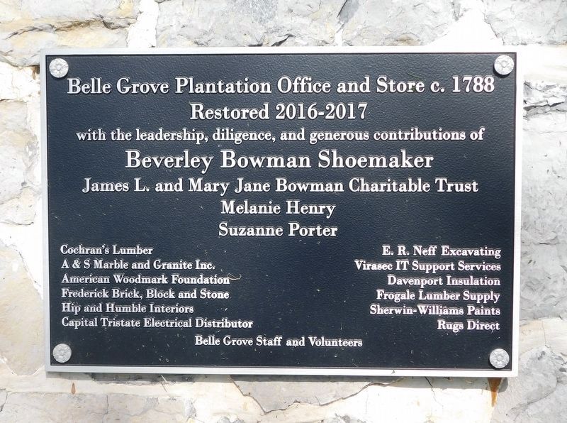
3. Plantation Office & Store Restoration Plaque
Credits. This page was last revised on November 19, 2023. It was originally submitted on October 24, 2020, by Devry Becker Jones of Washington, District of Columbia. This page has been viewed 336 times since then and 12 times this year. Photos: 1, 2. submitted on October 24, 2020, by Devry Becker Jones of Washington, District of Columbia. 3. submitted on November 19, 2023, by Bradley Owen of Morgantown, West Virginia.
