Sharpsburg in Washington County, Maryland — The American Northeast (Mid-Atlantic)
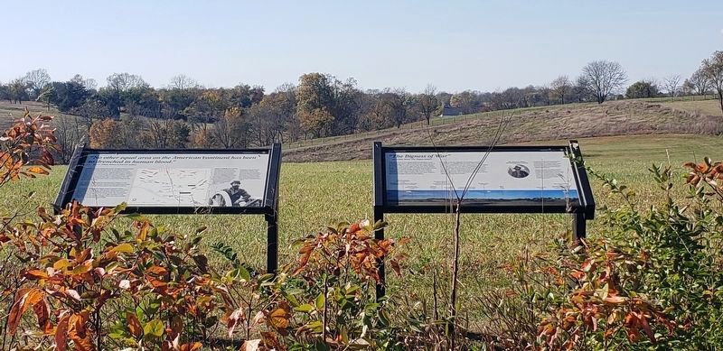
"The Bigness of War"
Lt. William Wood, 19th Virginia Infantry
— Antietam National Battlefield —
Standing on the far ridgeline and looking toward you, Confederate Lt. William Wood of the 19th Virginia Infantry described how he was "impressed as never before by the bigness of war. For miles in something of a semi-circle the enemy had batteries of heavy guns planted on every hill... and it seemed that every gun opened every minute. The smoke rolled backward to the mountains, but their destructive shot and shell were falling, it would appear, on every foot of land."
Col. James H. Childs 4th Pennsylvania Cavalry
Col. James H. Childs Of the 4th Pennsylvania Cavalry was in temporary command of Averell's Brigade at Antietam. He was leading the brigade across the Middle Bridge onto the Newcomer Farm when he was struck in the hip by an artillery round that killed two soldiers and four horses.
After his wounding, Col. Childs continued tending to his military duties, then sent a message to the surgeons that "if not attending to any one whose life could be saved, to come to him, as he was in great pain." He died less than an hour later leaving a widow and three children home in Pittsburgh. There is a monument to Col. Childs across Rt. 34 from the Newcomer house.
Erected by National Park Service.
Topics. This historical marker is listed in this topic list: War, US Civil. A significant historical date for this entry is September 17, 1862.
Location. 39° 27.886′ N, 77° 43.888′ W. Marker is in Sharpsburg, Maryland, in Washington County. Marker can be reached from Shepherdstown Pike (Maryland Route 34) half a mile east of Richardson Avenue, on the left when traveling east. Marker is at the end of the Tidball Trail 0.3 miles west of the Newcomer House. Touch for map. Marker is at or near this postal address: 18422 Shepherdstown Pike, Keedysville MD 21756, United States of America. Touch for directions.
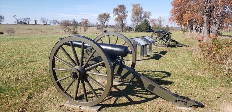
Other nearby markers. At least 8 other markers are within walking distance of this marker. Capt. John C. Tidball, Battery A, 2nd U.S. Artillery (here, next to this marker); a different marker also named Capt. John C. Tidball (here, next to this marker); Battery A, 2d U.S. Artillery (about 500 feet away, measured in a direct line); Battery E, 1st U.S. Artillery (about 500 feet away); Batteries C and G, 3d U.S. Artillery
(about 500 feet away); Batteries B and L, 2d U.S. Artillery (about 500 feet away); Battery M, 2d U.S. Artillery (about 500 feet away); Battery K, 5th U.S. Artillery (about 500 feet away). Touch for a list and map of all markers in Sharpsburg.
Also see . . .
1. Antietam National Battlefield. National Park Service (Submitted on October 24, 2020.)
2. Newcomer House. Heart of the Civil War Heritage Area (Submitted on October 24, 2020.)
Credits. This page was last revised on October 31, 2020. It was originally submitted on October 23, 2020, by Bradley Owen of Morgantown, West Virginia. This page has been viewed 155 times since then and 22 times this year. Last updated on October 24, 2020, by Bradley Owen of Morgantown, West Virginia. Photos: 1, 2, 3. submitted on October 23, 2020, by Bradley Owen of Morgantown, West Virginia. • Bernard Fisher was the editor who published this page.


