Near Middletown in Frederick County, Virginia — The American South (Mid-Atlantic)
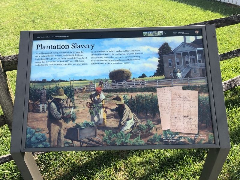
Plantation Slavery
Cedar Creek and Belle Grove National Historical Park
— National Park Service, U.S. Department of the Interior —
In the Shenandoah Valley, small family farms were the norm but plantations did exist, including Belle Grove. Major Isaac Hite, Jr. and his family recorded 276 enslaved people that they owned between 1783 and 1851. Some worked raising crops of wheat, corn, flax, and other grains or tended livestock. Others worked in Hite's industries, of which there were a blacksmith shop, saw mill, grist mill, and distillery. Enslaved workers were involved in every household task or income-producing venture and their labor was critical to the plantation's success.
[Caption:]
Isaac Hite kept detailed records of his enslaved workers. Note the annotations in the far right columns: "runaway," "sold," "given to…," "died."
Erected by National Park Service, U.S. Department of the Interior.
Topics. This historical marker is listed in these topic lists: African Americans • Agriculture • Industry & Commerce. A significant historical year for this entry is 1783.
Location. 39° 1.281′ N, 78° 18.239′ W. Marker is near Middletown, Virginia, in Frederick County. Marker is on Belle Grove Road (Route 727) 0.3 miles south of Meadow Mills Road (Virginia Route 624), on the right when traveling north. Touch for map. Marker is at or near this postal address: 336 Belle Grove Rd, Middletown VA 22645, United States of America. Touch for directions.
Other nearby markers. At least 8 other markers are within walking distance of this marker. The Shenandoah Valley / Battle of Cedar Creek, October 19, 1864 (within shouting distance of this marker); Old Hall at Belle Grove (within shouting distance of this marker); A Rich Prize (within shouting distance of this marker); In Honor of Joist Hite (1685-1761) (within shouting distance of this marker); Outflanked! (within shouting distance of this marker); The Enslaved Burial Ground (within shouting distance of this marker); Cedar Creek Battlefield and Belle Grove (within shouting distance of this marker); Enslaved Quarter Site (about 300 feet away, measured in a direct line). Touch for a list and map of all markers in Middletown.
Additional keywords. slavery, forced labor, slave labor
Credits. This page was last revised on October 24, 2020. It was originally submitted on October 24, 2020, by Devry Becker Jones of Washington, District of Columbia. This page has been viewed 164 times since then and 15 times this year. Photos: 1, 2. submitted on October 24, 2020, by Devry Becker Jones of Washington, District of Columbia.

