Tolchester Bandstand
Chesapeake Bay Maritime Museum
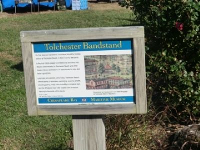
Like many amusement parks today, Tolchester Beach offered plenty of activities---swimming, a penny arcade, shooting gallery, many rides including a miniature train and the Whirlpool Dips roller coaster, and of course dancing to the music of the bands.
Topics. This historical marker is listed in this topic list: Entertainment.
Location. Marker has been reported permanently removed. It was located near 38° 47.262′ N, 76° 13.182′ W. Marker was in St. Michaels, Maryland, in Talbot County. It was on Mill Street. This marker is on the grounds of the Chesapeake Maritime Museum. Touch for map. Marker was in this post office area: Saint Michaels MD 21663, United States of America.
We have been informed that this marker is no longer there and will not be replaced. This page is an archival view of what was.
Regionally,
this page online

Other nearby markers. At least 8 other markers are within walking distance of this location: Tolchester Beach Bandstand (here, next to this marker); Point Lookout Fog Bell Tower (a few steps from this marker); Bushwack Boat (a few steps from this marker); Sharptown Barge (within shouting distance of this marker); Smith Island Crabbing Skiff (within shouting distance of this marker); Small Boat Shed (within shouting distance of this marker); St. Michaels Packing Company Warehouse (within shouting distance of this marker); Chesapeake Bay Small Craft (within shouting distance of this marker). Touch for a list and map of all markers in St. Michaels.
Another marker is no longer nearby. Tolchester Beach Bandstand
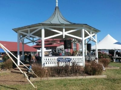
Regarding Tolchester Bandstand. There is a "Whirl Pool Dips" article on Wikipedia.
Related marker. Click here for another marker that is related to this marker. This marker has been replaced by the linked marker.
Credits. This page was last revised on November 1, 2020. It was originally submitted on November 29, 2012, by Don Morfe of Baltimore, Maryland. This page has been viewed 597 times since then and 31 times this year. Last updated on October 24, 2020, by Carl Gordon Moore Jr. of North East, Maryland. Photos: 1, 2, 3. submitted on November 29, 2012, by Don Morfe of Baltimore, Maryland. • J. Makali Bruton was the editor who published this page.
