
St. Michaels in Talbot County, Maryland — The American Northeast (Mid-Atlantic)
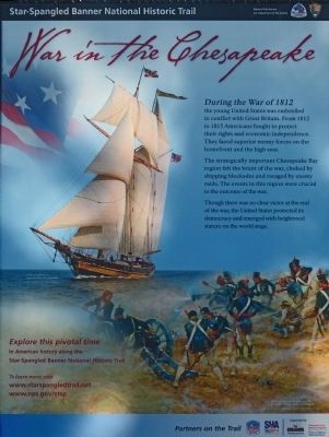
War in the Chesapeake
Star-Spangled Banner National Historic Trail
| — | National Park Service, U.S. Department of the Interior | — |
Photographed by Allen C. Browne, November 23, 2012
1. War in the Chesapeake Marker
The strategically important Chesapeake Bay region felt the brunt of the war, choked by shipping blockades and ravaged by enemy raids. The events in this region were crucial to the outcome of the war. Though there was no clear victory at the end of the war, the United States protected its democracy and emerged with heightened stature on the world stage.
Erected by National Park Service, U.S. Department of the Interior.
Topics and series. This historical marker is listed in this topic list: War of 1812. In addition, it is included in the Star-Spangled Banner National Historic Trail series list. A significant historical year for this entry is 1812.
Location. 38° 47.236′ N, 76° 13.234′ W. Marker is in St. Michaels, Maryland, in Talbot County. It can be reached from Cherry Street. On the waterfront promenade in front of the Chesapeake Bay Maritime Musuem. Touch for map. Marker
this page online

Regionally, this marker is on the Eastern Shore. It is also in the American Mid-Atlantic, on the Delmarva Peninsula, in the Tidewater, in the Chesapeake Bay Region, and on the Eastern Seaboard. Globally, it is in the North Atlantic Region, North America, the Western Hemisphere, the Western World, and the Anglosphere. Historically, it finds itself in what was once one of the original Thirteen Colonies and also the Antebellum South.
Other nearby markers. At least 8 other markers are within walking distance of this marker: Deflecting the Enemy (here, next to this marker); What's under your feet? (here, next to this marker); "O! say can you see…" (here, next to this marker); Oystering on the Chesapeake (here, next to this marker); Navy Point Historic Houses (a few steps from this marker); Lost Overboard (within shouting distance of this marker); A Mighty Pull (within shouting distance of this marker); From Seafood Packing to Tourism (within shouting distance of this marker). Touch for a list and map of all markers in St.
Photographed by Allen C. Browne, November 23, 2012
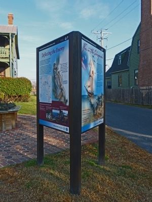
2. War in the Chesapeake and Deflecting the Enemy Markers
Other markers no longer nearby. What's under your feet? (was here, next to this marker but has been replaced with another marker now near it); Freedom's Figurehead (was a few steps from this marker but has been permanently removed); a different marker also named Navy Point Historic Houses (was within shouting distance of this marker but has been permanently removed).
More about this marker. This marker appears to be identical to one in Havre de Grace. It is half of a pair of markers including the Deflecting the Enemy marker.
Photographed by Allen C. Browne, November 23, 2012
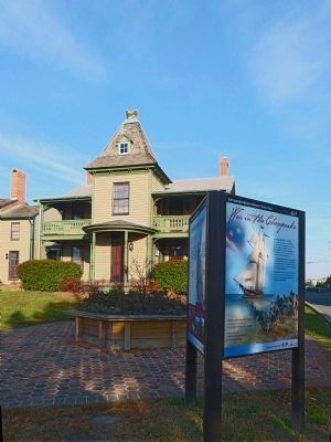
3. War in the Chesapeake Marker in front of Eagle House
Credits. This page was last revised on November 1, 2020. It was originally submitted on November 26, 2012. This page has been viewed 613 times since then and 13 times this year. Last updated on October 25, 2020, by Carl Gordon Moore Jr. of North East, Maryland. Photos: 1, 2, 3. submitted on November 26, 2012, by Allen C. Browne of Silver Spring, Maryland. • J. Makali Bruton was the editor who published this page.
