Hermiston in Umatilla County, Oregon — The American West (Northwest)
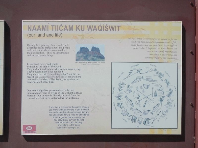
Naamí Tiičám Ku Waqíwit
(our land and life)
Inscription.
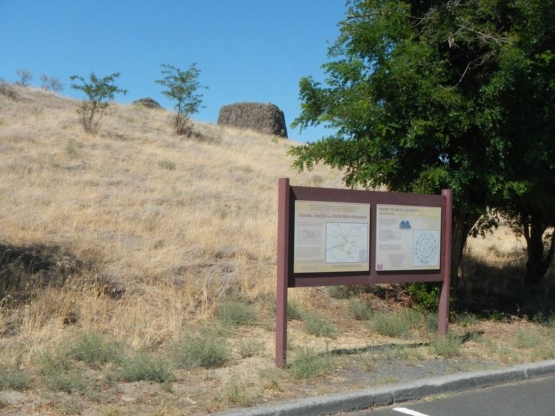
(There are two panels to this marker.)
During their journey, Lewis and Clark described many things about the people and landscapes they encountered on their expedition. The misunderstood and missed many things.
In our land Lewis and Clark bemoaned the lack of firewood. They did not understand why salmon were dying. The bought many dogs for food. The noted a rock "resembling a hat" but did not record the Cayuse Sisters, two basalt pillars more than twice the size of Hat Rock. just upriver near today's state border line.
If you live in a place for thousands of years you know when and where to get firewood. You understand what anadromous fish are. You understand how to reap the abundance fro the garden that surrounds you. You know every curve of land, every formation and its story. You belong to the place. I does not belong to you.
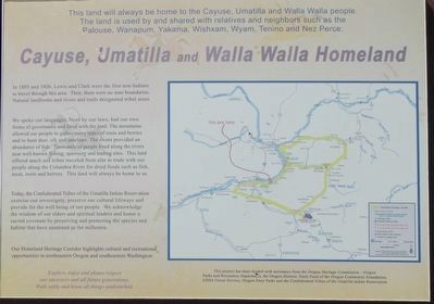
This land will always be home to the Cayuse, Umatilla and Walla Walla people. The land is used by and shared with relatives and neighbors such as the Palouse, Wanapum, Yakama, Wishxam, Wyam, Tenino and Nez Perce.
In 1805 and 1806, Lewis and Clark were the first non-Indians to travel through this area. Then, there were no state boundaries. Natural landforms and rivers and trails designated tribal areas.
We spoke our languages, lived by our laws, had our own forms of governance and lived with the land. The mountains allowed our people to gather many types of roots and berries and to hunt deer, elk and antelope. The rivers provided an abundance of fish. Thousands of people lived along the rivers near well-known fishing, spawning and trading sites. This land offered much and tribes traveled from afar to trade with our people along the Columbia River for dried foods such as fish, meat, roots and berries. This land will always be home to us.
Today, the Confederated Tribes of the Umatilla Indian Reservation exercise our sovereignty, preserve our cultural lifeways and provide for the well being of our people. We acknowledge the wisdom of our elders and spiritual leaders and honor a sacred covenant by preserving and protecting the species and habitat that have sustained us for millennia.
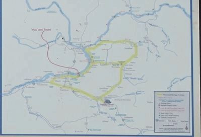
Our Homeland Heritage Corridor highlights cultural and recreational opportunities in northeastern Oregon and southeastern Washington.
Explore, enjoy and please respect our ancestors and all future generations. Walk softly and leave all things undisturbed.
Erected by Oregon Parks and Recreation Department.
Topics. This historical marker is
Photographed By Barry Swackhamer, August 14, 2020
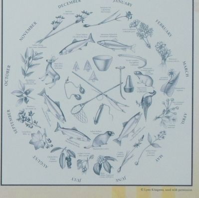
2. Circular calendar depicting seasonal food resources
We fight today for the resources we depend on for our traditional life ways and religious ceremonies: fish, roots, berries, and our medicines. We struggle to protect what is important to us so that we can continue to speak our language, continue to sing our songs and continue to follow our ceremonies.
Location. 45° 55.178′ N, 119° 10.11′ W. Marker is in Hermiston, Oregon, in Umatilla County. Marker is on Marina Drive near Hat Rock State Park Road. The marker is in the Marina Drive parking lot of Hat Rock State Park. Touch for map. Marker is in this post office area: Hermiston OR 97838, United States of America. Touch for directions.
Other nearby markers. At least 8 other markers are within 9 miles of this marker, measured as the crow flies. A Team of Discovery (here, next to this marker); It's All Downhill From Here (here, next to this marker); How Do You Make a Hat? (approx. ¼ mile away); The Umatilla Rapids (approx. 6.6 miles away); The Lewis and Clark Expedition (approx. 6.6 miles away); Cayuse, Umatilla and Walla Walla Homeland (approx. 6.6 miles away); Patímaa Tiičámna (approx. 6.6 miles away); Strangers "from the clouds" (approx. 8.9 miles away in Washington). Touch for a list and map of all markers in Hermiston.
Credits. This page was last revised on October 26, 2020. It was originally submitted on October 26, 2020, by Barry Swackhamer of Brentwood, California. This page has been viewed 97 times since then and 7 times this year. Photos: 1, 2, 3, 4, 5. submitted on October 26, 2020, by Barry Swackhamer of Brentwood, California.
