Orleans in Barnstable County, Massachusetts — The American Northeast (New England)
The United States Lifesaving Service
Lifesaving Heritage of Orleans
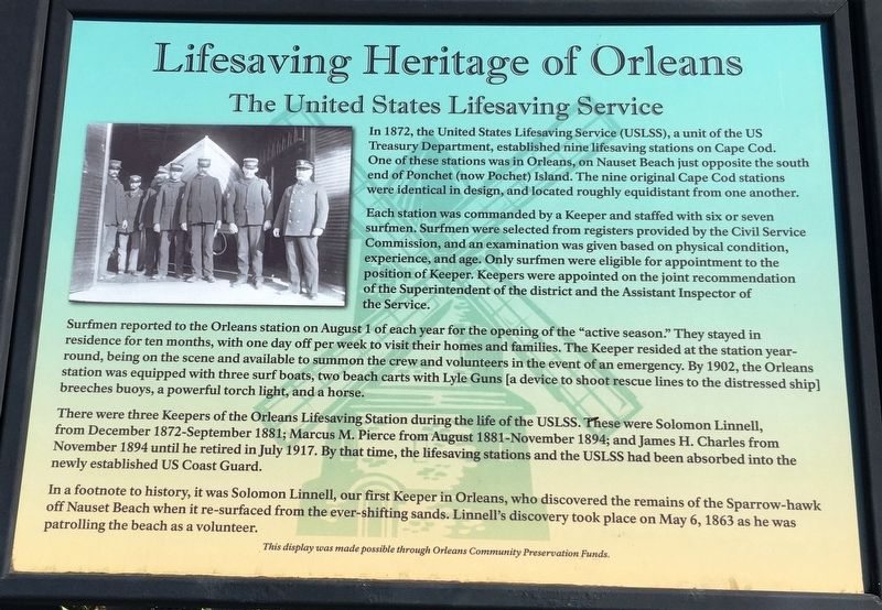
In 1872, the United States Lifesaving Service (USLSS), a unit of the US Treasury Department, established nine lifesaving stations on Cape Cod. One of these stations was in Orleans, on Nauset Beach just opposite the south end of Ponchet (now Pochet) Island. The nine original Cape Cod stations were identical in design, and located roughly equidistant from one another.
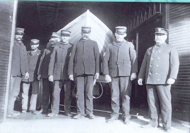
Each station was commanded by a Keeper and staffed with six or seven surfmen. Surfmen were selected from registers provided by the Civil Service Commission, and an examination was given based on physical condition, experience, and age. Only surfmen were eligible for appointment to the position of Keeper. Keepers were appointed on the joint recommendation of the Superintendent of the district and the Assistant Inspector of the Service.
Surfmen reported to the Orleans station on August 1 of each for the opening of the “active season.” They stayed in residence for ten months, with one day off per week to visit their homes and families. The Keeper resided at the station year-round, being on the scene and available to summon the crew and volunteers in the event of an emergency. By 1902, the Orleans station was equipped with three surf boats, two beach carts with Lyle Guns [a device to shoot rescue lines to a distressed ship] breeches buoys, a powerful torch light, and a horse.
There were three Keepers of the Orleans Lifesaving Station during the life of the USLSS. These were Solomon Linnell, from December 1872 – September 1881; Marcus M. Pierce from August 1881 – November 1894; and James H. Charles from November 1894 until he retired in July 1917. By that time, the lifesaving stations and the USLSS had been absorbed into the newly established US Coast Guard.
In a footnote to history, it was Solomon Linnell, our first Keeper in Orleans, who discovered the remains of the Sparrow-hawk off Nauset Beach when it re-surfaced from the ever shifting sands. Linnell’s discovery took place on May 6, 1863 as he was patrolling the beach as a volunteer.
This display was made possible through Orleans Community Preservation Funds
Erected by Orleans Community Preservation Committee.
Topics. This historical marker is listed in these topic lists: Disasters • Industry & Commerce.
Location. 41° 47.191′ N, 69° 56.205′ W. Marker is in Orleans, Massachusetts, in Barnstable County. Marker is at the intersection of Beach Road and Surf Path, on the left when traveling east on Beach Road. The marker is located at the east end of the Nauset Beach
parking lot. Touch for map. Marker is at or near this postal address: 250 Beach Road, Orleans MA 02653, United States of America. Touch for directions.
Other nearby markers. At least 8 other markers are within 3 miles of this marker, measured as the crow flies. Benjamin Sparrow (here, next to this marker); The Legacy Continues (here, next to this marker); The Birth of the Coast Guard (here, next to this marker); The Legacy Endures (here, next to this marker); The Legacy Begins (here, next to this marker); Nauset Beach (about 300 feet away, measured in a direct line); East Orleans Country Store (approx. 1˝ miles away); Universalist Society Meeting House (approx. 2.1 miles away). Touch for a list and map of all markers in Orleans.
Credits. This page was last revised on October 30, 2020. It was originally submitted on October 27, 2020, by Brandon D Cross of Flagler Beach, Florida. This page has been viewed 156 times since then and 13 times this year. Photos: 1, 2, 3. submitted on October 27, 2020, by Brandon D Cross of Flagler Beach, Florida. • J. Makali Bruton was the editor who published this page.


