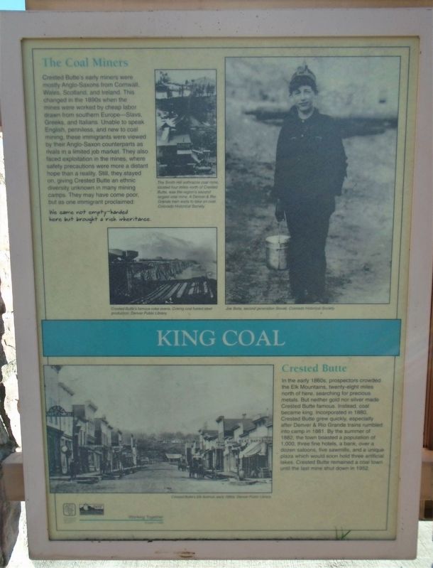
King Coal
The Coal Miners
Crested Butte's early miners were mostly Anglo-Saxons from Cornwall, Wales, Scotland, and Ireland. This changed in the 1890s when the mines were worked by cheap labor drawn from southern Europe—Slavs, Greeks, and Italians. Unable to speak English, penniless, and new to coal mining, these immigrants were viewed by their Anglo-Saxon counterparts as rivals in a limited job market. They also faced exploitation in the mines, where safety precautions were more a distant hope than a reality. Still, they stayed on, giving Crested Butte an ethnic diversity unknown in many mining camps. They may have come poor, but as one immigrant proclaimed:
We came not empty-handed here
but brought a rich inheritance.
Crested Butte
In the early 1860s, prospectors crowded the Elk Mountains, twenty-eight miles north of here, searching for precious metals. But neither gold nor silver made Crested Butte famous. Instead, coal became king. Incorporated in 1880, Crested Butte grew quickly, especially after Denver & Rio Grande trains rumbled into camp in 1881. By the summer of 1882, the town boasted a population of 1,000, three fine hotels, a bank, over a dozen saloons, five sawmills, and a unique plaza which would soon hold three artificial lakes. Crested Butte remained a coal town until the last
[Photo captions, clockwise from bottom left, read]
• Crested Butte's Elk Avenue, early 1880s.
• Crested Butte's famous coke ovens. Coking coal fueled steel production.
• The Smith Hill anthracite coal mine, located four miles north of Crested Butte, was the region's second largest coal mine. A Denver & Rio Grande train waits to take on coal.
• Joe Slota, second generation Slovak.
Erected 1996 by Colorado Historical Society and Colorado Dept of Transportation.
Topics. This historical marker is listed in these topic lists: Environment • Industry & Commerce • Settlements & Settlers. A significant historical year for this entry is 1880.
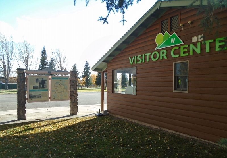
Location. 38° 32.675′ N, 106° 55.27′ W. Marker is in Gunnison, Colorado, in Gunnison County. Marker is adjacent to the Gunnison County Visitor Center, but not visible from the road. Touch for map. Marker is at or near this postal address: 500 East Tomichi Avenue, Gunnison CO 81230, United States of America. Touch for directions.
Other nearby markers. At least 8 other markers are within walking distance of this marker. Two Great Trains (here, next to this marker); Ho For The Gunnison! (here, next to this marker); Gunnison Country (here, next to this marker); The World's Largest Collegiate Emblem! (a few steps from this marker); Bruce-Frew American Legion Post No. 54 Hut and History
Also see . . .
1. Remembering Colorado's Coal Wars...and Coal Miners (Trembath, 2015). Denver Public Library website entry (Submitted on October 27, 2020, by William Fischer, Jr. of Scranton, Pennsylvania.)
2. The Mining Industry in Colorado. History Colorado website entry (Submitted on October 27, 2020, by William Fischer, Jr. of Scranton, Pennsylvania.)
3. Life in the Coal Camps of Southern Colorado, 1890-1933 (Klein thesis, 1995). University of Colorado website entry (Submitted on October 27, 2020, by William Fischer, Jr. of Scranton, Pennsylvania.)
Credits. This page was last revised on August 30, 2023. It was originally submitted on October 27, 2020, by William Fischer, Jr. of Scranton, Pennsylvania. This page has been viewed 146 times since then and 14 times this year. Photos: 1, 2. submitted on October 27, 2020, by William Fischer, Jr. of Scranton, Pennsylvania.

