Near Mechanicsville in Hanover County, Virginia — The American South (Mid-Atlantic)
“The Old Church”
Erected on this spot in 1753
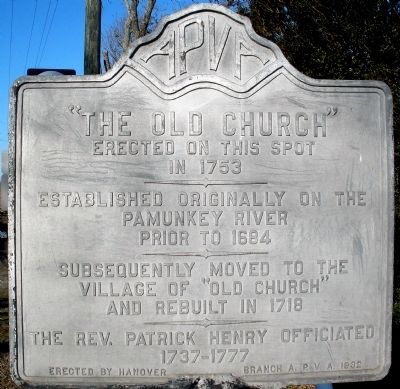
Photographed by Bernard Fisher, January 31, 2009
1. “The Old Church” Marker
Subsequently moved to the village of “Old Church” and rebuilt in 1718
The Rev. Patrick Henry officiated 1737-1777
Erected 1932 by Hanover Branch, Association for the Preservation of Virginia Antiquities.
Topics. This historical marker is listed in these topic lists: Colonial Era • Religion & Religious Structures. A significant historical year for this entry is 1684.
Location. 37° 38.675′ N, 77° 13.263′ W. Marker is near Mechanicsville, Virginia, in Hanover County. It is at the intersection of Old Church Road and McClellan Road, on the left when traveling south on Old Church Road. The marker is adjacent to the historic Old Church Tavern. Touch for map. Marker is in this post office area: Mechanicsville VA 23111, United States of America. Touch for directions.

Regionally, this marker is in the Piedmont, in Central Virginia, and in the Richmond Metropolitan Area. It is also in the American South, specifically in the Upper South, and on the Eastern Seaboard. Globally, it is in the North Atlantic Region, North America, the Western Hemisphere,
this page online
Other nearby markers. At least 8 other markers are within 4 miles of this marker, measured as the crow flies: Stuart's Ride (approx. 0.3 miles away); Edmund Ruffin's Grave (approx. 0.8 miles away); a different marker also named Stuart’s Ride (approx. 1.4 miles away); Cavalry Action At Linney's (approx. 1.9 miles away); a different marker also named Stuart's Ride (approx. 2.4 miles away); Cornwallis's Route (approx. 3.1 miles away); "Old Virginia Barn" (approx. 3.8 miles away); "Prestley Barn" (approx. 3.8 miles away). Touch for a list and map of all markers in Mechanicsville.
Another marker is no longer nearby. Henry's Call to Arms (was approx. 3.1 miles away but has been confirmed missing).
Regarding “The Old Church”. Immanuel Episcopal Church was established in Hanovertown on the Pamunkey River in 1684. When the parish was divided, a new church was built near this crossroads in
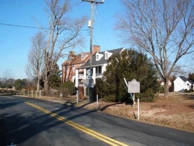
Photographed by Bernard Fisher, January 31, 2009
2. “The Old Church” Marker at Old Church Hotel
Also see . . .
1. Immanuel Episcopal Church history. (Submitted on February 5, 2009, by Bernard Fisher of Richmond, Virginia.)
2. Civil War Traveler. Lee vs. Grant: The 1864 Overland Campaign Tour (Submitted on April 1, 2009, by Bernard Fisher of Richmond, Virginia.)
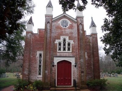
Photographed by Bernard Fisher, March 28, 2009
3. Immanuel Episcopal Church built in 1853.
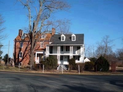
Photographed by Bernard Fisher, January 31, 2009
4. Old Church Hotel (private residence)
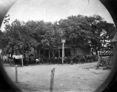
Photographed by Timothy O'Sullivan, June 4, 1864
5. Cold Harbor, Va, vicinity. Cavalry horses outside the Old Church Hotel. Library of Congress
Headquarters of General Sheridan's Cavalry Corps.
Credits. This page was last revised on June 16, 2016. It was originally submitted on February 5, 2009, by Bernard Fisher of Richmond, Virginia. This page has been viewed 5,008 times since then and 181 times this year. Photos: 1, 2. submitted on February 5, 2009, by Bernard Fisher of Richmond, Virginia. 3. submitted on March 31, 2009, by Bernard Fisher of Richmond, Virginia. 4. submitted on February 5, 2009, by Bernard Fisher of Richmond, Virginia. 5. submitted on March 27, 2009, by Bernard Fisher of Richmond, Virginia. • Kevin W. was the editor who published this page.
