Marker Logo HMdb.org THE HISTORICAL
MARKER DATABASE
“Bite-Size Bits of Local, National, and Global History”
Soulard in St. Louis, Missouri — The American Midwest (Upper Plains)
 

Ripple Row

2620-2630 S 12th St.

— Circa 1865 —


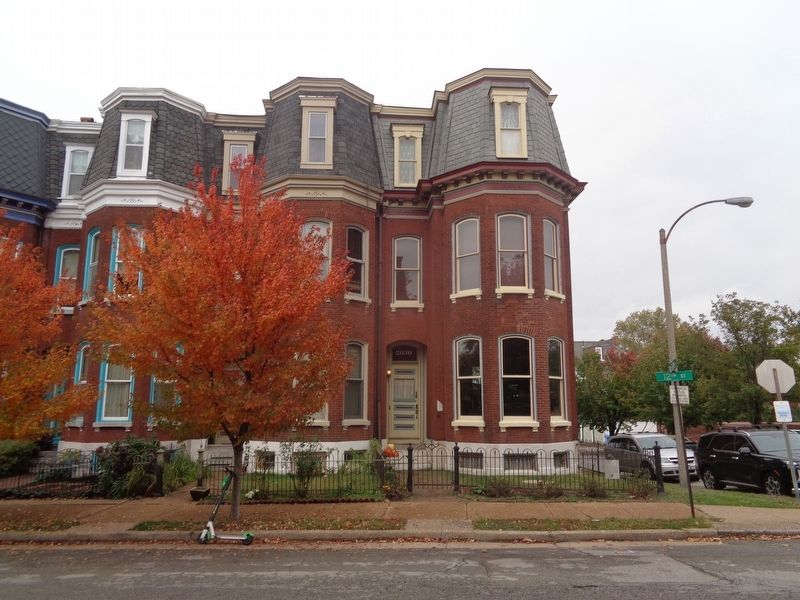
Ripple Row Marker image. Click for full size.
Photographed By Jason Voigt, October 28, 2020
1. Ripple Row Marker
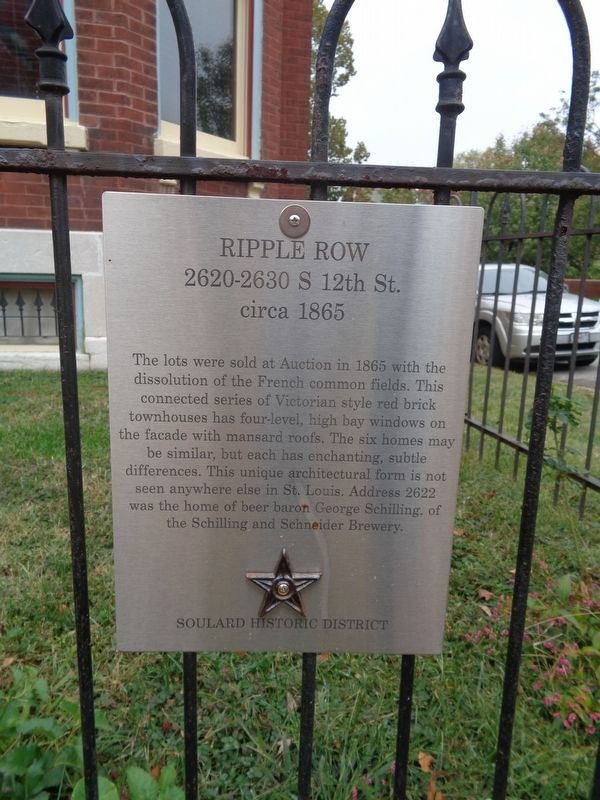
Inscription. The lots were sold at Auction in 1865 with the dissolution of the French common fields. This connected series of Victorian style red brick townhouses has four-level, high bay windows on the façade with mansard roofs. The six homes may be similar, but each has enchanting, subtle differences. This unique architectural form is not seen anywhere else in St. Louis. Address 2622 was the home of beer baron George Schilling, of the Schilling and Schneider Brewery.
 
Erected 2019 by Soulard Historic District.
 
Topics and series. This historical marker is listed in these topic lists: ArchitectureIndustry & Commerce. In addition, it is included in the Missouri, St. Louis, Soulard Historic District ⚜️ series list. A significant historical year for this entry is 1865.
 
Location. 38° 36.074′ N, 90° 12.763′ W. Marker is in St. Louis, Missouri. It is in Soulard. Marker is on South 12th Street north of McGirk Street, on the right when traveling north. Touch for map. Marker is at or near this postal address: 2630 S 12th St, Saint Louis MO 63118, United States of America. Touch for directions.
 
Other nearby markers. At least 8 other markers are within walking distance of this marker. Louis Obert Mansion (a few steps from this marker); Max Feuerbacher Mansion (about 300 feet away, measured in a direct line); Mad Art Gallery (about 400 feet away); Henry Brunelle House
Paid Advertisement
Click on the ad for more information.
Please report objectionable advertising to the Editor.
Click or scan to see
this page online
(about 400 feet away); Martie "Murph" Aboussie Park (about 500 feet away); Cat's Meow (about 500 feet away); Big Daddy's (about 800 feet away); Vincent's Market (approx. 0.2 miles away). Touch for a list and map of all markers in St. Louis.
 
Ripple Row Marker image. Click for full size.
Photographed By Jason Voigt, October 28, 2020
2. Ripple Row Marker
Wide view of marker (posted on the fence)
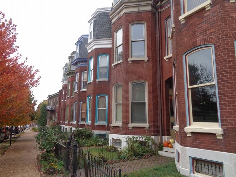
Ripple Row Marker image. Click for full size.
Photographed By Jason Voigt, October 28, 2020
3. Ripple Row Marker
While it is, in many ways, impossible to get a shot of all the homes in one photo, this may help provide a vision of Ripple Row (looking north).
 
 
Credits. This page was last revised on January 30, 2023. It was originally submitted on October 31, 2020, by Jason Voigt of Glen Carbon, Illinois. This page has been viewed 323 times since then and 47 times this year. Photos:   1, 2, 3. submitted on October 31, 2020, by Jason Voigt of Glen Carbon, Illinois.
Share this page.  
Share on Tumblr
m=159008

CeraNet Cloud Computing sponsors the Historical Marker Database.
This website earns income from purchases you make after using our links to Amazon.com. We appreciate your support.
Paid Advertisement
Apr. 23, 2024