Pawleys Island in Georgetown County, South Carolina — The American South (South Atlantic)
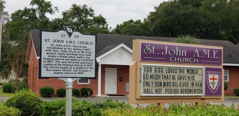
St. John A.M.E. Church
St. John A.M.E. Church was established in the spring of 1867 with Rev. Saby Green as the first pastor. Early meetings were held under a brush arbor until a log framed church was built at Litchfield in 1867. The current brick sanctuary replaced the original church in 1947. The church began as a member of the Waccamaw Circuit, but became a station church in 1965.
Erected 2017 by St. John A.M.E. Church. (Marker Number 22 65.)
Topics. This historical marker is listed in these topic lists: African Americans • Churches & Religion.
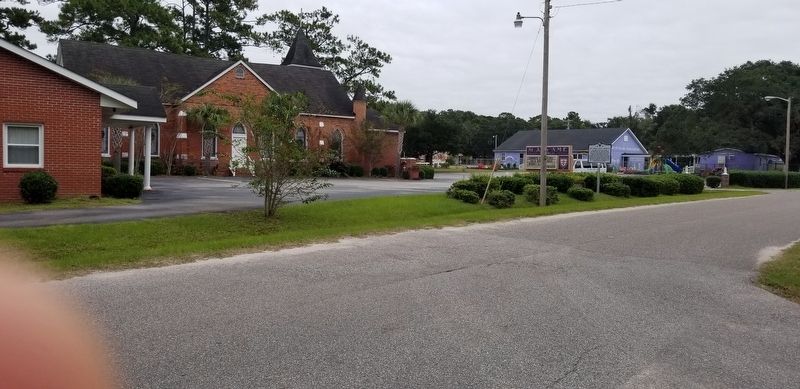
Location. 33° 27.184′ N, 79° 7.413′ W. Marker is on Pawleys Island, South Carolina, in Georgetown County. Marker is at the intersection of Duncan Avenue and Godfrey Road, on the right when traveling west on Duncan Avenue. Touch for map. Marker is at or near this postal address: 76 Duncan Ave, Pawleys Island SC 29585, United States of America. Touch for directions.
Other nearby markers. At least 8 other markers are within 3 miles of this marker, measured as the crow flies. School House (approx. 0.7 miles away); Waverly Building (approx. 0.7 miles away); Pawley’s Island / Waccamaw Neck (approx. 1.3 miles away); All Saints Parish (1767) / All Saints, Waccamaw (approx. 1.4 miles away); Pawleys Island House of Worship (approx. 1.7 miles away); R.F.W. Allston Causeway (approx. 2 miles away); R. F. W. Allston House (approx. 2.2 miles away); P. C. J. Weston House / Pelican Inn (approx. 2.3 miles away). Touch for a list and map of all markers in Pawleys Island.
Credits. This page was last revised on November 1, 2020. It was originally submitted on October 31, 2020, by Charles Keller of Myrtle Beach, South Carolina. This page has been viewed 385 times since then and 48 times this year. Photos: 1, 2, 3. submitted on October 31, 2020, by Charles Keller of Myrtle Beach, South Carolina. • Bernard Fisher was the editor who published this page.


