Luray in Page County, Virginia — The American South (Mid-Atlantic)
Luray
Where the Caverns meet the Sky
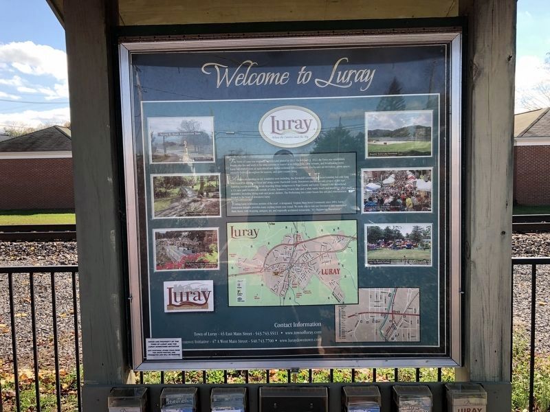
The Town of Luray was originally surveyed and platted in 1811. On February 8, 1812, the Town was established. People who live and work in the area continue to marvel at its rolling hills, clear streams, and breathtaking views. Luray has evolved from an agricultural and timber economy into a community that focuses on recreation, green spaces, energetic festivals throughout the seasons, and quiet country living.
Activities are limitless in our wonderful town including, the Hawksbill Greenway, an award winning two mile long trail located in downtown Luray along scenic HAwksbill Creek. Downtown murals, the only project of this type featuring murals painted by locals depicting things indigenous to Page County and Luray. Tranquil Lake Arrowhead, a 131 acre park located just outside of Luray features a 34 acre lake and a white sandy beach and numerous other park amenities, including hiking trails and picnic shelters. The Performing Arts Center boasts fine arts and entertainment located at the heart of downtown Luray.
Visiting Luray is fabulous anytime of the year! A designated Virginia Main Street Community since 2004, Luray Downtown Initiative provides many exciting events year round. We invite you to visit our Downtown and experience Main Street, with shopping, antiques, art, and regionally acclaimed restaurants. "It's Happening Downtown!"
Erected by Town of Luray, Luray Downtown Initiative.
Topics. This historical marker is listed in this topic list: Settlements & Settlers. A significant historical date for this entry is February 8, 1812.
Location. 38° 39.896′ N, 78° 29.012′ W. Marker is in Luray, Virginia, in Page County. Marker can be reached from Cave Hill Road, 0.2 miles west of Lee Highway (U.S. 211/340), on the left when traveling west. Touch for map. Marker is at or near this postal address: 970 Lee Highway, Luray VA 22835, United States of America. Touch for directions.
Other nearby markers. At least 8 other markers are within walking distance of this marker. Shenandoah At War (here, next to this marker); Car & Carriage Caravan Museum (within shouting distance of this marker); The Beautiful Caverns of Luray (about 300 feet away, measured in a direct line); Luray Caverns (about 300 feet away); The Luray Valley Museum (about 400 feet away); The World's First Bluegrass Festival (about 400 feet away); Heartpine Cafe (about 400 feet away); Willow Grove Mill In Olden Days (about 500 feet away). Touch for a list and map of all markers in Luray.

Photographed By Devry Becker Jones (CC0), October 31, 2020
2. A marker with identical information can be found in Downtown Luray at the Visitor Center
Credits. This page was last revised on November 1, 2020. It was originally submitted on November 1, 2020, by Devry Becker Jones of Washington, District of Columbia. This page has been viewed 136 times since then and 20 times this year. Photos: 1, 2. submitted on November 1, 2020, by Devry Becker Jones of Washington, District of Columbia.
