Fredericksburg in Spotsylvania County, Virginia — The American South (Mid-Atlantic)
Civilians in the Crossfire
The Battle of Chancellorsville
| — | Fredericksburg and Spotsylvania National Military Park | — |
Photographed by Craig Swain, November 10, 2007
1. Civilians in the Crossfire Marker
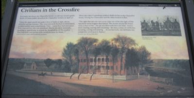
In seventy-two hours the Chancellor family's world was turned upside down. A Union soldier described the Chancellor women on April 30:
"Upon the upper porch was quite a bevy of ladies in light, dressy, attractive spring costumes. They were not at all abashed or intimidated, scolded audibly and reviled bitterly. They ... stated they had assurances from General Lee, who was just ahead, that he was there anxiously awaiting an opportunity to extend the 'hospitalities of the country.' They had little conception of the terrors in store for them...."
Unknown Union soldier, 118th Pennsylvania Volunteers
Three days later Confederate artillery shells set fire to the Chancellor house, forcing Sue Chancellor and the other women to flee.
"The sight that met our eyes as we came out of the dim light of that basement room beggars description. The woods around the house were a sheet of fire - the air was filled with shot and shell - horses were running, rearing and screaming - the men, a mass of confusion moaning, cursing, and praying.... At our last look, our old home was completely enveloped in flames."
Fourteen-year-old Sue Chancellor
Erected by National
this page online
Topics. This historical marker is listed in this topic list: War, US Civil. A significant historical month for this entry is April 1692.
Location. 38° 18.527′ N, 77° 38.085′ W. Marker is in Fredericksburg, Virginia, in Spotsylvania County. It is at the intersection of Plank Road / Germania Highway (State Highway 3) and Elys Ford Road (County Route 610), on the right when traveling west on Plank Road / Germania Highway. Located at stop three of the driving tour of Chancellorsville Battlefield, the Chancellorsville Inn. Touch for map. Marker is at or near this postal address: 8840 Elys Ford Rd, Fredericksburg VA 22407, United States of America. Touch for directions.

Regionally, this marker is in the Washington Metropolitan Area, in Northern Virginia, and in the Piedmont. It is also in the American South, specifically in the Upper South, in the Mid-Atlantic, and on the Eastern Seaboard. Globally, it is in the North Atlantic Region, North America, the Western Hemisphere, the Western World, and the Anglosphere. Historically, it finds itself in what was once the territory of the Mississippian
Photographed by Craig Swain, November 10, 2007
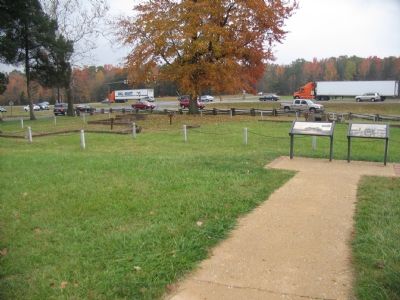
2. Markers Beside the Chancellorsville Inn Ruins
Other nearby markers. At least 8 other markers are within walking distance of this marker: The Chancellor Slaves (here, next to this marker); Climactic Struggle (within shouting distance of this marker); Lee's Greatest Triumph (within shouting distance of this marker); The Chancellorsville Intersection (within shouting distance of this marker); a different marker also named Battle of Chancellorsville (about 300 feet away); Chancellorsville Clearing (about 700 feet away); Chancellorsville Campaign (approx. 0.2 miles away); a different marker also named Chancellorsville Campaign (approx. 0.2 miles away). Touch for a list and map of all markers in Fredericksburg.
Other markers no longer nearby. Chancellorsville Home of Mrs. Sanford Chancellor (was here, next to this marker but has been permanently removed); Battle of Chancellorsville (was within shouting distance of this marker but has been permanently removed); Chancellorsville (was within shouting distance of this marker but has been permanently removed); a
Photographed by Bill Coughlin, April 18, 2023
3. Civilians in the Crossfire Marker
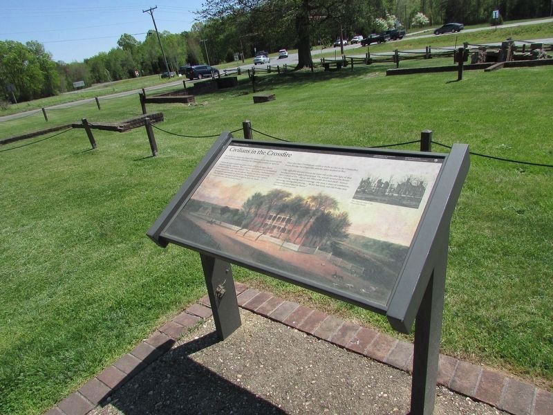
More about this marker. The background of the marker is a painting of the Chancellor House as it stood before the war. A photo on the upper right shows "The charred ruins of the Chancellor house."
Regarding Civilians in the Crossfire. This is one of several markers for the Battle of Chancellorsville at the Chancellorsville Intersection, scene of considerable fighting in the battle. See the Chancellorsville Intersection Virtual Tour by Markers in the links section for a listing of related markers on the tour.
Also see . . . Chancellorsville Intersection Virtual Tour by Markers. The Chancellorsville Intersection portion of the battlefield (stop three on the driving tour of the battlefield) includes markers at the intersection of the historic Plank and Ely's Ford Roads. Considerable fighting occurred here on May 3, 1863. (Submitted on December 8, 2007, by Craig Swain of Leesburg, Virginia.)
Photographed by Craig Swain, November 10, 2007
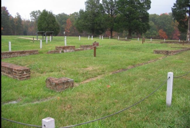
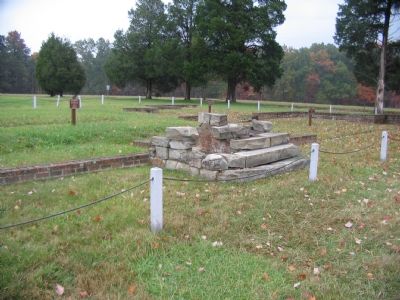
4. Portion of the Runins of the Inn
This portion of the Inn was built in 1815.
Photographed by Craig Swain, November 10, 2007
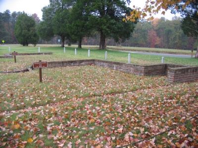
5. The Original Portion of the Inn
This section dates to the late 1700s.
Photographed by Craig Swain, November 10, 2007
6. The East Wing of the Inn
Extensions were also added here in 1815. Behind the Inn ruins are those of an another extension dating to the 1840s.
Credits. This page was last revised on May 28, 2024. It was originally submitted on November 29, 2007. This page has been viewed 1,584 times since then and 29 times this year. Last updated on November 2, 2020, by Bradley Owen of Morgantown, West Virginia. Photos: 1, 2. submitted on November 29, 2007, by Craig Swain of Leesburg, Virginia. 3. submitted on April 24, 2023, by Bill Coughlin of Woodland Park, New Jersey. 4, 5, 6. submitted on November 29, 2007, by Craig Swain of Leesburg, Virginia. • J. Makali Bruton was the editor who published this page.
