Bluemont in Loudoun County, Virginia — The American South (Mid-Atlantic)
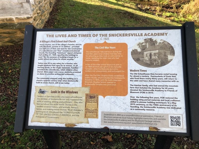
The Lives And Times Of The Snickersville Academy
C. 1825
Photographed by Devry Becker Jones (CC0), October 31, 2020
1. The Lives And Times Of The Snickersville Academy Marker
A Village's First School And Church
Amos Clayton, son of the village's founder, and his wife Elizabeth, parents of 12 children — provided one half-acre of their own land for the construction of a schoolhouse and "free" (nondenominational) church. The founding "Indenture" signed at Clayton Hall on May 21, 1825, specifies the building be used "for the purpose of building a house for a public school and place for divine worship."
Tuition was $3 to pay salary for a teacher, who taught students from ages six to sixteen, on all learning levels, in the single classroom. Families provided the schoolbooks, which children often shared. Since paper was scarce, students scratched on slates to practice writing and arithmetic.
The community stopped using this building as a church a quarter century later when Snickersville built its stone church, still in use today.
this page online
A few of the older school boys took part in an 1864 skirmish just uphill on Snickersville Turnpike, when Confederate and Union soldiers met unexpectedly and exchanged fire.
After the Civil War, Virginia slowly established public schools, which included the Snickersville Academy in 1870, until the multi-classroom Mountain Shadow School opened on Snickersville Turnpike two years later.
Modern Times
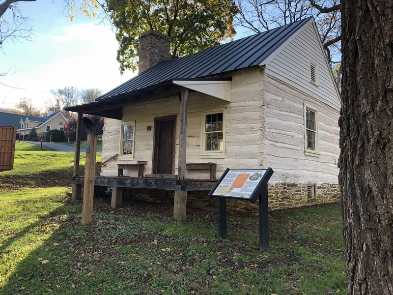
The Old Schoolhouse then became rental housing for almost a century. Descendants of Susie Neil, who lived there nearly thirty years, still return to the cabin and have shared many memories with us.
The Hatcher family, who had owned the mountain farm that included the Academy for 60 years, donated the Snickersville Academy to Friends of Bluemont (FOB)
Photographed by Devry Becker Jones (CC0), October 31, 2020
2. The Lives And Times Of The Snickersville Academy Marker
Over the following five years, FOB restored the building using period materials and local craftsmen skilled in pioneer building techniques. In a May 2015 ceremony, on the 190th anniversary of its founding, the Snickersville Academy was dedicated as a community resource.
Established in 2002 as a nonprofit historical association, Friends of Bluemont preserves local history, highlights memories, and operates the Snickersville Academy and the Bluemont Heritage website. See www.bluemontva.org and www.bluemontheritage.org.
Erected by Friends of Bluemont.
Topics. This historical marker is listed in these topic lists: Education • Religion & Religious Structures • War, US Civil. A significant historical date for this entry is May 21, 1825.
Location. 39° 6.633′ N, 77° 50.148′ W. Marker is in Bluemont, Virginia, in Loudoun County. It can be reached from Snickersville Turnpike (Virginia Route 734) just west of Clayton Hall Road ( Route 760), on the left when traveling west. Touch for map. Marker is at or near this postal address: 33685 Snickersville Turnpike, Bluemont VA 20135, United States of America. Touch for directions.

Regionally, this marker is in the Washington Metropolitan Area and in Northern Virginia. It is also in the American South, specifically in the Upper South, and in the Mid-Atlantic. Globally, it is in North America, the Western Hemisphere, the Western World, and the Anglosphere. Historically, it finds itself in what was once the territory of the Mississippian Culture, one of the original Thirteen Colonies, one of the Confederate States of America, and the Antebellum South.
Other nearby markers. At least 8 other markers are within walking distance of this marker: The Snickersville Academy (about 400 feet away, measured in a direct line); Bluemont Historic District (about 400 feet away); Bluemont (about 400 feet away); Snickersville Turnpike (about 400 feet away); a different marker also named Snickersville Turnpike (approx. half a mile away); Mt. Airy Fight (approx. 0.7 miles away); Lt. Col. Roger Preston Chew (1843-1921) (approx. 0.9 miles away); Appalachian Trail and Bears Den (approx. one mile away). Touch for a list and map of all markers in Bluemont.
Other markers no longer nearby. Crook and Early (was approx. 0.7 miles away but has been confirmed missing); Forerunner of Wireless Telegraphy (was approx. 0.7 miles away but has been confirmed missing); Clark County / Loudoun County (was approx. 0.7 miles away but has been confirmed missing).
Credits. This page was last revised on November 2, 2020. It was originally submitted on November 2, 2020, by Devry Becker Jones of Washington, District of Columbia. This page has been viewed 577 times since then and 22 times this year. Photos: 1, 2. submitted on November 2, 2020, by Devry Becker Jones of Washington, District of Columbia.
