Waller in Waller County, Texas — The American South (West South Central)
Waller

Photographed by Gary Estep, January 1, 2026
1. Waller Marker
Extension of the Houston and Texas Central Railroad here about 1857 provided the means for a growing number of settlers in this area to market their farm and ranch products. The town was platted by K. H. Faulkner in 1884 and named Waller for signer of Texas Declaration of Independence and Waller County Judge Edwin Waller. The village soon boasted a post office, general store, and school. Telephone service arrived in 1912, gas and electric utilities in 1928. And in 1947 the town was incorporated. Waller's steady growth has been sustained by its farm and ranch industry.
Erected 1994 by Texas Historical Commission. (Marker Number 8124.)
Topics. This historical marker is listed in these topic lists: Industry & Commerce • Railroads & Streetcars • Settlements & Settlers. A significant historical year for this entry is 1857.
Location. 30° 3.466′ N, 95° 55.48′ W. Marker is in Waller, Texas, in Waller County. It is at the intersection of Farr Street and Cherry Street, on the left when traveling south on Farr Street. The marker is located in front of the new Waller City Hall. Touch for map. Marker is at or near this
this page online

Regionally, this marker is in the Houston Metropolitan Area. It is also in the American South and on the Gulf Coast. Globally, it is in North America, a Gulf of Mexico state, the Western Hemisphere, the Western World, and the Anglosphere. Historically, it finds itself in what was once New Spain, the Republic of Texas, one of the Confederate States of America, and the Antebellum South.
Other nearby markers. At least 8 other markers are within 6 miles of this marker, measured as the crow flies: First United Methodist Church of Waller (about 300 feet away, measured in a direct line); Site of South Texas Baptist College (approx. 0.3 miles away); Site of St. Mary's Catholic Church and Cemetery (approx. 2.2 miles away); Jacob E. Freeman (approx. 4.3 miles away); Wyatt Chapel Community Cemetery (approx. 4.9 miles away); Pine Island Baptist Church (approx. 5.1 miles away); Shiloh Baptist Church (approx. 5.6 miles away); Shiloh Cemetery (approx. 5.6 miles away). Touch for a list and map of all markers in Waller.
Also see . . . Waller Texas.
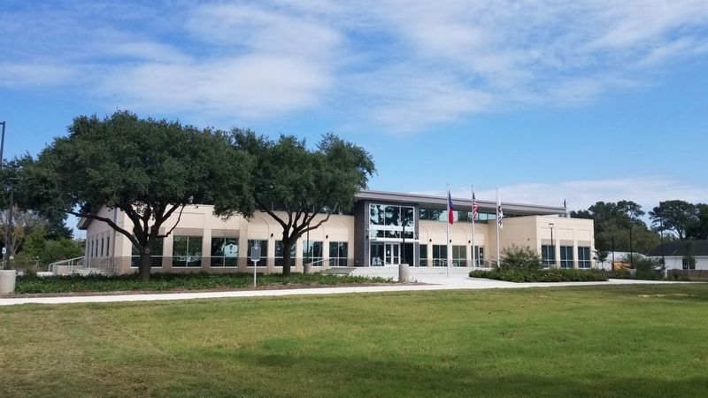
Photographed by James Hulse, October 24, 2020
2. Waller Marker

Photographed by James Hulse, October 24, 2020
3. Waller Marker
Credits. This page was last revised on January 1, 2026. It was originally submitted on November 4, 2020, by James Hulse of Medina, Texas. This page has been viewed 444 times since then and 27 times this year. Photos: 1. submitted on January 1, 2026, by Gary Estep of Anna, Texas. 2, 3. submitted on November 4, 2020, by James Hulse of Medina, Texas. • J. Makali Bruton was the editor who published this page.
