Near Clarkston in Asotin County, Washington — The American West (Northwest)
Álpáwayma Village
Inscription.
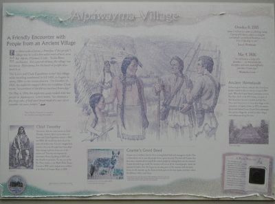
For thousands of years, a Nimiipuu ("the people") village was located a few miles west of here, near the Álpáha (Alpowa) Creek - Snake River confluence. For a period of time, the village was known as Álpáwatma, for the band of people who lived here.
The Lewis and Clark Expedition visited this village while traveling westbound in fall 1805, and again in spring 1806 on the return journey. On October 11, 1805, the explorers stopped there for breakfast. Clark wrote, "we purchased all the fish we could and Seven dogs."
On May 4, 1806, the explorers again traded with the people at Álpáwatma.Lewis wrote, "we obtained a few large cakes of half cured bread made of the root which resembles the sweet potato."
Note: the Nez Perce are also known as the Nimiipuu meaning, ("the people").
Chief Timothy
Tamootsin, who was later known as Chief Timothy, lived at Álpáwatma when the Lewis and Clark Expedition visited in 1805 and 1806. He would have been about five years old at the time. Can you imagine how curious a five-year-old might have been about these strange explorers for east of the mountains? Timothy was baptised (sic) by missionary Henry Spalding in 1839 and was friendly to pioneers. He was one of the Nez Perce leaders at the Walla Walla Treaty Council in 1855, and he helped rescue soldiers at the Battle of Steptoe Butte in 1858.
Coyote's Good Deed
Coyote was a trickster, but he often accomplished bold and courageous deeds. One of theses deeds was to save the people from a great monster. Fox had told Coyote that there was a monster devouring all the animal people by tucking them into his stomach. Coyote decided to go inside the monster and rescue all the animal people. Inside the monster he built a fire. He began to cut away parts of the monster with his knife. As he cut the monster up. he threw its body parts to the four winds, and that's where the different tribes came from.
Summarized from the full story by Allen Pinkham, Nez Perce, from his book Salmon and His People. American Indian tribes of this region tell many stories about coyote and other animal people.
May 4, 1806
"we arrived at a lodge of 6 families...we halted here for breakfast and with much difficulty purchase 2 lean dogs." ~ Meriwether Lewis ~
Ancient Homelands
Archaeological evidence indicates the Nimiipuu people resided in this vicinity for at least 6,000 years. When the United States Government defined Nez Perce lands in the 1863 treaty, this part of their homeland was not included, and the Nez Perce were forced to move from this village to a reservation at Lapwai, Idaho. In 1975, the waters that pooled behind Lower Granite Dam submerged this ancient village site, as well as other villages and settlements along the river.
A Warm Welcome
The Nimiipuu people welcomed the Lewis and Clark Expedition in 1805-1806. They treated the explorers with hospitality and kindness, offering them food, keeping their horses over the winter and guiding them down river.
Take a rubbing of the handshake from the Peace and Friendship medal Lewis and Clark gave tribal leaders.
Erected by Lewis & Clark Expedition - Washington.
Topics. This historical marker is listed in these topic lists: Exploration • Native Americans • Settlements & Settlers. A significant historical date for this entry is May 4, 1806.
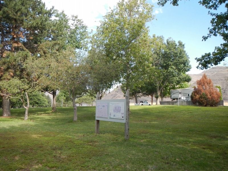
Location. 46° 24.944′ N, 117° 11.578′ W. Marker is near Clarkston, Washington, in Asotin County. Marker can be reached from Silcott Road near U.S. 12. The marker is located in Chief Timothy Park on Silcott Island. Touch for map. Marker is in this post office area: Clarkston WA 99403, United States of America. Touch for directions.
Other nearby markers. At least 8 other markers are within 8 miles of this marker, measured as the crow flies. Snake River Passage & Columbia Plains Crossing (here, next to this marker); Temuut'su (approx. one mile away); Lewis & Clark Historic Trail (approx. 3.6 miles away); Lewis and Clark Enter Washington (approx. 5.3 miles away); Lewis and Clark (approx. 6.9 miles away); Granite Lake Park (approx. 6.9 miles away); Lewis & Clark Almost Slept Here (approx. 6.9 miles away); Nimiipuu Homelands (approx. 7.3 miles away). Touch for a list and map of all markers in Clarkston.
Credits. This page was last revised on November 4, 2020. It was originally submitted on November 4, 2020, by Barry Swackhamer of Brentwood, California. This page has been viewed 216 times since then and 58 times this year. Photos: 1, 2. submitted on November 4, 2020, by Barry Swackhamer of Brentwood, California.

