Death Valley National Park in Inyo County, California — The American West (Pacific Coastal)
Keane Wonder Mine
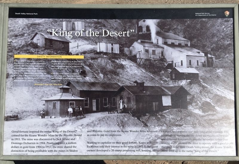
“King of the Desert”
Good fortune inspired the name “King of the Desert,“ coined for the Keane Wonder Mine by the Rhyolite Herald in 1911. The mine was discovered by Jack Keane and Domingo Etcharren in 1904. Producing over a million dollars in gold from 1904 to 1917, the mine shared the distinction of being profitable with the mines in Skidoo and Rhyolite. Gold from the Keane Wonder Mine returned as coins to pay its employees.
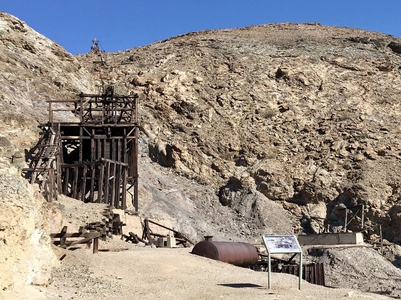
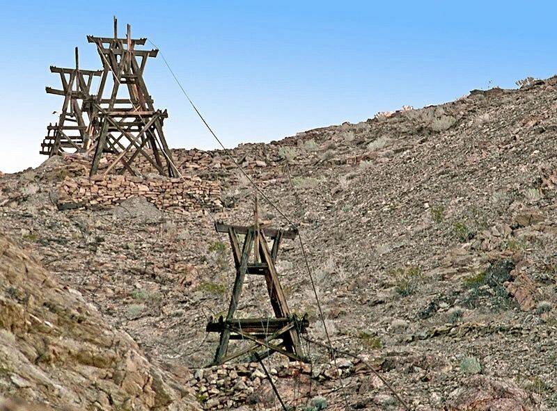
Wanting to capitalize on their good fortune, Keane and Etcharren sold their interest in the mine in 1907. Subsequent owners developed a 20-stamp processing mill, housing, an ice plant, and a spectacular mile-long aerial tramway. The advantage to moving the ore down the mountain by tram and to tunnel horizontally into the mountain rather than sinking shafts allowed the mine to operate with a good profit margin. Unlike most Death Valley mines, the Keane Wonder Mine lived up to the name “King of the Desert.“
Erected 2017 by National Park Service.
Topics. This historical marker is listed in these topic lists: Industry & Commerce • Natural Resources. A significant historical year for this entry is 1911.
Location. 36° 40.152′ N, 116° 54.557′ W. Marker is in Death Valley National Park, California, in Inyo County. Marker can be reached from Beatty Road. Take the dirt road 2.8 miles east from Beatty Road to the parking lot then hike up a small hill to the marker. Touch for map. Marker is in this post office area: Death Valley CA 92328, United States of America. Touch for directions.
Other nearby markers. At least 8 other markers are within 15 miles of this marker, measured as the crow flies. Old Stovepipe Wells (approx. 9˝ miles away); Devil’s Cornfield (approx. 9.7 miles away); Twenty Mule Teams (approx. 13.2 miles away); White Gold (approx. 13.2 miles away); Borax (approx. 13.2 miles away); Old Harmony Borax Works (approx. 13.3 miles away); Titus Canyon Road (approx. 13.6 miles away in Nevada); Leadfield (approx. 14.9 miles away). Touch for a list and map of all markers in Death Valley National Park.
Related marker. Click here for another marker that is related to this marker. — The original marker at Keane Wonder Mine.
Credits. This page was last revised on August 20, 2023. It was originally submitted on November 4, 2020, by Craig Baker of Sylmar, California. This page has been viewed 212 times since then and 30 times this year. Photos: 1, 2, 3, 4. submitted on November 4, 2020, by Craig Baker of Sylmar, California. • J. Makali Bruton was the editor who published this page.


