Near Trona in Inyo County, California — The American West (Pacific Coastal)
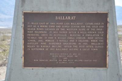
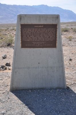
Ballarat
Erected 2001 by Death Valley 49ers, Inc. and Slim Princess Chapter No. 395 and Billy Holcomb Chapter No. 1069, E Clampus Vitus. (Marker Number 107.)
Topics and series. This historical marker is listed in these topic lists: Industry & Commerce • Notable Places • Settlements & Settlers. In addition, it is included in the E Clampus Vitus, and the Postal Mail and Philately series lists. A significant historical month for this entry is September 1917.
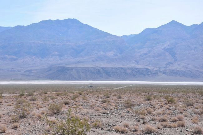
Location. 36° 1.991′ N, 117° 16.907′ W. Marker is near Trona, California, in Inyo County. Marker is at the intersection of Trona Wildrose Road and Ballarat Road, on the right when traveling north on Trona Wildrose Road. Marker is located immediately south of this intersection about 19 miles north of Trona. The ghost town of Ballarat is about 3.5 miles east of here by dirt road that crosses Panamint Dry Lake. Touch for map. Marker is in this post office area: Trona CA 93592, United States of America. Touch for directions.
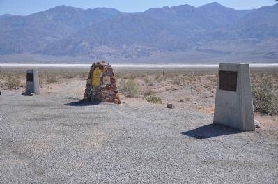
Other nearby markers. At least 6 other markers are within 17 miles of this marker, measured as the crow flies. Panamint City (here, next to this marker); a different marker also named Ballarat (here, next to this marker); a different marker also named Ballarat (approx. 3.3 miles away); Fish Canyon (approx. 10 miles away); Valley Wells (approx. 14.4 miles away); Barker Ranch (approx. 16.2 miles away).
More about this marker. Within one week after this marker was originally placed by the Death Valley '49ers, it was stolen. A second marker was later placed and it was also removed. Finally someone placed a very large sheet of metal with the words cut into it using a cutting torch. Now a bronze plaque has again been placed with the cooperation of the Slim Princess and Billy Holcomb Chapters and is expected to remain. SOURCE: Billy Holcomb Chapter 1069 35th Anniversary Plaque Book by Phillip Holdaway
Regarding Ballarat. Ballarat started as a watering stop and mail was left here for the miners who worked nearby.
SOURCE: Billy Holcomb Chapter 1069 35th Anniversary Plaque Book by Phillip Holdaway
Also see . . .
1. Ballarat. Visit the ghost town Ballarat in a photographic tour. Ballarat was a mining town in the desolate Panamint Valley. (Submitted on December 31, 2011.)
2. The Ghost Town of Ballarat. (Submitted on December 31, 2011.)
Additional commentary.
1. Ballarat
From the National Park Service Website – Death Valley Ghost Towns
(http://www.nps.gov/deva/historyculture/death-valley-ghost-towns.htm)
Ballarat came into being in 1897 with many gold strikes in the Panamint Mountains. The Radcliffe mine alone produced 15,000 tons of gold ore from 1898-1903. The town was named after a famous Australian gold camp and was home to 400 people in 1898. Several legendary Death Valley figures lived in town. Ballarat is now privately owned and contains the ruins of several adobe buildings. The townsite is located off the Panamint Valley road west of Death Valley proper.
— Submitted December 31, 2011.
Credits. This page was last revised on November 5, 2020. It was originally submitted on December 20, 2011. This page has been viewed 711 times since then and 17 times this year. Last updated on November 5, 2020, by Craig Baker of Sylmar, California. Photos: 1, 2. submitted on December 20, 2011, by Michael Kindig of Elk Grove, California. 3, 4. submitted on December 25, 2011, by Michael Kindig of Elk Grove, California. • J. Makali Bruton was the editor who published this page.


