Berkeley Springs in Morgan County, West Virginia — The American South (Appalachia)
The Industrial North End
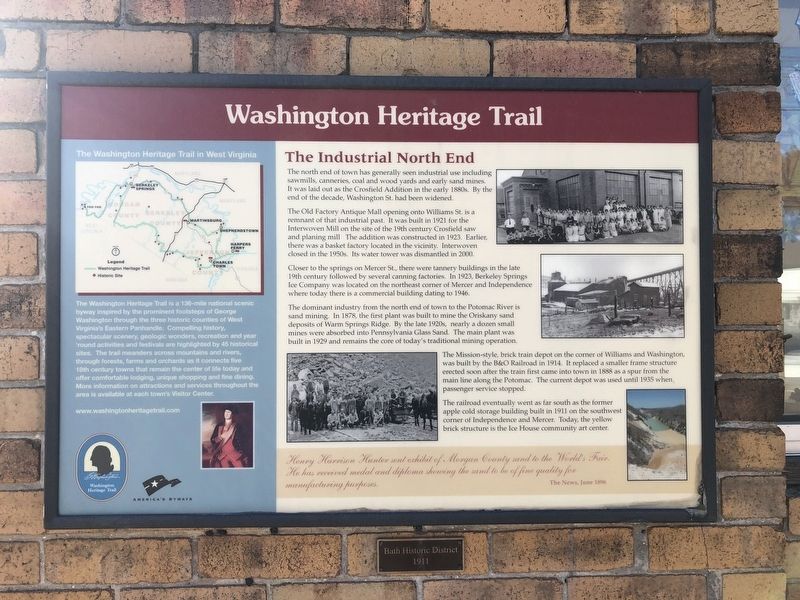
Washington Heritage Trail
The north end of town has generally seen industrial use including sawmills, canneries, coal and wood yards and sand mines. It was laid out as the Crosfield Addition in the early 1880s. By the end of the decade, Washington St. had been widened.
The Old Factory Antique Mall opening onto Williams St. is a remnant of that industrial past. It was built in 1921 for the Interwoven Mill on the site of the 19th century Crosfield saw and planing mill. The addition was constructed in 1923. Earlier, there was a basket factory located in the vicinity. Interwoven closed in the 1950s. Its water tower was dismantled in 2000.
Closer to the springs on Mercer St., there were tannery buildings in the late 19th century followed by several canning factories. In 1923, Berkeley Springs Ice Company was located on the northeast corner of Mercer and Independence where today there is a commercial building dating to 1946.
The dominant industry from the north end of town to the Potomac River is sand mining. In 1878, the first plant was built to mine the Oriskany sand deposits of Warm Springs Ridge. By the late 1920s, nearly a dozen small mines were absorbed into Pennsylvania Glass Sand. The main plant was built in 1929 and remains the core of today's traditional mining operation.
The Mission-style brick train depot on the corner of Williams and Washington, was built by B&O Railroad in 1914. It replaced a smaller frame structure erected soon after the train first came into town in 1888 as a spur from the main line along the Potomac. The current depot was used until 1935 when passenger service stopped.
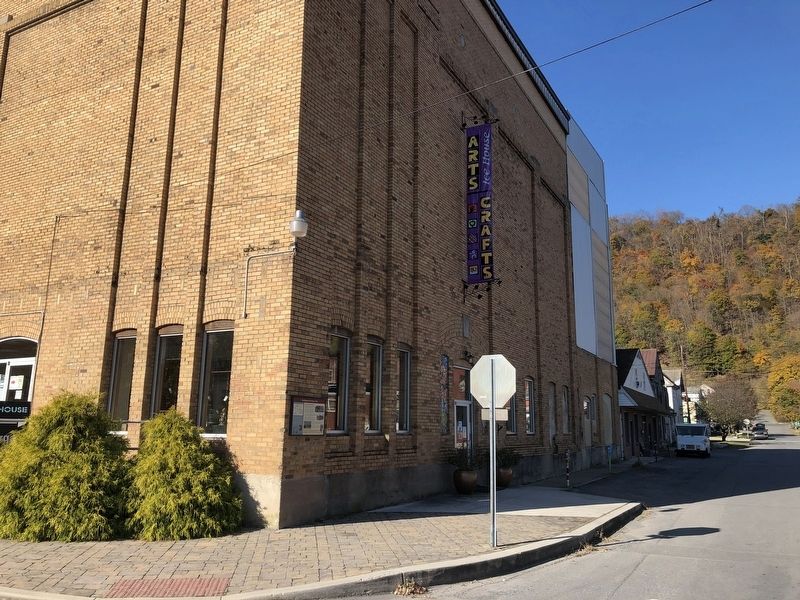
The railroad eventually went as far south as the former apple cold storage building built in 1911 on the southwest corner of Independence and Mercer. Today, the yellow brick structure is the Ice House community art center.
Henry Harrison Hunter sent exhibit of Morgan County sand to the World's Fair. He has received medal and diploma showing the sand to be of fine quality for manufacturing purposes.
The News, June 1896
Topics and series. This historical marker is listed in these topic lists: Architecture • Industry & Commerce • Natural Resources • Railroads & Streetcars. In addition, it is included in the Baltimore and Ohio Railroad (B&O), and the West Virginia, Washington Heritage Trail series lists. A significant historical month for this entry is June 1896.
Location. 39° 37.683′ N, 78° 13.544′ W. Marker is in Berkeley Springs, West Virginia, in Morgan County. Marker is at the intersection of Independence Street and North Mercer Street, on the right when traveling east on
Other nearby markers. At least 8 other markers are within walking distance of this marker. Thomas Ayers (within shouting distance of this marker); Solomon Smith (within shouting distance of this marker); Hugh Walker (within shouting distance of this marker); Bath Historic District (within shouting distance of this marker); Henry Whiting (within shouting distance of this marker); Robert Brown (within shouting distance of this marker); a different marker also named Hugh Walker (about 300 feet away, measured in a direct line); Tannery vs Hotels (about 300 feet away). Touch for a list and map of all markers in Berkeley Springs.
Credits. This page was last revised on November 6, 2020. It was originally submitted on November 6, 2020, by Devry Becker Jones of Washington, District of Columbia. This page has been viewed 88 times since then and 7 times this year. Photos: 1, 2. submitted on November 6, 2020, by Devry Becker Jones of Washington, District of Columbia.

