
Onyx in Kern County, California — The American West (Pacific Coastal)
Walker's Pass
Photographed by Alan Price
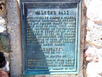
1. Walker's Pass Marker
Discovered by Joseph R. Walker, American trail-blazer who left the San Joaquin Valley through this pass in 1834. This area was traversed by topographer Edward M. Kern, after whom the Kern River was named, while accompanying the Fremont expedition of 1845. After 1860 it became a mining freight route to Owens Valley.
Erected 1932 by Bakersfield Parlor No. 42 N.S.G.W., El Tejon Parlor No. 239 N.S.G.W., and Kern County Chamber of Commerce. (Marker Number 99.)
Topics and series. This historical marker is listed in this topic list: Roads & Vehicles. In addition, it is included in the California Historical Landmarks, the E Clampus Vitus, the National Historic Landmarks, and the Native Sons/Daughters of the Golden West series lists. A significant historical year for this entry is 1834.
Location. 35° 39.769′ N, 118° 1.611′ W. Marker is in Onyx, California, in Kern County. It is on Isabella Walker Pass Road (State Highway 178 at milepost 79.8), on the right when traveling east. Touch for map. Marker is in this post office area: Onyx CA 93255, United States of America. Touch for directions.

Regionally, this marker is in California’s
this page online
Other nearby markers. At least 2 other markers are within 17 miles of this marker, measured as the crow flies: Indian Wells (approx. 8.7 miles away); Sageland (approx. 16.4 miles away).
Another marker is no longer nearby. Freeman Junction (was approx. 7.9 miles away but has been confirmed missing).
More about this marker. Although the marker references El Tejon Parlor No. 239 NSGW, El Tejon 239 is a parlor of the Native Daughters of the Golden West (NDGW). How the ones who placed the plaque allowed this to stand is anyone's guess.
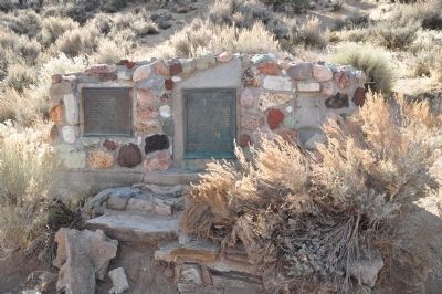
This location was plaqued as an E Clampus Vitus historical marker in October of 1963, but that specific marker is no longer there. The location of the 1963 marker can be seen in the 2011 photo, the white concrete spot on
Photographed by Michael Kindig, December 4, 2011
2. Walker's Pass Markers
The missing E Clampus Vitus marker site is seen on the far right.
In 2012 E Clampus Vitus completely rebuilt and reset the base of the markers which had eroded away as can be seen in the 2011 and 2013 photos. They dedicated the latest granite and ceramic plaque, thus replacing the 1963 plaque at that time.
Regarding Walker's Pass. This site was designated California Historical Landmark No. 99 in 1932.
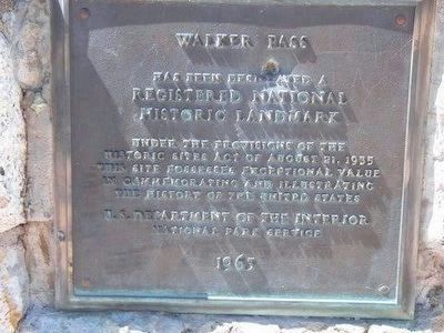
This site was designated a National Historic Landmark in 1961.
Statement of Significance:
Named for Joseph R. Walker, a fur trapper and guide. Native Americans showed the still remote pass to Walker in 1834, and he led the first immigrant wagon train into California through this pass in 1843.
Note: Early map makers marked the wrong pass as Walker’s Pass, and the mistake persists today. This is not the pass used by Walker.
Related marker. Click here for another marker that is related to this marker. — “The Original Walker’s Pass” is the correct location of Walker’s Pass.
Photographed by Michael Kindig, December 4, 2011
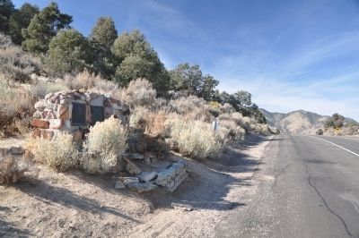
3. Walker's Pass
Photographed by Alan Price
4. National Historic Landmark
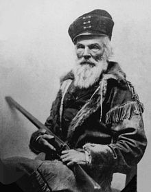
Photographed by Wikipedia
5. Joseph R. Walker
Photographed by Lester J Letson, September 23, 2006
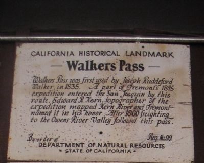
6. Walker's Pass Marker 99
This small plaque hangs in the Kern County Court House Museum in Havilah, California. The plaque dates from the 1930's when Keyesville became Historical Landmark number 98, Walker's Pass Historical Landmark number 99, and Havilah number 100.
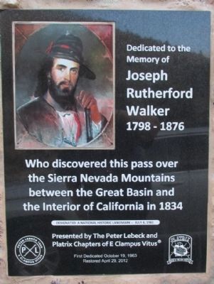
Photographed by Denise Boose, December 31, 2013
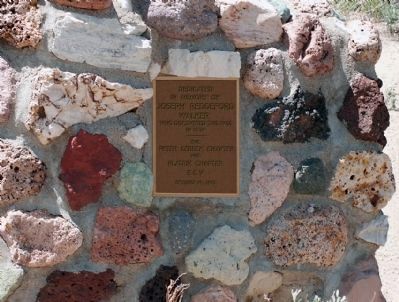
7. Joseph Rutherford Walker Marker
Dedicated to the Memory of Joseph Rutherford Walker 1798-1876
Who discovered this pass over the Sierra Nevada Mountains between the Great Basin and the Interior of California in 1834. Disignated a National Historic Landmark --July 4, 1961
Presented by The Peter Lebeck and Platrix Chapters of E Clampus Vitus
First Dedicated October 19, 1963
Restored April 29. 2012
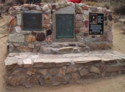
Photographed by Lester J Letson, July 18, 2013
8. Repaired Walker's Pass Base and Marker
Members of E Clampus Vitus came together in 2012 to completely rebuild the base for the marker prior to installing the ceramic granite marker seen on the right.
Photographed by Unknown, circa 1963
9. 3rd Walker's Pass Marker, Since Replaced
This brass marker was dedicated in 1963, but was vandalized and destroyed around 40 years later. A new granite and ceramic marker with John Walker's picture on it now takes its place
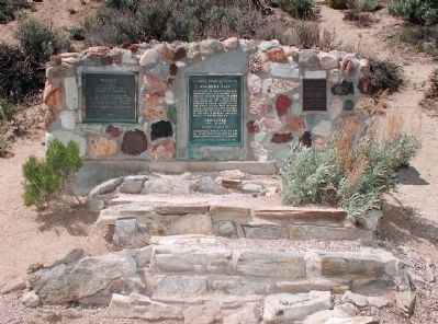
Photographed by Unknown, circa unknown
10. View of the 3 Original Walker's Pass Markers
All 3 original markers as the looked from 1963 to the 1990's when the base started falling apart. The marker on the right was vandalized around 2003 and replaced with a granite marker in 2012.
Credits. This page was last revised on November 7, 2025. It was originally submitted on December 7, 2011, by Michael Kindig of Elk Grove, California. This page has been viewed 2,344 times since then and 60 times this year. Last updated on November 11, 2020, by James King of San Miguel, California. Photos: 1. submitted on August 27, 2015, by Alan Price or Jayne Hotchkiss-Price of Caliente, California. 2, 3. submitted on December 7, 2011, by Michael Kindig of Elk Grove, California. 4. submitted on August 27, 2015, by Alan Price or Jayne Hotchkiss-Price of Caliente, California. 5. submitted on December 7, 2011, by Michael Kindig of Elk Grove, California. 6. submitted on February 21, 2012, by Lester J Letson of Fresno, California. 7. submitted on December 31, 2013, by Denise Boose of Tehachapi, California. 8. submitted on January 2, 2014, by Lester J Letson of Fresno, California. 9, 10. submitted on January 3, 2014, by Lester J Letson of Fresno, California. • Syd Whittle was the editor who published this page.
