Laurelville in Hocking County, Ohio — The American Midwest (Great Lakes)
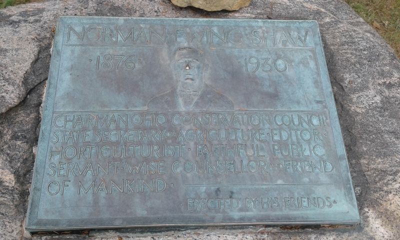
Norman Ewing Shaw
1876 - 1930
Erected by His Friends.
Topics. This historical marker is listed in these topic lists: Agriculture • Communications • Government & Politics • Horticulture & Forestry.
Location. 39° 29.75′ N, 82° 36.9′ W. Marker is in Laurelville, Ohio, in Hocking County. Marker can be reached from Ohio Route 374, 0.1 miles west of Thompson Ridge Road (County Road 36), on the right when traveling west. Touch for map. Marker is at or near this postal address: 16350 Route 374, Laurelville OH 43135, United States of America. Touch for directions.
Other nearby markers. At least 8 other markers are within 7 miles of this marker, measured as the crow flies. Our Inspirations (approx. 5˝ miles away); Sphinx Head (approx. 5.8 miles away); Devil’s Bathtub (approx. 5.8 miles away); Old Man’s Cave (approx. 5.8 miles away); a different marker also named Old Man’s Cave (approx. 5.8 miles away); Whispering Cave (approx. 6 miles away); Laurelville Veterans Memorial (approx. 6.8 miles away); Cedar Falls Bent Bridge (approx. 7.1 miles away).
Credits. This page was last revised on November 23, 2020. It was originally submitted on November 12, 2020, by Craig Doda of Napoleon, Ohio. This page has been viewed 316 times since then and 12 times this year. Photos: 1, 2. submitted on November 12, 2020, by Craig Doda of Napoleon, Ohio. • Devry Becker Jones was the editor who published this page.

