Near Richmond in Chesterfield County, Virginia — The American South (Mid-Atlantic)
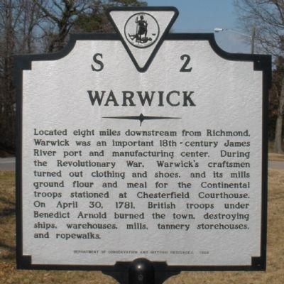
Warwick
Erected 1988 by Department of Conservation and Historic Resources. (Marker Number S-2.)
Topics and series. This historical marker is listed in these topic lists: Settlements & Settlers • War, US Revolutionary. In addition, it is included in the Virginia Department of Historic Resources (DHR) series list. A significant historical month for this entry is April 1864.
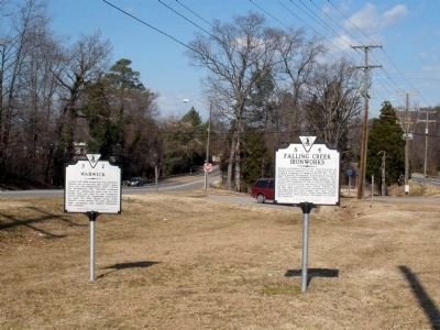
Location. 37° 26.289′ N, 77° 26.326′ W. Marker is near Richmond, Virginia, in Chesterfield County. Marker is on Jefferson Davis Highway (U.S. 1) 0.4 miles south of Chippenham Parkway (Virginia Route 150), in the median. The marker is located at the Falling Creek Wayside. Touch for map. Marker is in this post office area: Richmond VA 23234, United States of America. Touch for directions.
Other nearby markers. At least 8 other markers are within walking distance of this marker. Falling Creek Ironworks (here, next to this marker); Historic Village of Bensley (within shouting distance of this marker); Natural History (within shouting distance of this marker); Historic Route 1 (within shouting distance of this marker); Falling Creek Iron Works (within shouting distance of this marker); a different marker also named Natural History (within shouting distance of this marker); Iron Furnace Overlook (within shouting distance of this marker); Cary’s Mill Overlook (within shouting distance of this marker). Touch for a list and map of all markers in Richmond.
Credits. This page was last revised on January 13, 2022. It was originally submitted on February 10, 2009, by Bernard Fisher of Richmond, Virginia. This page has been viewed 1,150 times since then and 45 times this year. Photos: 1, 2. submitted on February 10, 2009, by Bernard Fisher of Richmond, Virginia. • Kevin W. was the editor who published this page.

