Four Corners Resettled
Community Connections
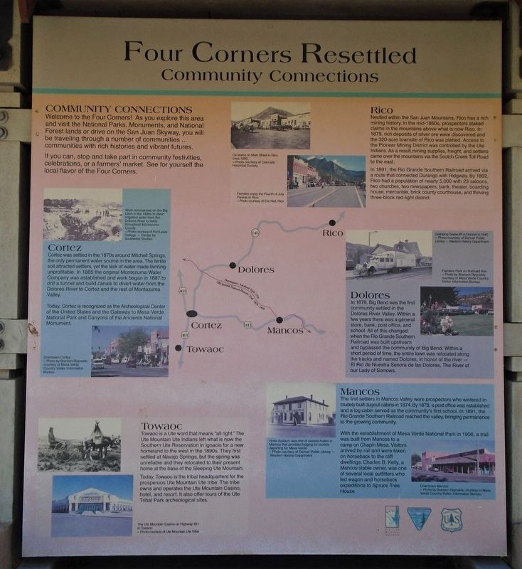
Community Connections
Welcome to the Four Corners! As you explore this area and visit the National Parks, Monuments, and National Forest lands or drive on the San Juan Skyway, you will be traveling through a number of communities... communities with rich histories and vibrant futures.
If you can, stop and take part in community festivals, celebrations, or a farmers' market. See for yourself the local flavor of the Four Corners.
Cortez
Cortez was settled in the 1870s around Mitchell Springs, the only permanent water source in the area. The fertile soil attracted settlers, yet the lack of water made farming unprofitable. In 1885 the original Montezuma Water Company was established and work began in 1887 to drill a tunnel and build canals to divert water from the Dolores River to Cortez and the rest of Montezuma Valley.
Today, Cortez is recognized as the Archeological Center of the United States and the Gateway to Mesa Verde National Park and Canyons of the Ancients National Monument.
[Photo captions read]
• Work commences on the Big Ditch in the 1890s to divert water from the Dolores River to fields throughout Montezuma County.
• Downtown Cortez
Towaoc
Towaoc is a Ute word that means "all right." The Ute Mountain Ute Indians left what is
Today, Towaoc is the tribal headquarters for the prosperous Ute Mountain Ute tribe. The tribe owns and operates the Ute Mountain Casino, hotel, and resort. It also offers tours of the Ute Tribal Park archeological sites.
[Photo captions read]
• [Top photo no caption]
• The Ute Mountain Casino on Highway 491 in Towaoc
Rico
Nestled within the San Juan Mountains, Rico has a rich mining history. In the mid-1860s, prospectors staked claims in the mountains above what is now Rico. In 1879, rich deposits of silver ore were discovered and the 320-acre townsite of Rico was platted. Access to the Pioneer Mining District was controlled by the Ute Indians. As a result, mining supplies, freight, and settlers came over the mountains via the Scotch Creek Toll Road to the east.
In 1891, the Rio Grande Southern Railroad arrived via a route that connected Durango with Ridgway. By 1892, Rico had a population of nearly 5,000 with 23 saloons, two churches, two newspapers, bank, theater, boarding house, mercantile, brick county courthouse, and thriving three-block red-light district.
[Photo captions read]
• Families enjoy the Fourth of July Parade in Rico.
Dolores
In 1878, Big Bend was the first community settled in the Dolores River Valley. Within a few years there was a general store, bank, post office, and school. All of this changed when the Rio Grande Southern Railroad was built upstream and bypassed the community of Big Bend. Within a short period of time, the entire town was relocated along the tracks and named Dolores, in honor of the river — El Rio de Nuestra Senora de las Dolores, The River of our Lady of Sorrows.
[Photo captions read]
• Galloping Goose #5 in Dolores in 1940.
• Flanders Park on Railroad Ave.
Mancos
The first settlers in Mancos Valley were prospectors who wintered in crudely built dugout cabins in 1874. By 1878, a post office was established and a log cabin served as the community's first school. In 1891, the Rio Grande Southern Railroad reached the valley, bringing permanence to the growing community.
With the establishment of Mesa Verde National Park in 1906, a trail was built from Mancos to a camp on Chapin Mesa. Visitors arrived by rail and were taken on horseback to the cliff dwellings. Charles B. Kelly, a Mancos stable owner, was one of several local outfitters who led wagon and horseback expeditions to Spruce Tree
House.
[Photo captions read]
• Hotel Ausburn was one of several hotels in Mancos that provided lodging for tourists departing for Mesa Verde.
• Downtown Mancos
Erected by US Forest Service, Bureau of Land Management, and San Juan Mountains Association.
Topics. This historical marker is listed in these topic lists: Environment • Industry & Commerce • Railroads & Streetcars • Settlements & Settlers. A significant historical year for this entry is 1885.
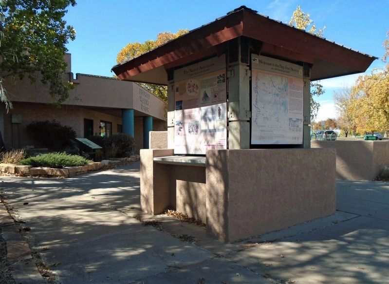
Location. 37° 20.953′ N, 108° 34.37′ W. Marker is in Cortez, Colorado, in Montezuma County. Marker is on Mildred Road north of Main Street (U.S. 160), on the left when traveling north. Marker is at the Colorado Welcome Center kiosk. Touch for map. Marker is at or near this postal address: 928 East Main Street, Cortez CO 81321, United States of America. Touch for directions.
Other nearby markers. At least 8 other markers are within walking distance of this marker. Welcome to the San Juan Skyway (here, next to this marker); Canyons of the Ancients National Monument (here, next to this marker); The Native Americans (here, next to this marker); War Memorial (within shouting distance of this marker); Veterans Memorial (within shouting distance of this marker); Owl Café (approx. 0.6 miles away); Cortez Public School (Calkins) (approx. 0.6 miles away); Belmont Bar (approx. 0.6 miles away). Touch for a list and map of all markers in Cortez.
Credits. This page was last revised on November 15, 2020. It was originally submitted on November 15, 2020, by William Fischer, Jr. of Scranton, Pennsylvania. This page has been viewed 146 times since then and 10 times this year. Photos: 1, 2. submitted on November 15, 2020, by William Fischer, Jr. of Scranton, Pennsylvania.

