Manor Township near Creswell in Lancaster County, Pennsylvania — The American Northeast (Mid-Atlantic)
Moving Heaven and Earth
The Atglen & Susquehanna in Manor Township
Photographed by Cosmos Mariner, August 27, 2018
1. Moving Heaven and Earth Marker
In 1877, the Columbia and Port Deposit Railroad (C&PD), under the control of the PRR, completed its route into Columbia, PA from the south (lower left images). Hosting passenger and freight services, the primarily single-track
this page online
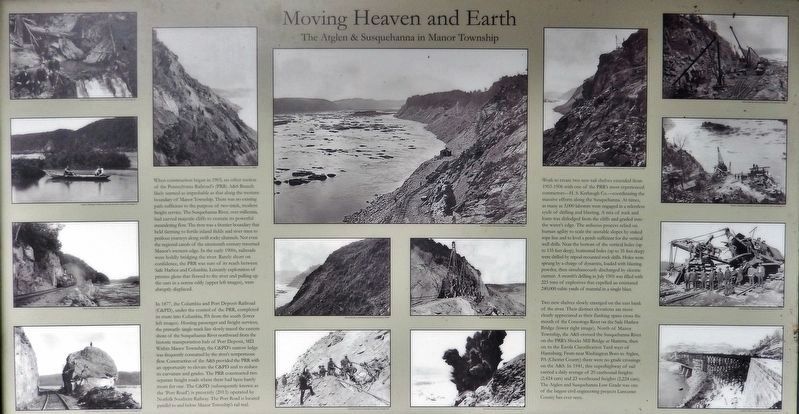
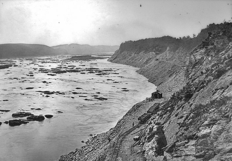
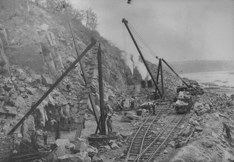
Work to create two new rail shelves extended from 1903-1906 with one of the PRR's most experienced contractors — H. S. Kerbaugh Co — coordinating the massive efforts along the Susquehanna. At times, as many as 3,000 laborers were engaged in a relentless cycle of drilling and blasting. A mix of rock and loam was dislodged from the cliffs and graded into the water's edge. The arduous process relied on human agility to scale the unstable slopes by staked rope line and to level a perch sufficient
Kline Collection, Railroad Museum of Pennsylvania, PHMC
2. Marker detail: Susquehanna River at Manor Township
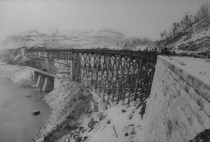
Two new shelves slowly emerged on the east bank of the river. Their distinct elevations are most clearly appreciated as their flanking spans cross the mouth of the Conestoga River on the Safe Harbor Bridge (lower right image). North of Manor Township, the A&S crossed the Susquehanna River on the PRR's Shocks Mill Bridge at Marietta, then on to the Enola Classification Yard west of Harrisburg. From near Washington Boro to Atglen, PA (Chester County) there were no grade crossings on the A&S. In 1941, this superhighway of rail carried a daily average of 29 eastbound freights (2,424 cars) and 23 westbound freights (2,224 cars). The Atglen and Susquehanna Low Grade was one of the largest civil engineering
Columbia Historic Preservation Society, Columbia, PA
3. Marker detail: trestle
Erected by Amtrak.
Topics. This historical marker is listed in these topic lists: Bridges & Viaducts • Industry & Commerce • Man-Made Features • Railroads & Streetcars. A significant historical year for this entry is 1903.
Location. 39° 57.862′ N, 76° 27.349′ W. Marker is near Creswell, Pennsylvania, in Lancaster County. It is in Manor Township. It can be reached from River Road half a mile south of Anchor Road, on the right when traveling south. Marker is located at the south end of the Turkey Hill Trail Nature Preserve parking lot, at the trailhead for the Enola Low Grade Trail, about 2/10 mile south of the park entrance from River Road. Touch for map. Marker is at or near this postal address: 2501 Enola Low Grade Trail, Conestoga PA 17516, United States of America. Touch for directions.

Regionally, this marker is in South-Central Pennsylvania, specifically in Pennsylvania Dutch Country, and in the Susquehanna Valley. It is also in the American Northeast and in the Mid-Atlantic. Globally, it is in North America, the Western Hemisphere, the Western World, and the
Kline Collection, Railroad Museum of Pennsylvania, PHMC
4. Marker detail: winch
Other nearby markers. At least 8 other markers are within 2 miles of this marker, measured as the crow flies: The Atglen & Susquehanna Low Grade (here, next to this marker); Turkey Hill Dairy proudly salutes (approx. 0.6 miles away); Great Minqua Path (approx. 0.9 miles away); Rieber House (approx. 1.1 miles away); Service Mens Honor Roll (approx. 1.6 miles away); Susquehanna Canal (approx. 1.8 miles away); Susquehanna and Tidewater Canal (approx. 1.8 miles away); Washington Boro Archaeological Sites (approx. 2 miles away).
More about this marker. This is a large, "billboard-style" marker, mounted on the south-facing side of the trailhead kiosk for the Enola Low Grade Rail Trail.
Related markers. Click here for a list of markers that are related to this marker. The Atglen & Susquehanna Low Grade
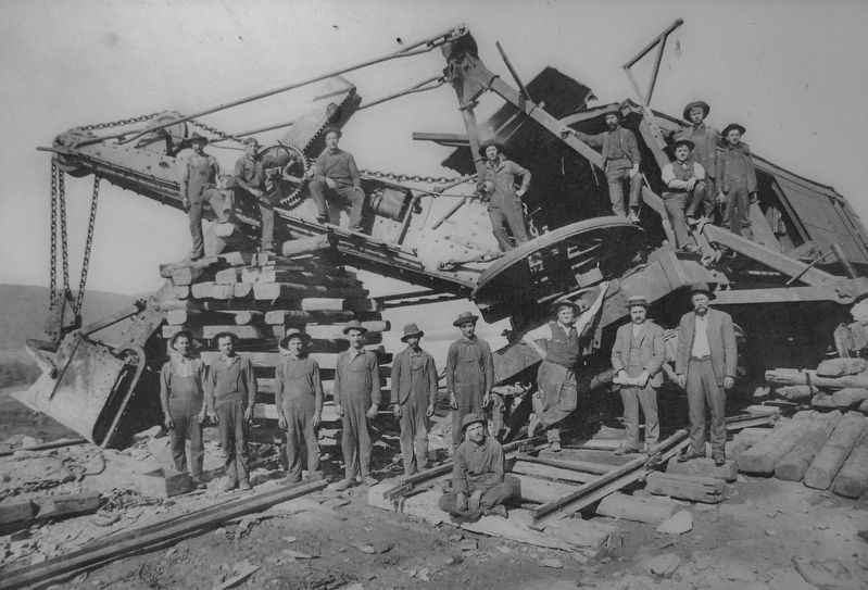
Kline Collection, Railroad Museum of Pennsylvania, PHMC
5. Marker detail: work crew
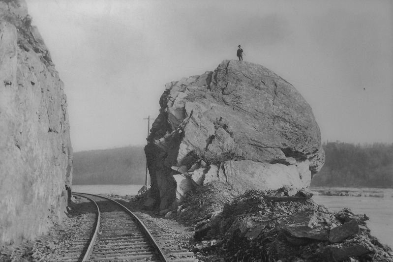
David H. Mellinger Collection, courtesy of Scott E. Kriner, Conestoga, PA
6. Marker detail: narrow, curved, waters' edge cut
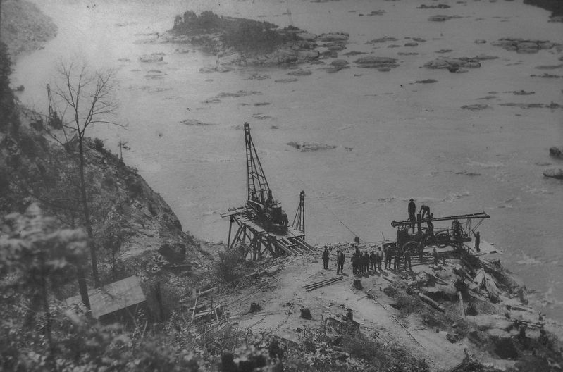
David H. Mellinger Collection, courtesy of Scott E. Kriner, Conestoga, PA
7. Marker detail: bridge work
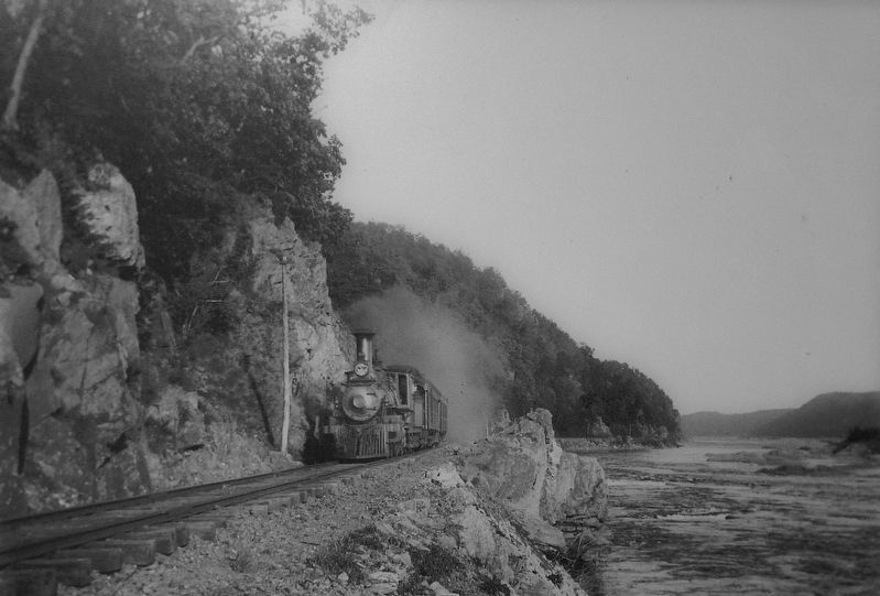
David H. Mellinger Collection, courtesy of Scott E. Kriner, Conestoga, PA
8. Marker detail: steam locomotive
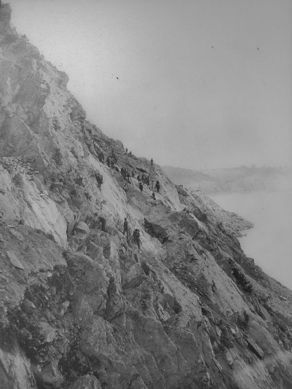
Kline Collection, Railroad Museum of Pennsylvania, PHMC
9. Marker detail: Cliff
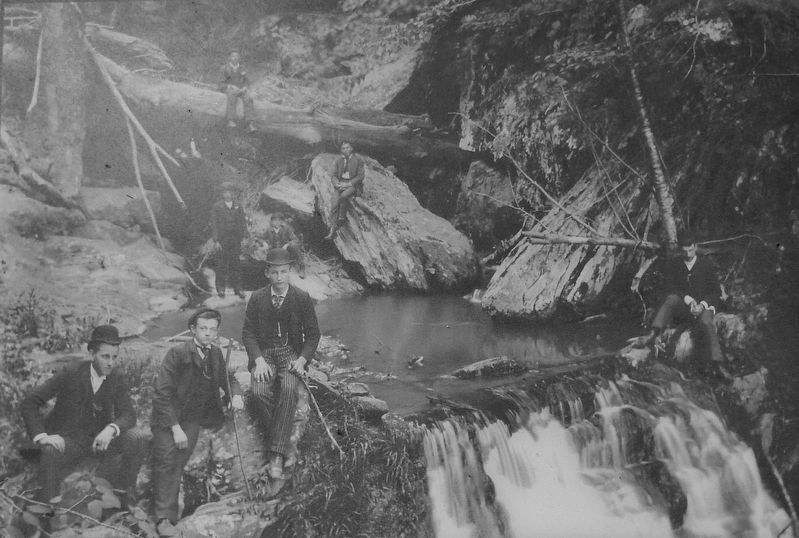
David H. Mellinger Collection, courtesy of Scott E. Kriner, Conestoga, PA
10. Marker detail: Waterfall
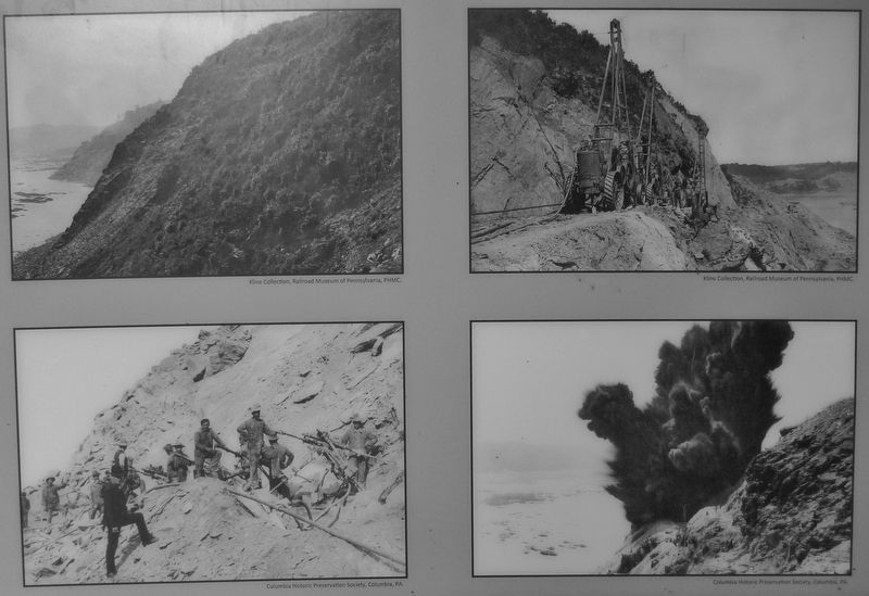
11. Marker detail: Construction photographs
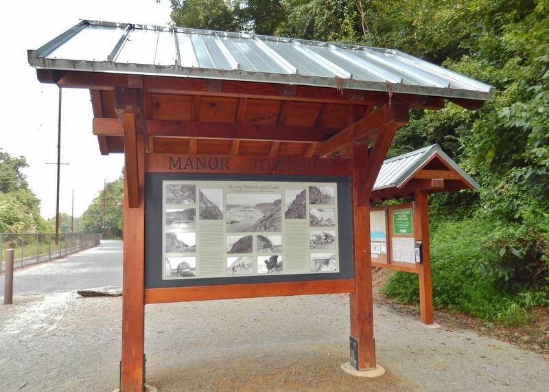
Photographed by Cosmos Mariner, August 27, 2018
12. Moving Heaven and Earth Marker (wide view; Enola Low Grade Trail parking lot in background)
Credits. This page was last revised on February 7, 2023. It was originally submitted on August 28, 2018, by Cosmos Mariner of Cape Canaveral, Florida. This page has been viewed 642 times since then and 49 times this year. Last updated on November 17, 2020, by Carl Gordon Moore Jr. of North East, Maryland. Photos: 1, 2, 3, 4, 5. submitted on August 29, 2018, by Cosmos Mariner of Cape Canaveral, Florida. 6, 7, 8. submitted on September 5, 2018, by Cosmos Mariner of Cape Canaveral, Florida. 9, 10, 11. submitted on October 30, 2018, by Cosmos Mariner of Cape Canaveral, Florida. 12. submitted on August 29, 2018, by Cosmos Mariner of Cape Canaveral, Florida. • Bill Pfingsten was the editor who published this page.
