Near Chester in Chesterfield County, Virginia — The American South (Mid-Atlantic)
Half-Way House
Butler’s Headquarters
— Bermuda Hundred Campaign —
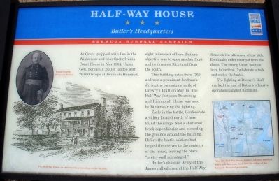
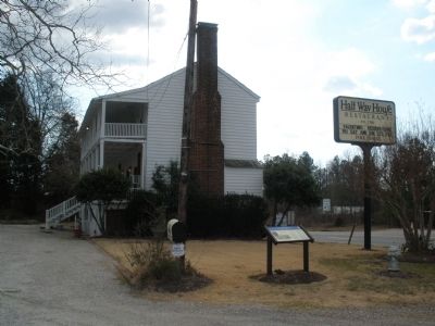
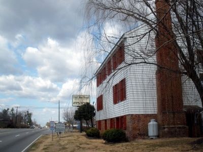
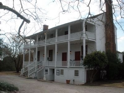
This building dates from 1760 and was a prominent landmark during the campaign’s battle of Drewry’s Bluff on May 16. The Half-Way (between Petersburg and Richmond) House was used by Butler during the fighting.
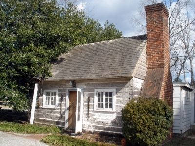
Early in the battle, Confederate artillery located north of here found the range. Shells shattered brick dependencies and plowed up the grounds around the building. Before the battle soldiers had helped themselves to the contents of the house, leaving the place “pretty well rummaged.”
Butler’s defeated Army of the James rallied around the Half-Way House on the afternoon of the 16th. Eventually order emerged from the chaos. The strong Union position here halted the Confederate attack and ended the battle.
The fighting at Drewry’s Bluff marked the end of Butler’s offensive operations against Richmond.
Erected by Virginia Civil War Trails.
Topics and series. This historical marker is listed in this topic list: War, US Civil. In addition, it is included in the Virginia Civil War Trails series list. A significant historical month for this entry is May 1864.
Location. 37° 23.139′ N, 77° 25.461′ W. Marker is near Chester, Virginia, in Chesterfield County. Marker is at the intersection of Jefferson Davis Highway (U.S. 1) and Wonderview Drive, on the right when traveling north on Jefferson Davis Highway. Touch for map. Marker is at or near this postal address: 10301 Jefferson Davis Highway, Richmond VA 23237, United States of America. Touch for directions.
Other nearby markers. At least 8 other markers are within 2 miles of this marker, measured as the crow flies. Halfway House (within shouting distance of this marker); a different marker also named The Half-Way House (within shouting distance of this marker); Into the "Bottle" (approx. 0.4 miles away); Proctor's Creek Fight (approx. 0.4 miles away); Second Battle of Drewry's Bluff (approx. 0.8 miles away); Drewry’s Bluff Battlefield (approx. 0.8 miles away); Osbornes (approx. 1.2 miles away); Farrar's Island (approx. 1.2 miles away). Touch for a list and map of all markers in Chester.
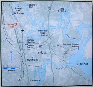
More about this marker. On the upper left is a photo of “Union General Benjamin Butler”. On the lower left is a period sketch with the caption, “The Half-Way House as sketched by a traveling artist in 1866”. On the lower right is map of the surrounding area. The map carries the caption, “From the Half-Way House, Butler’s infantry marched south and then east, back into the safety of the Bermuda Hundred peninsula”.
Also see . . .
1. CWSAC Battle Summary. Proctor's Creek (Submitted on February 11, 2009, by Bernard Fisher of Richmond, Virginia.)
2. Half-Way House Restaurant. (Submitted on February 11, 2009, by Bernard Fisher of Richmond, Virginia.)
3. Civil War Traveler. Chesterfield County (Submitted on February 12, 2009, by Bernard Fisher of Richmond, Virginia.)
Credits. This page was last revised on June 16, 2016. It was originally submitted on February 11, 2009, by Bernard Fisher of Richmond, Virginia. This page has been viewed 2,221 times since then and 42 times this year. Photos: 1, 2, 3, 4, 5, 6. submitted on February 11, 2009, by Bernard Fisher of Richmond, Virginia. • Craig Swain was the editor who published this page.
