Near Roy in Fergus County, Montana — The American West (Mountains)
A Fine Day for a Sail
Lewis and Clark on the Missouri

Photographed By Barry Swackhamer, August 24, 2020
1. A Fine Day for a Sail Marker
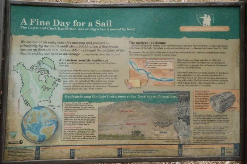
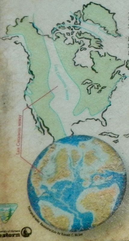
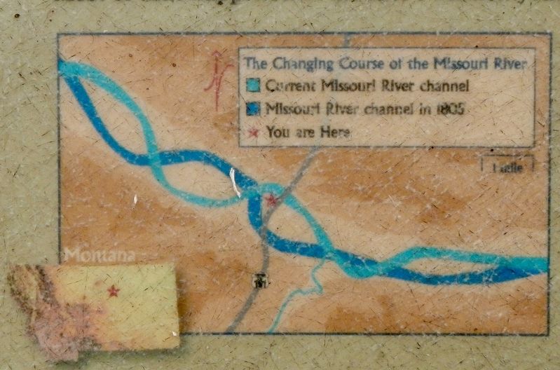
Captions: (bottom left) Paleogeographic Reconstruction of the Late Cretaceous Seaway; (upper center) The Changing Course of the Missouri River -- 1805 and Present-day; (middle right) Metamorphic rock from Canada brought here by a glacier.; (bottom sidebar) Badlands-type weathering on U.S. Highway 191 road cut just south of here. Bearpaw Shale (top), Judith River Formation (bottom).
We set out at a early hour this morning and proceed on principally by the chord untill about 9 A.M. when a fine breeze sprung up for the S.E. and enabled us though the ballance of the day to employ our sails to advantage... Meriwether Lewis, May 24, 1805
An ancient seaside landscape
Sailing would have been even better over 70 million years ago!
During much of the Cretaceous Period, and expedition across North America would have required ocean-going boats. Shallow seas advance from both the north and south and sometimes met to completely split the continent. At the same time. the early Rocky Mountains were rising. Some of the mountains were explosive volcanoes, spewing volcanic ash across the whole area. Dinosaurs stomped across the land. What a time!
The modern landscape
...The country high and broken, a considerable portion of black rock and brown sandy rock appear in the faces of the hills...the whole producing but little grass... - Meriwether Lewis, May 23, 1805
The present hills and river valley were sculpted by erosion of the old Cretaceous sedimentary rocks. Most of that happened in the last 5 million years. When Lewis and Clark sailed by in 1805, the Missouri River was not where you see it today! It was flowing up against the cut bank on the opposite (south) side of the valley.
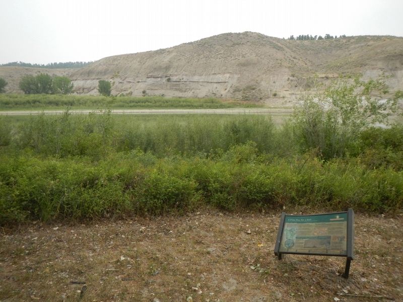
Since then, the river has snaked across its floodplain (the valley floor), as all meandering rivers will if they can. Across the river you can see a channel cut into older rocks. The little draw at its head probably used to angle down to the Missouri River when it was on the other side of the valley.
The Influence of ice
In the last two million years, glaciers advanced several times from the north. At least once the ice extended past this location. A melting glacier dumped the scattered large boulders you can see around the main kiosk and on the hills all around here.
Salts
Sodium, calcium, and magnesium salts originally deposited in the ancient marine sediments are still dissolving out of the rocks into modern streams and groundwater. The salts plagued the Lewis and Clark Expedition all across central and eastern Montana. One day earlier, Lewis described the small tributaries to the Missouri:
...they afford but little water...and that is so strongly impregnated with these salts that it is unfit for use;...I have tryed it by way of experiment & find it moderately pergative, but painfull to the intestens in it's operation. - Meriwether Lewis, May 23 1805
Big clear
gypsum crystals litter some exposed surfaces fo the Bearpaw Shale. They grew there from minerals dissolved out of the shale. Lewis and Clark's journals consistently misidentified this mineral as "quarts" (quartz)
(sidebar at bottom center)
Geologists map of the Late Cretaceous Rocks here as two formations.
The soft sedimentary rocks of the hills and riverbanks are mud and sand eroded from the young Rocky Mountains. They wee transported eastward by rivers and deposited here in the seaway and its coastal plain.
Bearpaw Shale Over 70 million years ago, the Late Cretaceous seaway covered this whole area. Mud that collected offshore in the sea is now soft, gray, thinly layered shale. It erodes to form the gently rolling hills all around you. Bearpaw Shale makes a "gumbo" soil that is very sticky and slippery when wet.
Judith River Formation Before the Bearpaw shale, about 75 million years ago, the sea was just a little east of here. The lighter colored sand and mud and thin black coal layers of this formation record estuaries, deltas, swamps, lagoons and river floodplains. The rocks are famous for dinosaur fossils - over 40 different species so far!
(timeline across the bottom, left to right)
The Geologic Time Scale (not shown to sale)
• Divisions of geologic time were defined in the 19th Century by major changes in the fossil record.
• Most of the boundaries are marked by worldwide extinction events.
• Numerical dates were added in the 20th Century using modern rock-dating techniques.
Mesozoic Era
250 million years ago: Triassic
208 million years ago: Jurassic
144 million years ago: Cretaceous Inland seas advance and retreat across North America, Rocky Mountains formed, Judith River and Bearpaw Shale sediments deposited in the Late Cretaceous
Cenozoic Era
66 million years ago: Tertiary Erosion began, ancestral Missouri River drainage established
2 million years ago: Quaternary Ice Ages, present landscape and river established
Present Day
Erected by Bureau of Land Management and The University of Montana, Western.
Topics and series. This historical marker is listed in these topic lists: Exploration • Natural Features • Paleontology. In addition, it is included in the Lewis & Clark Expedition series list. A significant historical date for this entry is May 24, 1805.
Location. 47° 37.816′ N, 108° 41.19′ W. Marker is near Roy, Montana, in Fergus County. Marker can be reached from the intersection of U.S. 191 and Missouri River. The marker is located in the James Kipp Recreation Area campground. Pass under the bridge to the picnic area at the northwest end of campground. Touch for map. Marker is in this post office area: Roy MT 59471, United States of America. Touch for directions.
Other nearby markers. At least 3 other markers are within 12 miles of this marker, measured as the crow flies. The Mighty Missouri - Lifeblood of the Plains (approx. half a mile away); The Little Rocky Mountains (approx. 11.7 miles away); a different marker also named The Little Rocky Mountains (approx. 11.7 miles away).
Also see . . . The Red and White Pirogues -- Discovering Lewis and Clark. During the nearly 600 days when the Corps of Discovery was on one river or another, they were under sail a little more than one-tenth of the time. The job of rowing, poling, cordelling, or warping a boat up a river, day after day, required some training and experience. Landlubbers had to be "quick studies." No matter how small the crew, each member had to learn to be part of a team... (Submitted on November 28, 2020, by Barry Swackhamer of Brentwood, California.)
Credits. This page was last revised on November 28, 2020. It was originally submitted on November 28, 2020, by Barry Swackhamer of Brentwood, California. This page has been viewed 131 times since then and 16 times this year. Photos: 1, 2, 3, 4. submitted on November 28, 2020, by Barry Swackhamer of Brentwood, California.


