Ephrata Township near Lititz in Lancaster County, Pennsylvania — The American Northeast (Mid-Atlantic)
Erb's Covered Bridge
Hammer Creek #1
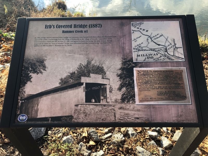
In 1885, bridge viewers reported that a bridge was necessary near Samuel Erb's farm where the Hammer Creek crossed the public road leading from the village of Rothsville to the village of Lincoln. Lancaster County Commissioners visited this site on May 27, 1887 and agreed to build this bridge the same season. Bridge proposals for either an "iron or wooden" bridge were advertised and this covered bridge was built in the summer of 1887 by John G. Bowman for $1,744.00.
[Sidebar:]
Notice to Bridge Builders.
Proposals for the erection of an Iron or Wooden Bridge, over Hammer Creek, between Ephrata and Warwick townships, about one mile from Millway Station, on Columbia and Reading Railway, will be received at the office of the County Commissioners, Lancaster, Pa., until noon, Monday, August 1, 1887.
Specifications for Wooden Bridge will be on file in the office.
Forfeit bond for $600 must accompany bid. Blanks for bond and bid can be obtained on application.
SAM'L MYERS,
JOHN GINGRICH,
HENRY F. HARTMAN,
Commissioners
Attest: Frank Griest, Clerk. je29-14tdWSM
Erected by County of Lancaster, Pennsylvania.
this page online
Topics and series. This historical marker is listed in this topic list: Bridges & Viaducts. In addition, it is included in the Covered Bridges series list. A significant historical date for this entry is May 27, 1887.
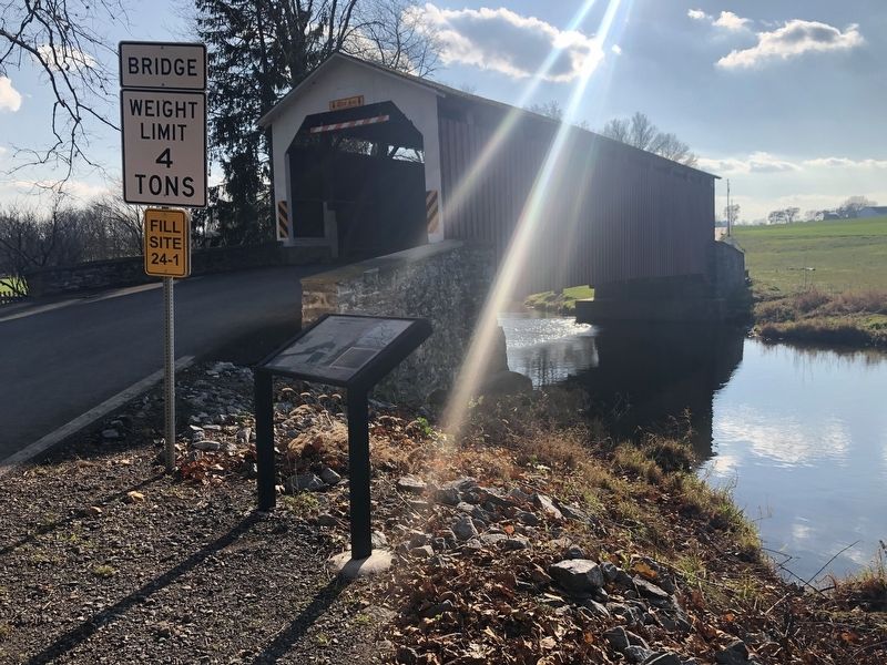
Location. 40° 10.08′ N, 76° 14.625′ W. Marker is near Lititz, Pennsylvania, in Lancaster County. It is in Ephrata Township. It is on Erbs Bridge Road 0.2 miles north of Millway Road, on the right when traveling south. The marker is on the north side of the bridge. Touch for map. Marker is at or near this postal address: 78 Erbs Bridge Rd, Lititz PA 17543, United States of America. Touch for directions.

Regionally, this marker is in South-Central Pennsylvania, specifically in Pennsylvania Dutch Country, and in the Susquehanna Valley. It is also in the American Northeast and in the Mid-Atlantic. Globally, it is in North America, the Western Hemisphere, the Western World, and the Anglosphere. Historically, it finds itself in what was once the Haudenosaunee (Iroquois) Confederacy and also one of the original Thirteen Colonies.
Other nearby markers. At least 8 other markers are within 3 miles of this marker, measured as
Credits. This page was last revised on February 7, 2023. It was originally submitted on November 29, 2020, by Devry Becker Jones of Washington, District of Columbia. This page has been viewed 755 times since then and 61 times this year. Photos: 1, 2. submitted on November 29, 2020, by Devry Becker Jones of Washington, District of Columbia.
