Thebes in Alexander County, Illinois — The American Midwest (Great Lakes)
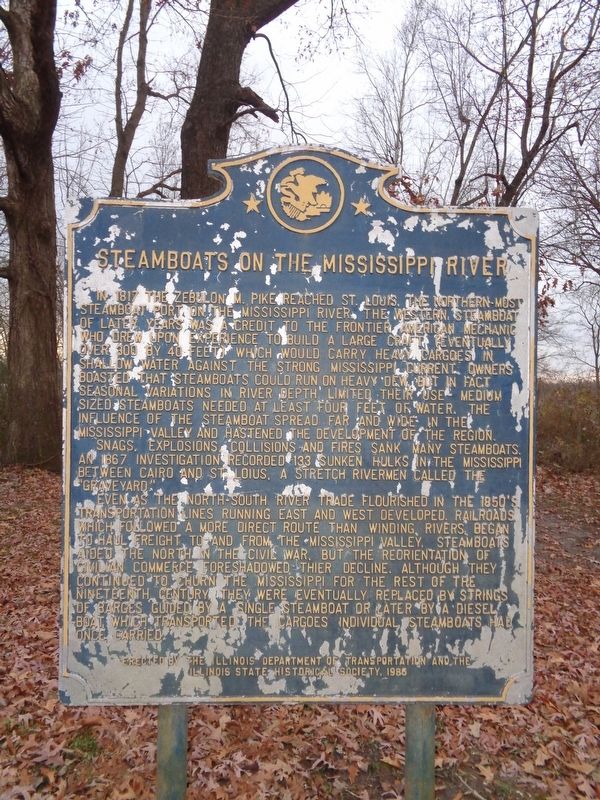
Steamboats on the Mississippi River

Photographed by Mark Parker, October 16, 2023
1. Steamboats on the Mississippi River Marker
Snags, explosions, collisions and fires sank many steamboats. An 1867 investigation recorded 133 sunken hulks in the Mississippi between Cairo and St. Louis, a stretch rivermen called the 'Graveyard.'
Even as the north-south river trade flourished in the 1850's transportation lines running east and west developed. Railroads, which followed a more direct route than winding rivers, began to haul freight to and from the Mississippi valley. Steamboats aided the North
this page online
Erected 1986 by Illinois Department of Transportation and the Illinois State Historical Society.
Topics and series. This historical marker is listed in these topic lists: Disasters • Waterways & Vessels. In addition, it is included in the Illinois State Historical Society series list. A significant historical year for this entry is 1817.
Location. 37° 13.567′ N, 89° 27.6′ W. Marker is in Thebes, Illinois, in Alexander County. It is on Pecan Street west of Illinois Route 3. Marker is located in a roadside park. Touch for map. Marker is at or near this postal address: Pecan St, Thebes IL 62990, United States of America. Touch for directions.

Regionally, this marker is in Southern Illinois — Little Egypt. It is also in the American Midwest, in the Ohio River Valley, in the Corn
Photographed by Jason Voigt, November 29, 2020
2. Steamboats on the Mississippi River Marker
Other nearby markers. At least 8 other markers are within 6 miles of this marker, measured as the crow flies: Lewis and Clark in Illinois (a few steps from this marker); Veterans Memorial (approx. 0.4 miles away); Original Pier Block (approx. 0.4 miles away); Thebes Courthouse (approx. 0.4 miles away); Old Thebes Courthouse (approx. half a mile away); Welcome to Illinois (approx. 5.6 miles away); The 20th Illinois Regiment (approx. 5.8 miles away in Missouri); Saving Fort D (approx. 5.8 miles away in Missouri). Touch for a list and map of all markers in Thebes.
Photographed by Jason Voigt, November 29, 2020
3. Steamboats on the Mississippi River Marker
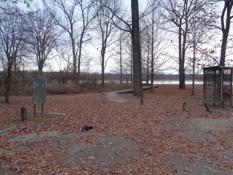
Marker is located in a roadside park overlooking the Mississippi River.
Credits. This page was last revised on August 21, 2024. It was originally submitted on November 29, 2020, by Jason Voigt of Glen Carbon, Illinois. This page has been viewed 1,234 times since then and 101 times this year. Photos: 1. submitted on August 20, 2024, by Mark Parker of Hickory, North Carolina. 2, 3. submitted on November 29, 2020, by Jason Voigt of Glen Carbon, Illinois.
