Near Chester in Randolph County, Illinois — The American Midwest (Great Lakes)
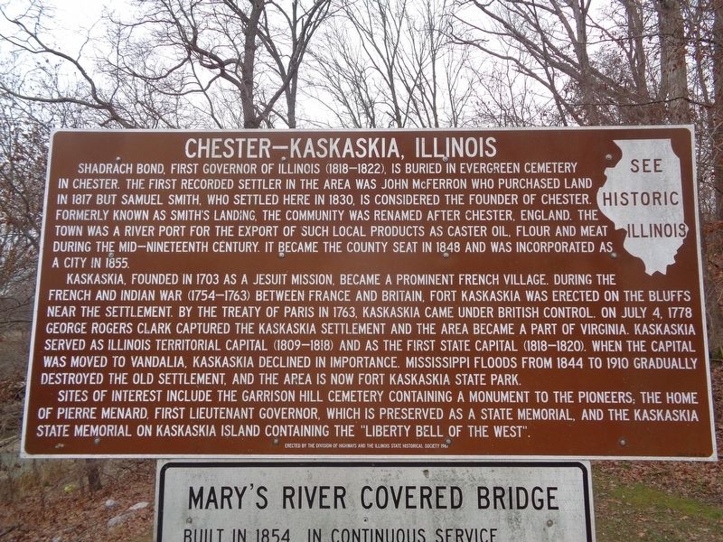
Chester-Kaskaskia, Illinois
Kaskaskia, founded in 1703 as a Jesuit mission, became a prominent French village, during the French and Indian War (1754-1763) between France and Britain. Fort Kaskaskia was erected on the bluffs near the settlement. By the Treaty of Paris in 1763, Kaskaskia came under British control. On July 4, 1778 George Rogers Clark captured the Kaskaskia settlement and the area became a part of Virginia. Kaskaskia served as Illinois Territorial capital (1809-1818) and as the first state capital (1818-1820). When the capital was moved to Vandalia, Kaskaskia declined in importance. Mississippi floods from 1844 to 1910 gradually destroyed the old settlement, and the area is now Fort Kaskaskia State Park.
Sites of interest include the Garrison Hill Cemetery containing a monument to the pioneers, the home of Pierre Menard, first Lieutenant Governor, which is preserved as a state memorial, and the Kaskaskia State Memorial, on Kaskaskia Island containing the "Liberty Bell of the West".
Erected 1967 by The Division of Highways and the Illinois State Historical Society.
Topics and series. This historical marker is listed in these topic lists: Forts and Castles • Settlements & Settlers • War, French and Indian • War, US Revolutionary. In addition, it is included in the Illinois State Historical Society series list. A significant historical date for this entry is July 4, 1778.
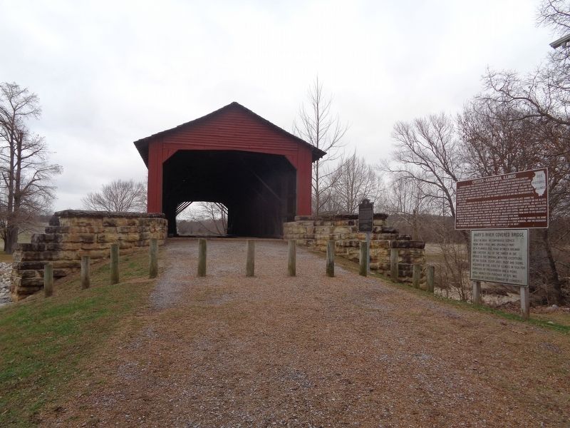
Location. 37° 56.894′ N, 89° 45.954′ W. Marker is near Chester, Illinois, in Randolph County. Marker can be reached from Illinois Route 150, 0.2 miles south of Briarhill Road. Marker is located outside Mary's River Covered Bridge. Touch for map. Marker is at or near this postal address: 3843 State Rte 150, Chester IL 62233, United States of America. Touch for directions.
Other nearby markers. At least 8 other markers are within 4 miles of this marker, measured as the crow flies. Mary's River Covered Bridge (here, next to this marker); George Rogers Clark Campsite (a few steps from this marker); Nana Oyl (approx. 1˝ miles away); Rough House (approx. 2.3 miles away); Sea Hag & Bernard the Vulture (approx. 2.6 miles away); Prof. O.G. Wotasnozzle
(approx. 3.3 miles away); Castor Oyl & Bernice the Whiffle Hen (approx. 3.3 miles away); Sherlock and Segar (approx. 3.7 miles away). Touch for a list and map of all markers in Chester.
More about this marker. In 1967, the Illinois State Historical Society erected three identical "Chester-Kaskaskia, Illinois" markers, and this is the only one still standing. The other two were placed elsewhere in Randolph County: one was at a rest stop off Highway 3 (two miles south of Ellis Grove) and the other was located at the tollbooth (which no longer exists) next to the Mississippi River bridge in Chester.
Credits. This page was last revised on December 2, 2020. It was originally submitted on December 2, 2020, by Jason Voigt of Glen Carbon, Illinois. This page has been viewed 403 times since then and 56 times this year. Photos: 1, 2. submitted on December 2, 2020, by Jason Voigt of Glen Carbon, Illinois.

