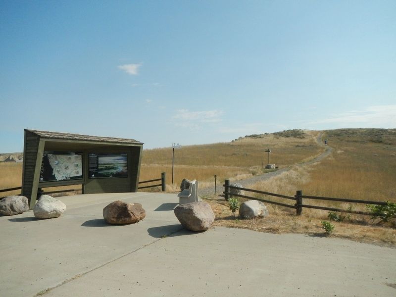
Near Loma in Chouteau County, Montana — The American West (Mountains)
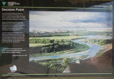
Decision Point
Information provided by the Mandans had been reliable to this point. But finding the Marias Ever was a surprise. The correct decision would lead the expedition to the best route across the Rocky Mountains. A wrong decision could strand them unprepared for a potentially deadly winter.
Lewis led a small party up the Marias; Clark, the Missouri. The Missouri was clear with a rocky bed, characteristics of rivers that have recently emerged from the mountains. The Marias was swollen and muddy from spring runoff. They chose the Missouri. The captains' judgement was rewarded the next day, when the falls were discovered.
"...to mistake the stream at this period of the season...would probably so dishearten the party that in might defeat the expedition altogether." -- Meriwether Lewis, June 3, 1805
Erected by Bureau of Land Management and National Conservation Lands.
Topics and series. This historical marker is listed in this topic list: Exploration. In addition, it is included in the Lewis & Clark Expedition series list. A significant historical date for this entry is June 3, 1805.
Location. 47° 55.509′ N, 110° 29.908′ W. Marker is near Loma, Montana, in Chouteau County. Marker is on Loma Ferry Road near Curlew Trail, on the left when traveling south. Touch for map. Marker is in this post office area: Loma MT 59460, United States of America. Touch for directions.
Other nearby markers. At least 8 other markers are within 4 miles of this marker, measured as the crow flies. Lewis and Clark National Historic Trail (within shouting distance of this marker); Ophir (about 500 feet away, measured in a direct line); Fort Piegan (about 700 feet away); a different marker also named Decision Point (about 800 feet away); The Manitoba Railroad (approx. ¾ mile away); Marias River (approx. ¾ mile away); Victims of Blood Indian Massacre (approx. ¾ mile away); A Montana Crossroads (approx. 3.3 miles away). Touch for a list and map of all markers in Loma.
Also see . . . Decision Point in the Lewis and Clark Expedition -- HistoryNet. An unexpected fork in the Missouri River presented a monumental challenge to the leadership of Lewis and Clark. (Submitted on December 5, 2020, by Barry Swackhamer of Brentwood, California.)

Photographed By Barry Swackhamer, August 23, 2020
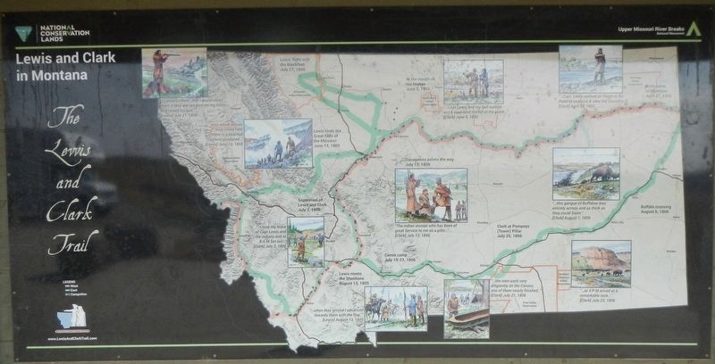
2. The Lewis and Clark Trail: Lewis and Clark in Montana Marker in the Decision Point Kiosk
(orange -- westward bound)
First camp in Montana, April 27, 1805 "...Capt Lewis walked on Shore in the Point to examine & view the Countrey" (Clark) April 27, 1805
At the mouth of the Marias, June 2, 1805 "...Capt Lewis and my Self walked out & ascended the hill in the point..." (Clark) June 3, 1805
Lewis finds the Great Falls of the Missouri, June 13, 1805 "...mist which arrises from these falls there is a beautiful rainbow produced..." (Lewis) June 13, 1805
Lewis meets the Shoshone, August 13, 1805 "...when they arrived I advanced toward them with the flag..." (Lewis) August 13, 1805
(green -- eastward bound)
Separation of Lewis and Clark, July 3, 1806 "...I took My leave of Capt Lewis and the indians and at 8 A M Set out..." (Clark) July 3, 1806
Sacagawea points the way, July 13, 1806 "The indian woman who has been of great Service to me as a pilot..." (Clark) July 13, 1806
Canoe camp, July 19-23, 1806 "...the men work very diligienty on the Canoes one of them near finished..." (Clark) July 21, 1806
Clark at Pompey's (Tower) Pillar, July 25, 1806 "...at 4 P M arived at a remarkable rock..." (Clark) July 25, 1806
Lewis' fight with the Blackfeet, July 27, 1806 "I called to them...that I would shoot them if they did not give me my horse and raised my gun..." (Lewis) July 27, 1806
Buffalo crossing, August 6, 1806 "...this gangue of Buffalow was entirely across and as thick as they could Swim." (Clark) August 1, 1806
Credits. This page was last revised on December 5, 2020. It was originally submitted on December 5, 2020, by Barry Swackhamer of Brentwood, California. This page has been viewed 149 times since then and 21 times this year. Photos: 1, 2, 3. submitted on December 5, 2020, by Barry Swackhamer of Brentwood, California.

