Near Loma in Chouteau County, Montana — The American West (Mountains)
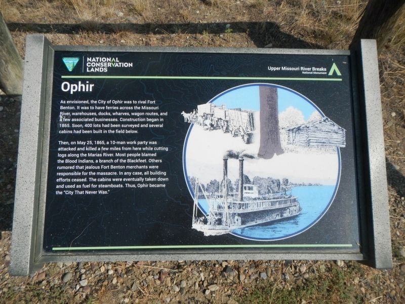
Ophir
Then, on May 25, 1865, a 10-man work party was attacked and killed a few miles from here while cutting logs along the Marias River. Most people blamed the Blood Indians, a branch of the Blackfeet. Others rumored that jealous Fort Benton merchants were responsible for the massacre. In any case, all building efforts ceased. The cabins were eventually taken down and used as fuel for steamboats. Thus, Ophir became the "City That Never Was."
Erected by Bureau of Land Management and National Conservation Lands.
Topics. This historical marker is listed in these topic lists: Disasters • Settlements & Settlers • Wars, US Indian. A significant historical date for this entry is May 25, 1865.
Location. 47° 55.55′ N, 110° 29.8′ W. Marker is near Loma, Montana, in Chouteau County. Marker can be reached from Loma Ferry Road near Curlew Trail. The marker is located on the foot-trail taking off from the Decision Point parking lot. Touch for map. Marker is in this post office area: Loma MT 59460, United States of America. Touch for directions.
Other nearby markers. At least 8 other markers are within 4 miles of this marker, measured as the crow flies. Fort Piegan (about 300 feet away, measured in a direct line); Decision Point (about 400 feet away); Lewis and Clark National Historic Trail (about 400 feet away); a different marker also named Decision Point (about 500 feet away); The Manitoba Railroad (approx. 0.8 miles away); Marias River (approx. 0.8 miles away); Victims of Blood Indian Massacre (approx. 0.8 miles away); A Montana Crossroads (approx. 3.2 miles away). Touch for a list and map of all markers in Loma.
Credits. This page was last revised on December 5, 2020. It was originally submitted on December 5, 2020, by Barry Swackhamer of Brentwood, California. This page has been viewed 293 times since then and 74 times this year. Photos: 1, 2, 3. submitted on December 5, 2020, by Barry Swackhamer of Brentwood, California.


