Near Big Sandy in Chouteau County, Montana — The American West (Mountains)
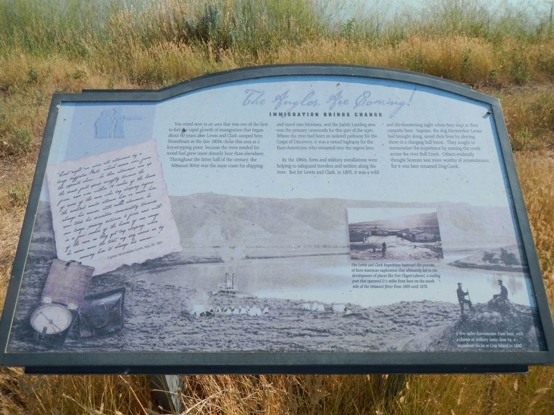
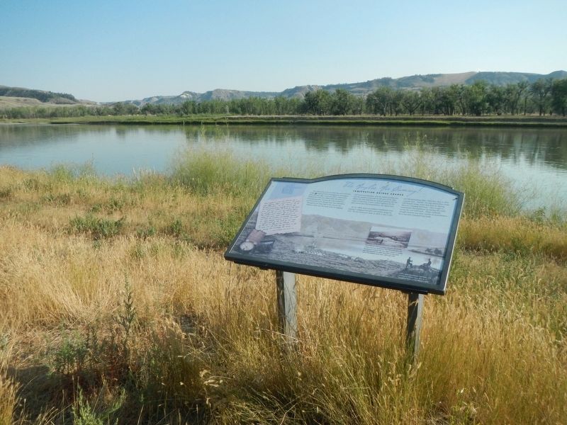
The Anglos Are Coming
Immigration Brings Change

Photographed By Barry Swackhamer, August 23, 2020
1. The Anglos Are Coming Marker
Captions: (background) A few miles downstream from here, with a cluster of military tents close by, a steamboat docks at Cow Island in 1880.; (lower right) The Lewis and Clark Expedition hastened the process of Euro-American exploration that ultimately led to the development of places like Fort Clagett (above), a trading post that operated 2 1/2 miles from here on the south side of the Missouri River from 1869 until 1878.
By the 1860s, fort and military installations were helping to safeguard travelers and settlers along the river. But for Lewis and Clark, in 1805, it was a wild and life-threatening night when they slept at their campsite here. Seaman, the dog Meriwether Lewis had brought along, saved their lives by alerting them to a charging bull bison. They sought to memorialize the experience by naming the creek across the river Bull Creek. Other evidently thought Seaman was more worthy of remembrance for it was later renamed Dog Creek.
"Last night we were all allarmed by a large buffalo Bull, which swam over from the opposite shore... he then allarmed ran up the bank full speed directly toward the fires, and was within 18 inches of the heads of some of the men who lay sleeping before the sentinel could allarm him or make him change his course, still more alarmed, he now took his direction immediately towards our lodge passing between 4 fires and and with in a few inched of the heads of one range of the men as they yet lay sleeping, when he came near the tents, my dog saved us by causing him to change his course..." - Captain Meriwether Lewis, May 29, 1805
Topics and series. This historical marker is listed in these topic lists: Exploration • Settlements & Settlers. In addition, it is included in the Lewis & Clark Expedition series list. A significant historical date for this entry is May 29, 1895.
Location. 47° 44.326′ N, 109° 37.333′ W. Marker is near Big Sandy, Montana, in Chouteau County. Marker can be reached from Judith Landing Road (State Highway 236), on the left when traveling south. The marker is located on a pathway heading east from the boat launch ramp. Touch for map. Marker is in this post office area: Big Sandy MT 59520, United States of America. Touch for directions.
Other nearby markers. At least 8 other markers are within one mile of this marker, measured as the crow flies. Welcome to the Mountain Ranges (here, next to this marker); Lewis and Clark National Historic Trail (here, next to this marker); Naturally Sustained Productivity (here, next to this marker); Tale of Two Treaties (here, next to this marker); Camp Cooke (approx. ¼ mile away); The Judith River Formation (approx. 0.3 miles away); Fort Chardon (approx. 0.4 miles away); The Judith Landing (approx. one mile away). Touch for a list and map of all markers in Big Sandy.
Credits. This page was last revised on December 5, 2020. It was originally submitted on December 5, 2020, by Barry Swackhamer of Brentwood, California. This page has been viewed 130 times since then and 14 times this year. Photos: 1, 2, 3. submitted on December 5, 2020, by Barry Swackhamer of Brentwood, California.

