Newburg in Louisville in Jefferson County, Kentucky — The American South (East South Central)
Forest Home Cemetery
Inscription.
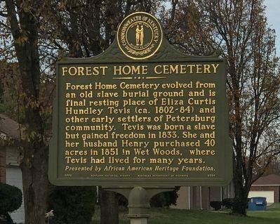
Forest Home Cemetery evolved from an old slave burial ground and is final resting place of Eliza Curtis Hundley Tevis (ca. 1802-84) and other early settlers of Petersburg community. Tevis was born a slave but gained freedom in 1833. She and her husband Henry purchased 40 acres in 1851 in Wet Woods, where Tevis had lived for many years.
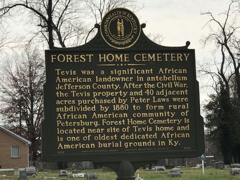
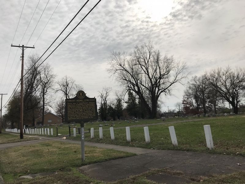
Tevis was a significant African American landowner in antebellum Jefferson County. After the Civil War, the Tevis property and 40 adjacent acres purchased by Peter Laws were subdivided by 1880 to form rural African American community of Petersburg. Forest Home Cemetery is located near site of Tevis home and is one of oldest dedicated African American burial grounds in Ky.
Erected 2002 by Kentucky Historical Society and Kentucky Department of Highways. (Marker Number 2094.)
Topics and series. This historical marker is listed in these topic lists: African Americans • Cemeteries & Burial Sites • Settlements & Settlers. In addition, it is included in the Kentucky Historical Society series list. A significant historical year for this entry is 1833.
Location. 38° 11.108′ N, 85° 40.044′ W. Marker is in Louisville, Kentucky, in Jefferson County. It is in Newburg. Marker is on Petersburg Road, 0.2 miles south of Unseld Boulevard, on the right when traveling south. Touch for map. Marker is at or near this postal address: 3650 Petersburg Road, Louisville KY 40218, United States of America. Touch for directions.
Other nearby markers. At least 8 other markers are within 2 miles of this marker, measured as the crow flies. Bashford Manor (approx. 1.1 miles away); Alonzo "Lonnie" Clayton / African American Jockey (approx. 1.2 miles away); Bray Place / Scoggan-Jones Horse Farm (approx. 1.4 miles away); Hayfield (approx. 1.9 miles away); Farmington (approx. 2 miles away); The Brothers Speed — Joshua and James (approx. 2 miles away); Agriculture & Farmington (approx. 2 miles away); Abraham Lincoln & Farmington — 1841 (approx. 2 miles away). Touch for a list and map of all markers in Louisville.
Also see . . . Forest Home Cemetery. From Kentucky Historical Society's Explore KY History series. (Submitted on December 9, 2020, by Duane and Tracy Marsteller of Murfreesboro, Tennessee.)
Credits. This page was last revised on February 12, 2023. It was originally submitted on December 7, 2020, by Duane and Tracy Marsteller of Murfreesboro, Tennessee. This page has been viewed 272 times since then and 38 times this year. Photos: 1, 2. submitted on December 7, 2020, by Duane and Tracy Marsteller of Murfreesboro, Tennessee. 3. submitted on December 9, 2020, by Duane and Tracy Marsteller of Murfreesboro, Tennessee.


