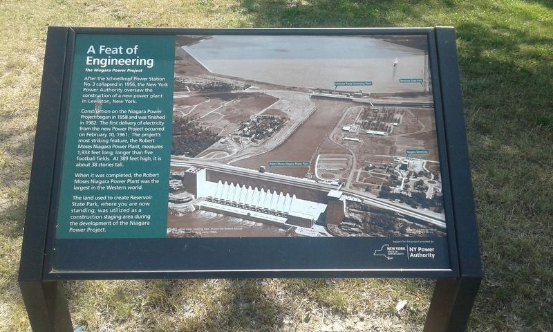
A Feat of Engineering
The Niagara Power Project
— Reservoir State Park —
After the Schoellkopf Power Station No. 3 collapsed in 1956, the New York Power Authority oversaw the construction of a new power plant in Lewiston, New York.
Construction on the Niagara Power Project began in 1958 and was finished in 1962. The first delivery of electricity from the new Power Project occurred on February 10, 1961. The project's most striking feature, the Robert Moses Niagara Power Plant, measures 1,933 feet long, longer than five football fields. At 389 feet high, it is about 38 stories tall.
When it was completed, the Robert Moses Niagara Power Plant was the largest in the Western world.
The land used to create Reservoir
State Park, where you are now
standing, was utilized as a
construction staging area during
the development of the Niagara
Power Project.
Erected by NY Power Authority.
Topics. This historical marker is listed in these topic lists: Industry & Commerce • Waterways & Vessels. A significant historical date for this entry is February 10, 1961.
Location. 43° 7.9′ N, 79° 0.9′ W. Marker is in Niagara Falls, New York, in Niagara County. Marker can be reached from Witmer Road (New York State Route 31) north of Woodard Avenue, on the right when traveling west. Located in Reservoir State Park. Touch for map
Other nearby markers. At least 8 other markers are within 2 miles of this marker, measured as the crow flies. Day into Night (within shouting distance of this marker); O'Shea Hall (1967), Seton Hall (1970) (approx. 1.1 miles away); For God and Country (approx. 1.2 miles away); Dunleavy Hall (approx. 1.2 miles away); The Seminary of Our Lady of Angels (approx. 1.2 miles away); Varsity Village (1939), Timon Hall (1952) (approx. 1.2 miles away); Bailo Hall (1992) (approx. 1.3 miles away); Veterans Memorial (approx. 1.3 miles away).
Also see . . . Niagara Power Project. (Submitted on December 12, 2020, by Michael Herrick of Southbury, Connecticut.)
Credits. This page was last revised on December 13, 2020. It was originally submitted on December 7, 2020, by Craig Doda of Napoleon, Ohio. This page has been viewed 137 times since then and 20 times this year. Photo 1. submitted on December 7, 2020, by Craig Doda of Napoleon, Ohio. • Michael Herrick was the editor who published this page.
