Erieville in Madison County, New York — The American Northeast (Mid-Atlantic)
The Syracuse & Chenango Valley Railroad
Photographed by Craig Doda, June 4, 2019
1. The Syracuse & Chenango Valley Railroad Marker
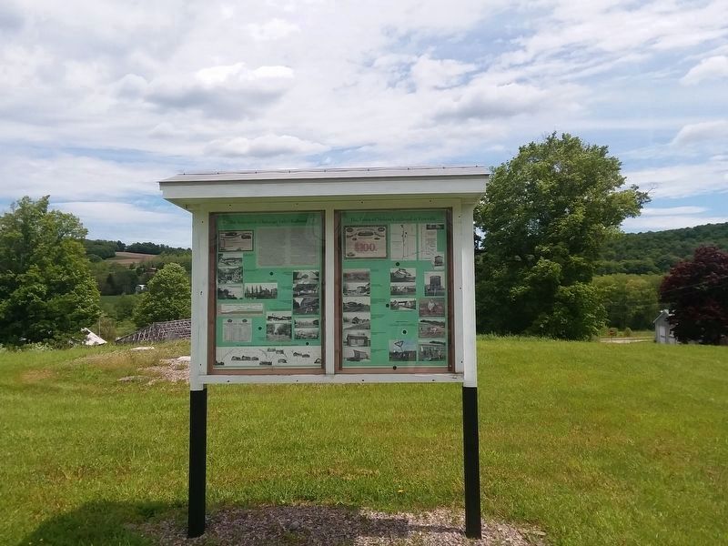
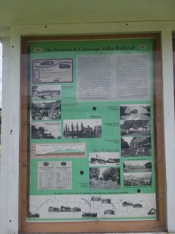
Inscription. During the mid-1860s, the New York & Oswego Midland Railroad desired to construct a portion of its line between Syracuse and Earlville. Due to difficulties relating to Syracuse providing construction aid, its route was altered to a more easterly location via Oneida. In order to satisfy the railroading needs of the upland townships of Georgetown, Nelson, and Cazenovia the Syracuse & Chenango Valley Railroad was formed on April 16, 1868. After a four year period of construction, the nearly 44 mile long line was opened on February 12, 1873. Its purpose was to connect the New York Central Railroad in Syracuse with the Oswego Midland (later the New York Ontario & Western Railway) at Earlville.
Engineering hallmarks along the line was the area's only tunnel (near Oran), a large Chittenango Creek (at Rippleton), many deep cuts and high fills, and a collection of rural wood frame depots. Along its line, people were transported, milk, sand, and explosive powder were shipped to markets, and ice was harvested and shipped from Cazenovia Lake.
Because of corporate failures, the S&CV was reorganized to become the Syracuse & Chenango
Click or scan to see this page online
Railroad (1873), Syracuse, Chenango & New York Railroad (1877), and the Syracuse, Ontario & New York Railway (1883). In 1891, it became a property of the New York Central's West Shore Railroad and operated as its Chenango Branch.
Although the railroad provided adequate and timely transportation services for many years, its purpose was eventually usurped by highway transportation and changing attitudes by the public who once sought its service. Consequently, the line was abandoned piecemeal: Earlville to Cazenovia- 1937. Cazenovia to Oran- 1944, Oran to Manlius- 1948, Manlius to Fayetteville- 1964, and Fayetteville to Dewitt in 1977.
Much survives today of this noteworthy line despite years of abandonment. The stations that had served Earlville, Lebanon, Georgetown, Erieville, Ballina, and Manlins all remain, although not all in their trackside location. The tunnel survives, as does its noteworthy bridge at Rippleton.
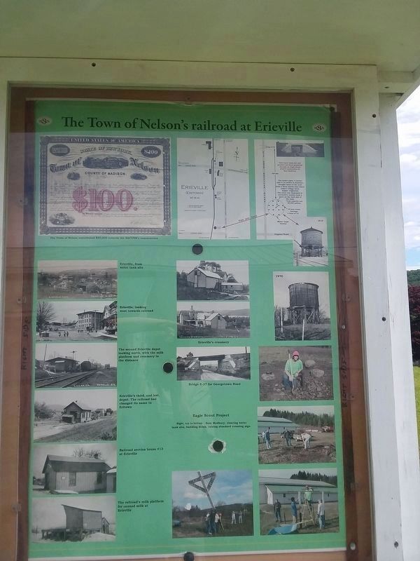
This site serves to perpetuate the memory of Erieville's water station, It was here that steam locomotives were able to replenish their supply of water that had become depleted by working up the hard grades from both
Photographed by Craig Doda, June 4, 2019
2. The Syracuse & Chenango Valley Railroad Marker
( back )
Syracuse and Earlville. The highest point on the line, at 1,641 feet, was situated nearby.
The idea for the preservation of this site was conceived by Erieville resident Jim Georges, and was accomplished under the supervision of Boy Scout Eagle Scout Project Coordinator George Schmit. The actual work of preparing the site for preservation was undertaken as an Eagle Scout project by Erieville resident Sam Medbury.
( back )
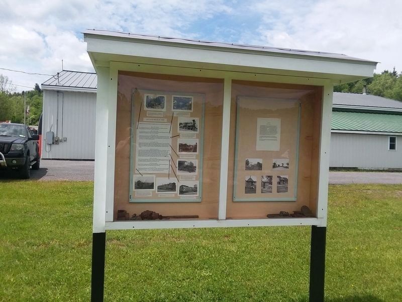
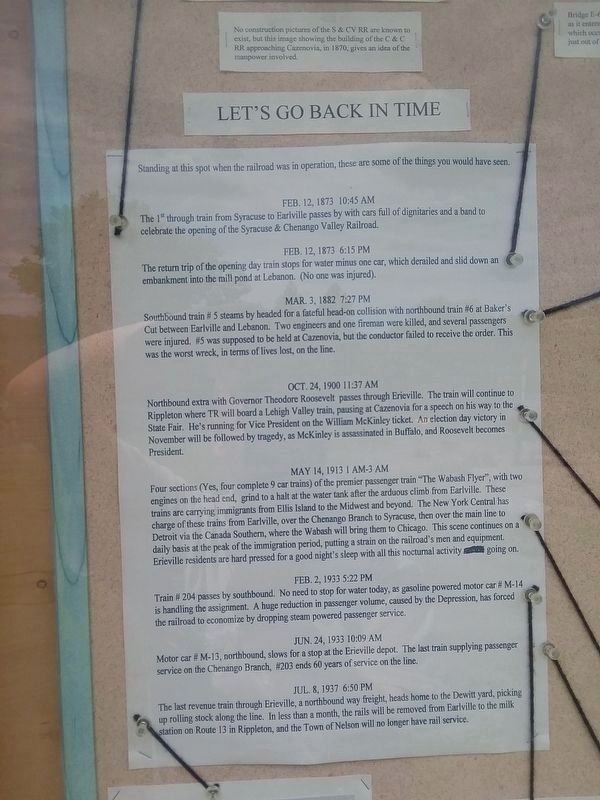
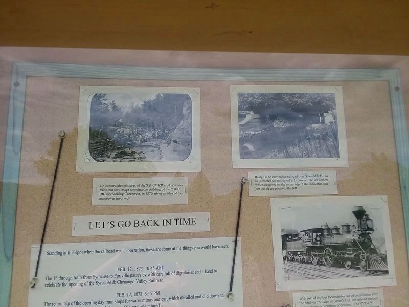
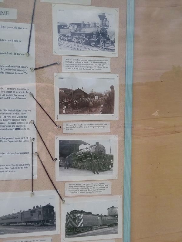
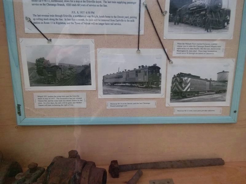
Standing at this spot when the railroad was in operation, these are some of the things you would have seen. ( photo captions )
Feb. 12, 1873 10:45 AM
The 1st through train from Syracuse to Earlville passes by with cars full of dignitaries and a band to celebrate the opening of the Syracuse & Chenango Valley Railroad.
Feb. 12, 1873 6:15 PM
The return trip of the opening day train stops for water minus one car, which derailed and slid down an embankment into the mill pond at Lebanon. (No one was injured).
Mar. 3, 1882 7:27 PM
Southbound train # 5 steams by headed for a fateful head-on collision with northbound train #6 at Baker's Cut between Earlville and Lebanon. Two engineers and one fireman were killed,
Photographed by Craig Doda, June 4, 2019
3. The Syracuse & Chenango Valley Railroad Marker
and several passengers were injured. #5 was supposed to be held at Cazenovia, but the conductor failed to receive the order. This was the worst wreck, in terms of lives lost, on the line.
Oct. 24, 1900 11:37 AM
Northbound extra with Governor Theodore Roosevelt passes through Erieville. The train will continue to Rippleton where TR will board a Lehigh Valley train, pausing at Cazenovia for a speech on his way to the State Fair. He's running for Vice President on the William McKinley ticket. An election day victory in November will be followed by tragedy, as McKinley is assassinated in Buffalo, and Roosevelt becomes President.
May 14, 1913 1 AM-3 AM
Four sections (Yes, four complete 9 car trains) of the premier passenger train "The Wabash Flyer", with two engines on the head end, grind to a halt at the water tank after the arduous climb from Earlville. These trains are carrying immigrants from Ellis Island to the Midwest and beyond. The New York Central has charge of these trains from Earlville, over the Chenango Branch to Syracuse, then over the main line to Detroit via the Canada Southern, where the Wabash will bring them to
Photographed by Craig Doda, June 4, 2019
4. The Syracuse & Chenango Valley Railroad Marker
Chicago. This scene continues on a daily basis at the peak of the immigration period, putting a strain on the railroad's men and equipment. Erieville residents are hard pressed for a good night's sleep with all this nocturnal activity going on.
Feb. 2, 1933 5:22 PM
Train # 204 passes by southbound. No need to stop for water today, as gasoline powered motor car # M-14 is handling the assignment. A huge reduction in passenger volume, caused by the Depression, has forced the railroad to economize by dropping steam powered passenger service.
Jun. 24, 1933 10:09 AM
Motor car # M-13, northbound, slows for a stop at the Erieville depot. The last train supplying passenger service on the Chenango Branch, #203 ends 60 years of service on the line.
Jul. 8, 1937 6:50 PM
The last revenue train through Erieville, a northbound way freight, heads home to the Dewitt yard, picking up rolling stock along the line. In less than a month, the rails will be removed from Earlville to the milk station on Route 13 in Rippleton, and the Town of Nelson will no longer have rail service.
( right panel )
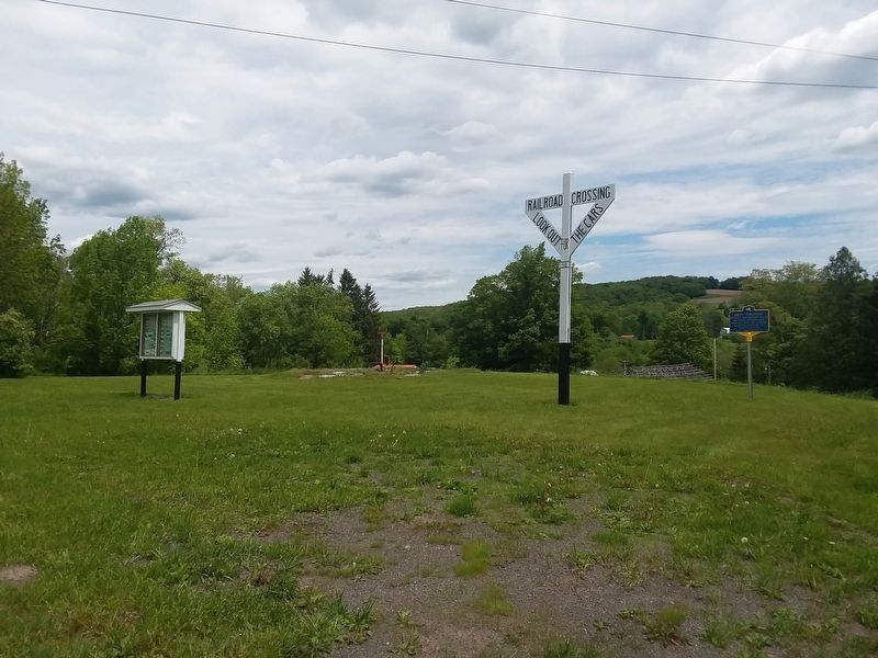
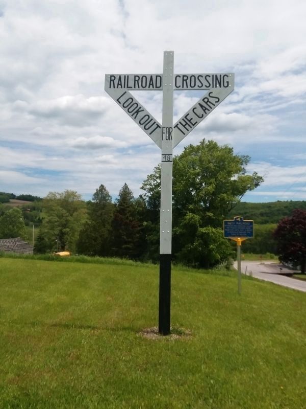
The crossing sign behind you is an authentic
Photographed by Craig Doda, June 4, 2019
5. The Syracuse & Chenango Valley Railroad Marker
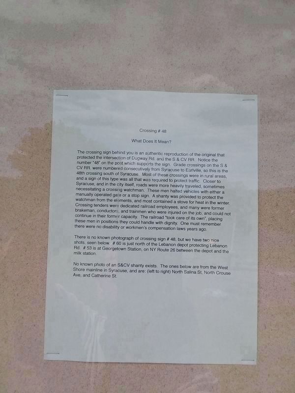
reproduction of the original that protected the intersection of Dugway Rd. and the S & CV RR. Notice the number "48” on the post which supports the sign. Grade crossings on the S & CV RR. were numbered consecutively from Syracuse to Earlville, so this is the 48th crossing south of Syracuse. Most of these crossings were in rural areas, and a sign of this type was all that was required to protect traffic. Closer to Syracuse, and in the city itself, roads were more heavily traveled, sometimes necessitating a crossing watchman. These men halted vehicles with either a manually operated gate or a stop sign. A shanty was provided to protect the watchman from the elements, and most contained a stove for heat in the winter. Crossing tenders were dedicated railroad employees, and many were former brakeman, conductors, and trainmen who were injured on the job, and could not continue in their former capacity. The railroad "took care of its own", placing these men in positions they could handle with dignity. One must remember there were no disability or workmen's compensation laws years ago.
There is no known photograph of crossing sign #
Photographed by Craig Doda, June 4, 2019
6. The Syracuse & Chenango Valley Railroad Marker
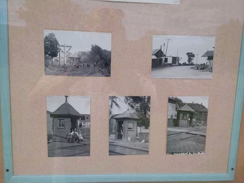
48, but we have two nice shots, seen below. # 60 is just north of the Lebanon depot protecting Lebanon Rd. # 53 is at Georgetown Station, on NY Route 26 between the depot and the milk station.
No known photo of an S&CV shanty exists. The ones below are from the West Shore mainline in Syracuse, and are: (left to right) North Salina St, North Crouse Ave, and Catherine St.
Topics. This historical marker is listed in this topic list: Railroads & Streetcars. A significant historical date for this entry is February 12, 1873.
Location. 42° 50.833′ N, 75° 45.267′ W. Marker is in Erieville, New York, in Madison County. It is on Dugway Road (County Route 60) west of Erieville Road (County Route 67), on the right when traveling west. Touch for map. Marker is in this post office area: Erieville NY 13061, United States of America. Touch for directions.
Regionally, this marker is in Upstate New York, specifically in Central New York, and in the Syracuse Metropolitan Area. It is also in the American Northeast and in the Mid-Atlantic. Globally, it is in North America, the Western Hemisphere, the Western World, and the Anglosphere. Historically, it finds
Photographed by Craig Doda, June 4, 2019
7. The Syracuse & Chenango Valley Railroad Marker
itself in what was once the Haudenosaunee (Iroquois) Confederacy, New Netherland, and one of the original Thirteen Colonies.
10. The Syracuse & Chenango Valley Railroad Marker
Photographed by Craig Doda, June 4, 2019
11. The Syracuse & Chenango Valley Railroad Marker
Photographed by Craig Doda, June 4, 2019
12. Railroad Crossing Sign #48
Credits. This page was last revised on December 12, 2020. It was originally submitted on December 7, 2020, by Craig Doda of Napoleon, Ohio. This page has been viewed 1,828 times since then and 143 times this year. Photos:1. submitted on December 7, 2020, by Craig Doda of Napoleon, Ohio. 2. submitted on December 12, 2020, by Craig Doda of Napoleon, Ohio. 3, 4. submitted on December 7, 2020, by Craig Doda of Napoleon, Ohio. 5, 6, 7, 8, 9, 10. submitted on December 12, 2020, by Craig Doda of Napoleon, Ohio. 11. submitted on December 7, 2020, by Craig Doda of Napoleon, Ohio. 12. submitted on December 12, 2020, by Craig Doda of Napoleon, Ohio. • Michael Herrick was the editor who published this page.