Snyder's Legacy
Ha Ha Tonka State Park
— Missouri State Parks —
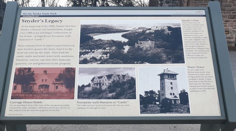
Snyder’s Legacy
At the beginning of the 1900s, Robert McClure Snyder, a Kansas City businessman, bought over 5,000 acres and began construction of use his dream-a magnificent European-style mansion or "castle."
Stone masons from Scotland supervised local men hired to quarry the stone, haul it to the work site and lay the walls. They built the castle, stable and water tower with sandstone, limestone, walnut, oak and other materials quarried, cut and gathered on the property.
Snyder's Plan
When Snyder planned
his estate, it included many
other improvements not
in existence today. The
architects' designs for the
house, barns, gates and
walkways carried a cost
estimate of S250,000 in 1906.
The castle originally overlooked a small spring-fed
lake. In the 1920s, Snyder's
sons fought to stop the
construction of Bagnell Dam
but failed. The resulting Lake
of the Ozarks divided the
5,000-acre estate and
consumed the small lake.
Water Tower
To your right is the
80-foot water tower ruins.
The first four floors were
living quarters for the estate
caretaker's family. A large
steel tank on the fifth floor
held water for the estate.
Vandals burned the interior
in 1976. It was reroofed and
stabilized in 1999.
Carriage House/Stable
You are standing
European-style Mansion or "Castle"
The castle ruins are up the trail to your left. You can catch
a glimpse of it through the trees.
Erected by Missouri Department of Natural Resources.
Topics. This historical marker is listed in these topic lists: Animals • Architecture • Forts and Castles • Roads & Vehicles. A significant historical year for this entry is 1906.
Location. 37° 58.517′ N, 92° 46.067′ W. Marker is in Ha Ha Tonka, Missouri, in Camden County. Marker is on Natural Bridge Road, half a mile State Highway D, on the right when traveling south. The marker is in the parking lot of the Ha Ha Tonka State Park. Touch for map. Marker is in this post office area: Camdenton MO 65020, United States of America. Touch for directions.
Other nearby markers. At least 4 other markers are within walking distance of this marker. One Man's Dream (here, next to this marker); American Indians, Trappers and Settlers (here, next to this marker); Water: Sculpting The Landscape (within shouting distance of this marker); The Water Tower (about 300 feet away, measured in a direct line).
Credits. This page was last revised on December 10, 2020. It was originally submitted on December 10, 2020, by Craig Doda of Napoleon, Ohio. This page has been viewed 449 times since then and 68 times this year. Photos: 1, 2. submitted on December 10, 2020, by Craig Doda of Napoleon, Ohio. • Devry Becker Jones was the editor who published this page.

