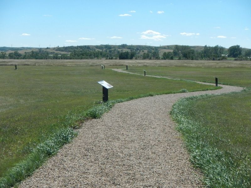
Near Stanton in Mercer County, North Dakota — The American Midwest (Upper Plains)
Geophysics and Archaeology
Fort Clark State Historic Site

Photographed By Barry Swackhamer, August 28, 2020
1. Geophysics and Archaeology Marker
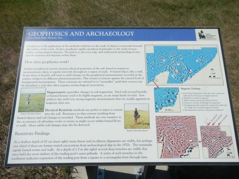
Captions: (center left) Magnetic data being collected.; (center) Resistance data being collected.; (right) Magnetic Findings; 1. Fort Clark Trading Post, with the main compound indicated by a large rectangular pattern; 2. Flagpole in central compound; 3. Main entryway facing the Missouri River; 4. Garreau's circular earthlodge & compound; 5. Dumping ground outside the compound, indicated by a large area of small magnetic features; 6. Euroamerican cemetery with graves indicated.
How does geophysics work?
Archeo-geophysical surveys measure physical properties of the soil, based on numerous measurements take at regular intervals throughout a region of study. A buried object, like a wall, house floor, or hearth, will tend to yield changes in the geophysical measurements recorded at the surface owing to its different physical properties. This creates a contrast against the natural level of background measurements. These contrasts are referred to as "anomalies" until their sources can be identified, a task that often requires archaeological excavations.
Magnetometry quantifies changes in soil magnetism. Fires around hearths or burned houses tend to be highly magnetic, as are many kinds of rocks. Iron artifacts also yield very strong magnetic measurements that are readily apparent in magnetic data sets.
Electric Resistivity methods use probes to inject a current into the soil. Resistance to that current resulting from buried objects and soil changes is recorded. These methods are very sensitive to the occurrence of subsurface rocks or stones as might occur within buried floors or walls, More subtle soil changes may also be detected.
Resistivity Findings
At a shallow depth of 50 cm (near right) many linear and rectilinear alignments are visible, but perhaps one-third of these are former trench excavations from archaeological digs in the 1970s. The remainder signify buried rooms and walls. At a depth of 1.5 m (far right) several deep trenches are visible that once held the stout members of the trading post's outer palisade. A series of such trenches to the southwest indicates expansion of the trading post from a square to a rectangular form through time.
Erected by State Historical Society of North Dakota.
Topics. This historical marker is listed in these topic lists: Anthropology & Archaeology • Forts and Castles.
Location. 47° 15.035′ N, 101° 16.355′ W. Marker is near Stanton, North Dakota, in Mercer County. Marker can be reached from 37th Avenue Southwest near 12th Street Southwest (State Highway 200), on the right when traveling north. The marker is located at the Fort Clark State Historic Site. Touch for map. Marker is in this post office area: Stanton ND 58571, United States of America. Touch for directions.
Other nearby markers. At least 8 other markers
are within walking distance of this marker. The Blockhouses (here, next to this marker); Two Bourgeois or Head Traders of the Fort (here, next to this marker); Trading Post Plan (here, next to this marker); Pierre Garreau's Lodge (within shouting distance of this marker); Fort Clark (circa 1830-1860) (about 300 feet away, measured in a direct line); The People (about 300 feet away); Missouri Valley Environs (about 500 feet away); Winter Villages and Lodges (about 500 feet away). Touch for a list and map of all markers in Stanton.
Credits. This page was last revised on December 13, 2020. It was originally submitted on December 13, 2020, by Barry Swackhamer of Brentwood, California. This page has been viewed 82 times since then and 6 times this year. Photos: 1, 2. submitted on December 13, 2020, by Barry Swackhamer of Brentwood, California.
