Near Stanton in Mercer County, North Dakota — The American Midwest (Upper Plains)
The Blockhouses
Fort Clark State Historic Site

Photographed By Barry Swackhamer, August 28, 2020
1. The Blockhouses Marker
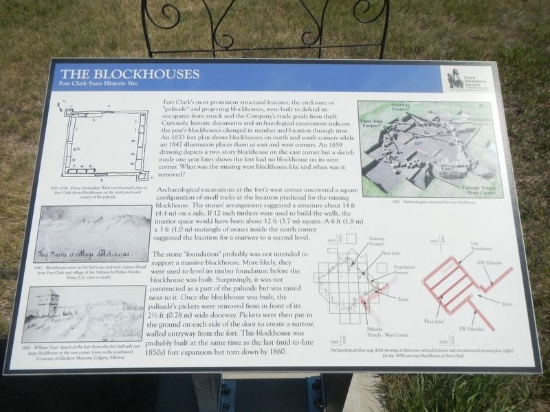
Captions: (top left) 1833-1834 - Prince Maximilian Wied von Neuwied's plan of Fort Clark shows blockhouses on the north and south corners of the palisade.; (middle left) 1847 - Blockhouses were on the fort's east and west corners (detail from Fort Clark and village of the Arikaras by Father Nicolas Point, S.J.; view to the south); (bottom left) 1860 - William Hays' sketch of the fort shows the fort had only one large blockhouse at the east corner (view to the southwest); (upper right) 2001 - Archaeologists excavated the west blockhouse; (lower right) Archaeological plan map (left) showing architecture-related features and reconstructed ground plan (right) for the 1850s era west blockhouse at Fort Clark.
Archaeological excavations at the fort's west corner uncovered a square configuration of small rocks at the location predicted for the missing blockhouse. The stone's arrangement suggested a structure about 14 ft (4.4 m) on a side. If 12 inch timbers were used to build the walls, the interior space would have been about 12 ft (3.7 m) square. A 6 ft (1.8 m) x 3ft (1.0 m) rectangle of stones inside the north corner suggested the location for a stairway to a second level.
The stone "foundation" probably was not intended to support a massive blockhouse. More likely, they were used to level its timber foundation before the blockhouse was built. Surprisingly, it was not constructed as part of the palisade but was raised next to it. Once the blockhouse was built, the palisade's pickets were removed from in front of its 2 1/2 ft (0.78 m) wide doorway. Pickets were then put in the ground on each side of the door to create a narrow walled entryway from the fort. This blockhouse was probably built at the same time as the last (mid-to-late) 1850s) fort expansion but torn down by 1860.
Erected by State Historical Society of North Dakota.
Topics. This historical marker is listed in this topic list: Forts and Castles. A significant historical year for this entry is 1833.
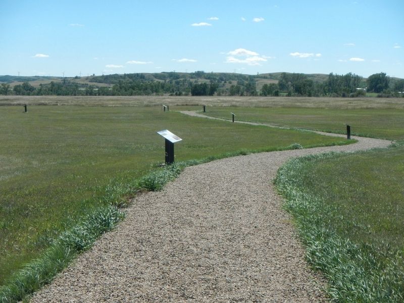
Location. 47° 15.035′ N, 101° 16.355′ W. Marker is near Stanton, North Dakota, in Mercer County. Marker can be reached from 37th Avenue Southwest near 12th Street Southwest (State Highway 200), on the right when traveling north. The marker is located at the Fort Clark State Historic Site. Touch for map. Marker is in this post office area: Stanton ND 58571, United States of America. Touch for directions.
Other nearby markers. At least 8 other markers are within walking distance of this marker. Geophysics and Archaeology (here, next to this marker); Two Bourgeois or Head Traders of the Fort (here, next to this marker); Trading Post Plan (here, next to this marker); Pierre Garreau's Lodge (within shouting distance of this marker); Fort Clark (circa 1830-1860)
(about 300 feet away, measured in a direct line); The People (about 300 feet away); Missouri Valley Environs (about 500 feet away); Winter Villages and Lodges (about 500 feet away). Touch for a list and map of all markers in Stanton.
Credits. This page was last revised on December 13, 2020. It was originally submitted on December 13, 2020, by Barry Swackhamer of Brentwood, California. This page has been viewed 151 times since then and 12 times this year. Photos: 1, 2. submitted on December 13, 2020, by Barry Swackhamer of Brentwood, California.
