Near Stanton in Mercer County, North Dakota — The American Midwest (Upper Plains)
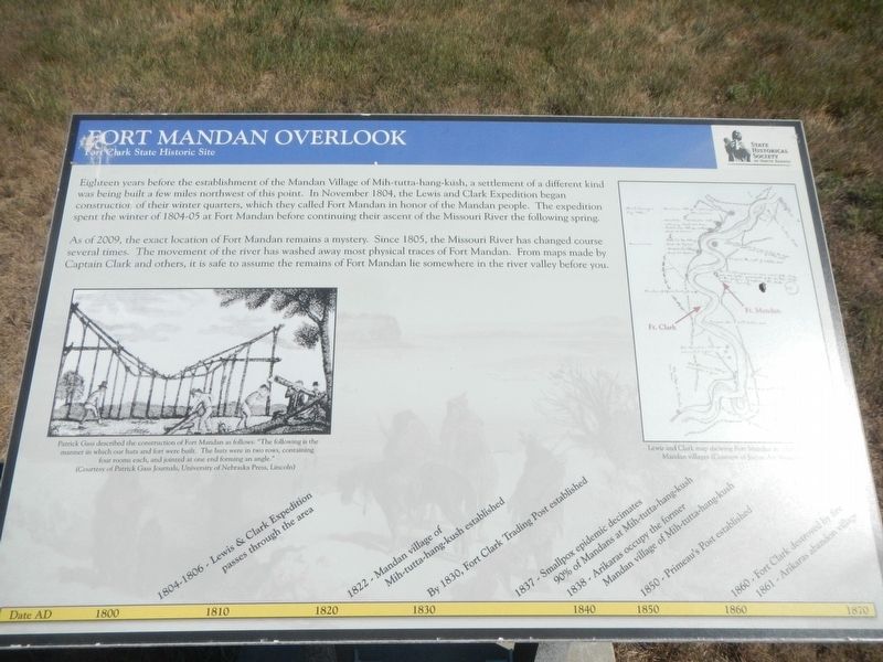
Fort Mandan Overlook
Fort Clark State Historic Site

Photographed By Barry Swackhamer, August 28, 2020
1. Fort Mandan Overlook Marker
Captions: (center left) Patrick Gass described the construction of Fort Mandan as follows: "The following is the manner in which our huts and fort were built. The hosts were in two rows, containing four rooms each, and joined at one end forming an angle."; (upper right) Lewis and Clark map showing Fort Mandan in relation (....) Mandan Villages.
(1800 to 1870 timeline across the bottom)
• 1804-1806 - Lewis & Clark Expedition passes through the area, • 1822 - Mandan village of Mih-tutta-hang-kush established, • By 1830, Fort Clark Trading Post established, • 1837 - Smallpox epidemic decimates 90% of Mandans at Mih-tutta-hang-kush, • 1838 - Arikaras occupy the former Mandan village of Mih-tutta-hang-kush, • 1850 - Primeau's Post established, • 1860 - Fort Clark destroyed by fire, • 1861- Arikaras abandon village
Erected by State Historical Society of North Dakota.
Topics and series. This historical marker is listed in these topic lists: Exploration • Forts and Castles. In addition, it is included in the Lewis & Clark Expedition series list.
Location. 47° 15.21′ N, 101° 16.373′ W. Marker is near Stanton, North Dakota, in Mercer County. Marker can be reached from 37th Avenue Southwest near 12th Street Southwest (State Highway 200), on the right when traveling north. The marker is located at the Fort Clark State Historic Site. Touch for map. Marker is in this post office area: Stanton ND 58571, United States of America. Touch for directions.
Other nearby markers. At least 8 other markers are within walking distance of this marker. Mandans and Arikaras of the Village (a few steps from this marker); Earthlodges (within shouting distance of this marker); Smallpox and the Central Plaza (within shouting distance of this marker); Stone Shelter (about 500 feet away, measured in a direct line); Winter Villages and Lodges (about 600 feet away); Missouri Valley Environs (about 600 feet away); Corrals (about 700 feet away); Fort Clark (circa 1830-1860) (about 800 feet away). Touch for a list and map of all markers in Stanton.
Credits. This page was last revised on December 14, 2020. It was originally submitted on December 14, 2020, by Barry Swackhamer of Brentwood, California. This page has been viewed 164 times since then and 18 times this year. Photos: 1, 2. submitted on December 14, 2020, by Barry Swackhamer of Brentwood, California.
