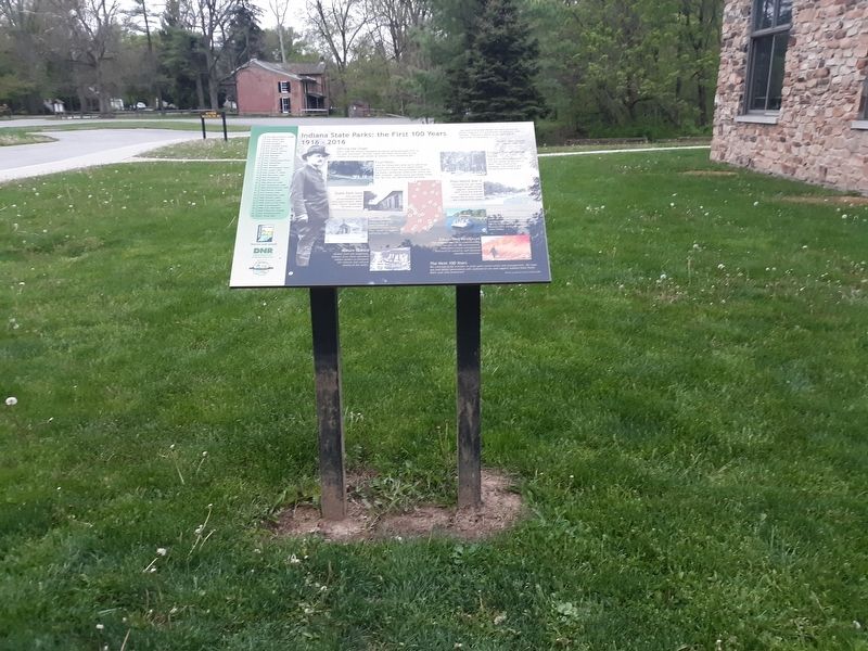
Chesterfield in Madison County, Indiana — The American Midwest (Great Lakes)
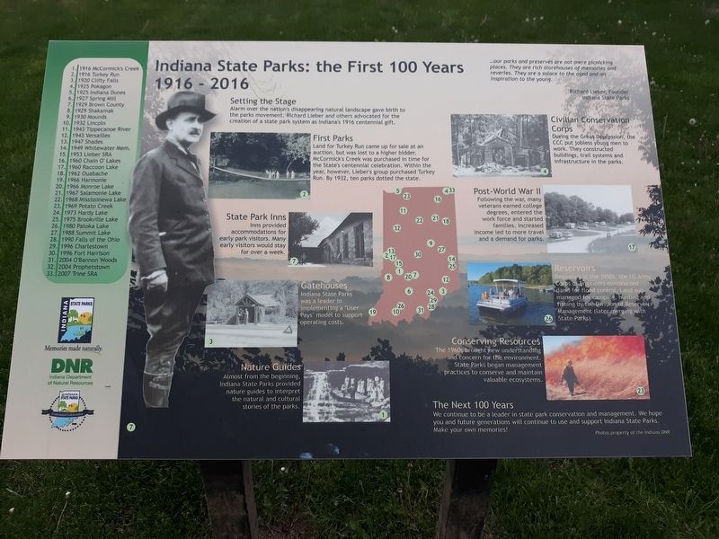
Indiana State Parks: the First 100 Years
1916 - 2016
…our parks and preserves are not mere picnicking places. They are rich storehouses of memories and reveries. They are a solace to the aged and an inspiration to the young.
Richard Lieber, Founder
Indiana State Parks
Setting the Stage
Alarm over the nation's disappearing natural landscape gave birth to the parks movement. Richard Lieber and others advocated for the creation of a state park system as Indiana's 1916 centennial gift.
First Parks
Land for Turkey Run came up for sale at an auction, but was lost to a higher bidder. McCormick's Creek was purchased in time for the State's centennial celebration. Within the year, however, Lieber's group purchased Turkey Run. By 1932, ten parks dotted the state.
State Park Inns
Inns provided accommodations for early park visitors. Many early visitors would stay for over a week.
Gatehouses
Indiana State Parks was a leader in implementing a "User Pays” model to support operating costs.
Nature Guides
Almost from the beginning, Indiana State Parks provided nature guides to interpret the natural and cultural stories of the parks.
Civilian Conservation Corps
During the Great Depression, the CCC put jobless young men to work. They constructed buildings, trail systems and infrastructure in the parks.
Post-World War II
Following the war, many veterans earned college degrees, entered the work force and started families. Increased income led to more travel and a demand for parks.
Reservoirs
Beginning in the 1950s, the US Army Corps of Engineers constructed dams for flood control. Land was managed for camping, hunting and fishing by the Division of Reservoir Management (later merging with State Parks).
Conserving Resources
The 1960s brought new understanding and concern for the environment. State Parks began management practices to conserve and maintain valuable ecosystems.
The Next 100 Years We continue to be a leader in state park conservation and management. We hope you and future generations will continue to use and support Indiana State Parks, Make your own memories!
Erected by Indiana Department of Natural Resources.
Topics and series. This historical marker is listed in these topic lists: Charity & Public Work • Parks & Recreational Areas. In addition, it is included in the Civilian Conservation Corps (CCC) series list. A significant historical year for this entry is 1916.
Location. 40° 5.733′ N, 85° 37.183′ W. Marker is in Chesterfield, Indiana, in Madison County. Marker is on Mounds Road (Indiana Route 232) one mile north of Donnelly Road (Local Road E100S), on the right when traveling south. Touch for map. Marker is at or near this postal address: 4306 Mounds Rd, Anderson IN 46017, United States of America. Touch for directions.
Other nearby markers. At least 8 other markers are within 2 miles of this marker, measured as the crow flies. Native American Memorial (here, next to this marker); The Mounds Dugout Canoe (within shouting distance of this marker); The Bronnenberg House (about 300 feet away, measured in a direct line); The Bronnenberg Family (about 300 feet away); a different marker also named The Bronnenberg House (about 300 feet away); The Great Mound (about 700 feet away); The Circle Mound (approx. half a mile away); The Moravian Mission (approx. 1˝ miles away). Touch for a list and map of all markers in Chesterfield.
Credits. This page was last revised on May 15, 2022. It was originally submitted on December 21, 2020, by Craig Doda of Napoleon, Ohio. This page has been viewed 92 times since then and 11 times this year. Photos: 1, 2. submitted on December 21, 2020, by Craig Doda of Napoleon, Ohio. • Devry Becker Jones was the editor who published this page.

