Awendaw in Charleston County, South Carolina — The American South (South Atlantic)
Old Wappetaw Church
Photographed by Mike Stroud, 2009
1. Old Wappetaw Church Marker
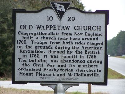
Congregationalists from New England built a church near here around 1700. Troops from both sides camped on the grounds during the American Revolution. Burned by the British in 1782, it was rebuilt in 1786. The building was abandoned during the Civil War and its members organized Presbyterian churches in Mount Pleasant and McClellanville.
Erected 1998 by St. James- Santee Parish Historical Society. (Marker Number 10-29.)
Topics and series. This historical marker is listed in these topic lists: Notable Places • Religion & Religious Structures. In addition, it is included in the South Carolina, Charleston County, St. James- Santee Parish Historical Society series list. A significant historical year for this entry is 1700.
Location. 32° 55.653′ N, 79° 42.865′ W. Marker is in Awendaw, South Carolina, in Charleston County. It is on Ocean Highway (U.S. 17) 0.1 miles north of 15 Mile Landing Road (South Carolina Highway 10-584), on the right when traveling south. Just north of Seewee Restaurant. Touch for map. Marker is in this post office area: Awendaw SC 29429, United States of America. Touch for directions.

Regionally,
this page online
Other nearby markers. At least 10 other markers are within 9 miles of this marker, measured as the crow flies: Wappetow Independent Congregational Church (about 600 feet away, measured in a direct line); Point Plantation / Richmond Plantation (approx. 4.9 miles away); Phillips Community (approx. 6.4 miles away); Wando Pottery (approx. 6½ miles away); Shell Rings and Shell Middens (approx. 6½ miles away); Brickyard Plantation (approx. 7.1 miles away); Sweetgrass Baskets (approx. 7.1 miles away); Thomas Lynch at Rivertowne (approx. 7.4 miles away); Confederate Lines (approx. 8.1 miles away); Snee Farm (approx. 8.1 miles away).
Another marker is no longer nearby. Cook's Old Field Cemetery / Copahee Plantation and Hamlin Beach
Photographed by Mike Stroud, February 15, 2009
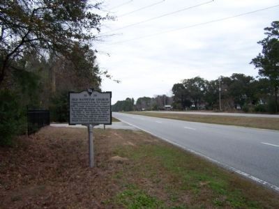
2. Old Wappetaw Church Marker, looking north along US 17
Also see . . .
1. Skirmish at Old Wappetaw Church, November 19, 1781. Although this battle was probably of some significance, it represents yet another gap in the published historical record. (Submitted on June 19, 2012, by Brian Scott of Anderson, South Carolina.)
2. Old Wappetaw Independent Congregational Church Cemetery. Find A Grave website listing (Submitted on June 19, 2012, by Brian Scott of Anderson, South Carolina.)
3. Congregational Church. Congregational churches are Protestant Christian churches practicing Congregationalist church governance, in which each congregation independently and autonomously runs its own affairs. (Submitted on June 19, 2012, by Brian Scott of Anderson, South Carolina.)
4. Congregationalists. Congregationalism is a form of Protestant Christianity which asserts the principle that a local congregation is completely autonomous under God and therefore should not submit to any outside, human authorities such as a regional or national synod of elders (as in Presbyterianism) or a bishop (as in
Photographed by Mike Stroud, February 2009
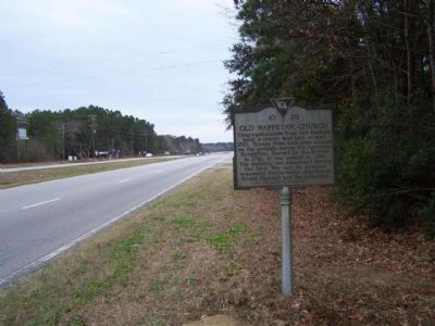
3. Old Wappetaw Church Marker, looking south along US17
Credits. This page was last revised on August 29, 2026. It was originally submitted on February 21, 2009, by Mike Stroud of Bluffton, South Carolina. This page has been viewed 3,502 times since then and 201 times this year. Photos: 1, 2, 3. submitted on February 21, 2009, by Mike Stroud of Bluffton, South Carolina. • Kevin W. was the editor who published this page.
